An amber warning midweek for N.Scotland as the heavy rain continues. There will be more thunderstorms and heavy showers moving across the UK today and the weekend looks cooler.
Today the heaviest rain is over northern Scotland but by Thursday night it could be Cornwall seeing stormy weather if the next low pressure develops before moving across southern England on Friday.
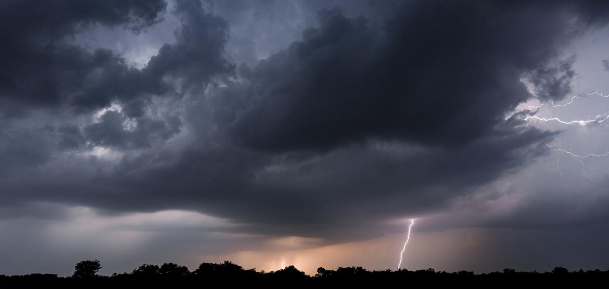
The warnings are no longer for Extreme Heat but for Heavy Rain and Thunderstorms. There are concerns from the Environment Agencies about flooding, particularly surface water flooding and some river levels and also disruption to travel. People are travelling around the UK on holiday, having day trips in the school break such as to Alton Towers, as well as moving for their everyday routine. The A96 and Aberdeen have seen horrendous conditions to start Wednesday with torrential rain and lightning. There is an amber rain warning over northern Scotland until Thursday morning with over 100mm of rain already. Belfast was hit by flooding yesterday and there was a peppering of storms and heavy downpours across the UK into the evening. More to come today.
Low pressure is centred over Scotland this morning and will only slowly drift away over Scandinavia by Thursday. A fresher northerly flow follows it as another low pressure sneaks along the English Channel by Friday bringing rain in the south.
The band of rain over northern Scotland will edge north then north-westwards today, so a shift in the areas getting soaked. Plenty of rain for Moray with the coastal cliff areas being a SEPA concern. Also, the NW Highlands and the Western Isles.
There is another band of rain over SE Scotland into Northumberland which will swing northwards over central Scotland, Perthshire whilst the rest of the UK faces an unsettled, changeable day,
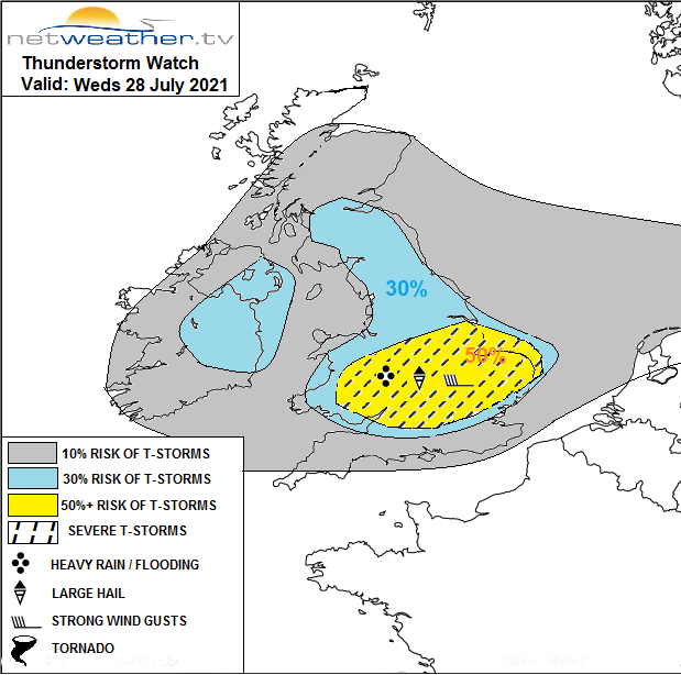
"A risk of severe thunderstorms may unfold across central and southern areas today...across south Wales, Midlands, Lincs and E Anglia – so here may see a severe risk unfold from any thunderstorms...perhaps one or two supercells too, capable primarily of localised damaging convective wind gusts of 50-60mph, but also isolated large hail of 2-3cm diameter. There is small risk of a tornado where winds back at the surface ahead of one or two troughs moving east during the day. CG lightning and localised flash-flooding are additional risks." Convective Forecast 28th
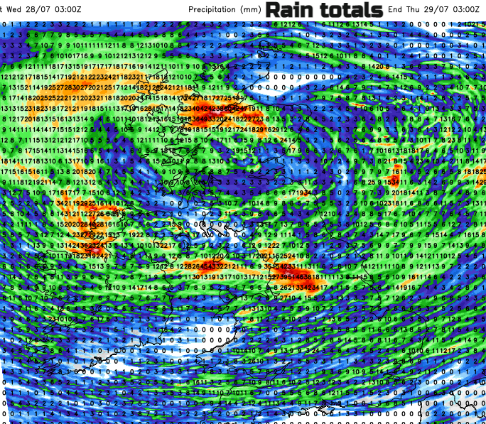
Swinging around the low pressure are clusters of heavy showers with a scattering of thundery downpours. This makes the fine detail of the forecast tricky and it’s not worth relying on the exact timings from a weather app of when will be dry and when a downpour or thunderstorm will arrive. Have a look at the Netweather Radar. You will see brightly coloured cells, the heavy showers working their way west to east. Often, they line up and some locations get a shower, a break and then another shower. The gaps in between can see longer drier spells, but most areas are at risk today, just take your brolly or raincoat.
In the sunnier spells, the temperatures will reach the high teens or low twenties. There is more of a breeze for the Welsh coasts and SW England, along the south coast of England with a moderate SW wind. By this afternoon although it will be breezy there should be some fine, sunny weather for Kent and Sussex, also south Wales and Pembrokeshire.
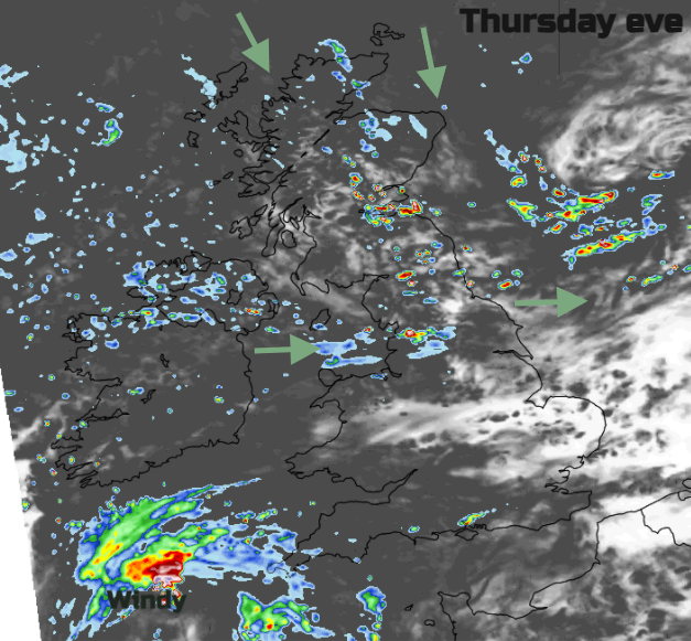
Thursday morning will bring a lot of sunshine and drier weather to Wales and most of England with a westerly wind. For Northern Ireland, Scotland and Cumbria there will be more cloud and outbreaks of rain with the wind veering to the NW.
The incoming SW low pressure needs watching. There is uncertainty around this development but currently the forecast showers bands of heavy rain with gales for Thursday night, even severe gales for Cornwall, Devon through the English Channel. As the low moves eastwards during Friday morning there will be more heavy rain and strong winds.
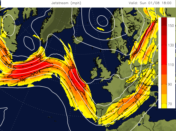
The end of July into the start of August looks cooler than average for much of the UK and around average by the end of the first week of August. The Jetstream continues to be a more southerly track, above southern England or France, even Spain. This keeps the UK in the fresher North Atlantic air and has been enhancing unsettled weather over mainland Europe with active thunderstorms and devasting flooding.
However, even with this cooler theme, there will still be strong sunshine at times. Friday looks warm for eastern England, particularly Yorkshire and eastern Scotland, up to Fife.
The weekend does look cooler for the northern half of the UK. Quite noticeable for anyone camping. There will still be a scattering of showers but not as many and longer dry and sunny spells across the UK.