Temperatures will rise into the thirties again today, with a scattering of thunderstorms developing this afternoon. But time is now ticking for the heatwave as wetter, cooler weather arrives in time for the weekend.
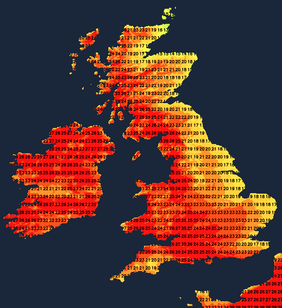
After yesterday's highest recorded temperature across Northern Ireland, 31.3C at Castlederg in County Tyrone, you can expect much of the same today as extreme heat warnings remain in force here, together with the South and West of Wales, and the West Country.
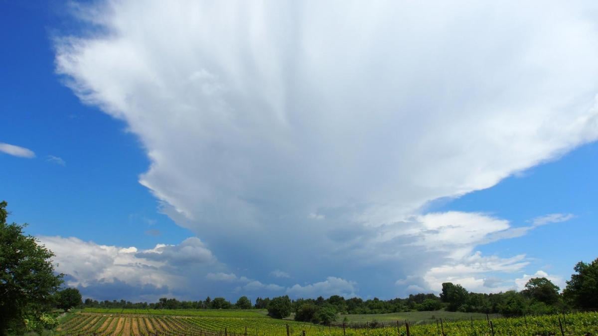
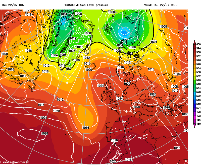
As our resident anticyclone weakens, though, and moves North, the heatwave will be over by the weekend as outbreaks of rain and thunderstorms move up from the South. Torrential downpours will also bring the risk of some flash flooding, although, across much of Scotland and Northern Ireland, you'll escape many of the showers, but even here it'll be turning cooler.
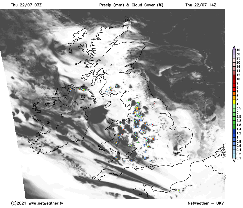
Like yesterday we have some mist and areas of low cloud to clear this morning, mainly in the East and across the North and East of Scotland. Much of this will 'burn' back to the coast, leaving most of the country with yet another fine summers day. There'll be lots of sunshine making it very hot again in the West and Northern Ireland where 30 to 31, even perhaps 32C could be reached. Elsewhere 25 to 28C is more likely in an East or North Easterly breeze that'll keep North Sea coasts refreshingly cooler. Although mostly dry, some cloud will build again, triggering isolated sharp showers and the odd heat thunderstorm, most likely in hilly areas.
Any sharp showers melt away into an evening that'll be warm and summery in most parts. There'll be some patchy cloud but clear spells after dark, especially in the West, where mist and a few short-lived fog patches will form towards morning. Areas of very low cloud will return to some central and eastern areas on an East or North Easterly breeze, making these parts murky by dawn. In another rather warm, humid night, temperatures generally shouldn't fall below 13 to 18C.
Friday will probably see more in the way of mist and low cloud in central and eastern areas at first, but this should eventually clear except some coastal areas, leaving most parts with another very warm or hot summers day. There'll be spells of albeit somewhat hazy sunshine, but with cloud building again to produce a few sharp showers or thunderstorms mostly towards the South West and over Northern Ireland. Here temperatures could reach 30C again, but elsewhere 23 to 26C is more likely, still very warm but slightly down on recent values. An East or North-East breeze will continue to keep North sea coasts refreshingly cooler.
For most, it'll be another warm, summery evening, with any showers and storms in the West tending to fade fading after dark to leave clear spells. It turns misty, with murky conditions returning to many central and eastern areas overnight. But across the South West and South, showers and thunderstorms will be moving in, heralding the beginning of the end of the heatwave. In another humid night, though, temperatures won't fall below 12 to 17C in a North Easterly breeze that may freshen a little.
Looking further afield into next week, taking in the remainder of July, it's a cooler, more unsettled outlook as our more traditional winds from the Atlantic return. But there's still the potential for the Azores high to push a ridge over or to the West of our shores. So perhaps another couple of summery days before the end of the month.