The hot weather continues with high pressure dominating. But, there will be the threat of heavy showers and thunderstorms developing, some of which could be severe.
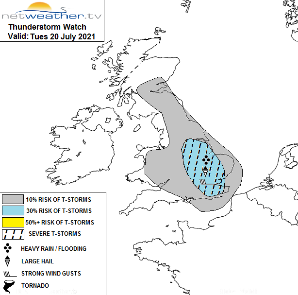
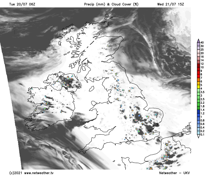
High pressure continues to dominate over the British Isles, and so for most of the country it will be another hot, dry, sunny day. However, some scattered heavy thundery showers will develop this afternoon, particularly in south-east England, and to a lesser extent in parts of central southern England, the south Midlands and East Anglia. Where these showers develop, they will tend to be slow-moving due to the lack of wind. Elsewhere it will generally stay dry, with just isolated showers developing in some places.
A storm forecast has been issued for today - there is the potential for severe storms.
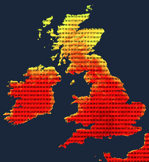
With a south-easterly breeze developing in most areas, some haar/sea fret will come onshore in eastern Scotland and north-east England. This will tend to quickly burn off inland, but could persist throughout the day along North Sea coasts. In these regions, daytime maximum temperatures will be suppressed, with highs generally between 17 and 20C. Elsewhere, it will be another hot day, with temperatures mostly reaching between 25 and 29C. Highs of 30 to 32C are possible mainly in the West Midlands, central southern England and south-west England.
The high pressure will gradually decline and move slowly north-eastwards, giving Britain a strengthening south-easterly airflow, but for the most part, the hot sunny weather will continue. On Wednesday, low cloud may become more extensive in eastern Scotland and persist near the north-east coast of England. High cloud will also move into the south-west of Britain. Otherwise, it will be another hot and generally dry and sunny day, with temperatures reaching highs of 25-29C and peaking at 30-32C locally in the south-west. Some scattered thundery showers will again break out, though less widely than today, the most likely places for these being the south-east and also the north-west of England.
Thursday may generally see more in the way of high cloud, but for most, it will still be predominantly sunny and hot. On Thursday, it is especially the west Midlands and east Wales that are most likely to reach around 30-31C. Low cloud and suppressed daytime temperatures will again affect North Sea coasts of eastern Scotland and north-east England. Scattered thundery showers are most likely to develop over Wales, central and southern England and north-west England.
On Friday, a slack area of low pressure will begin to push up from the south, giving a stronger east to south-easterly flow over Britain. It will increasingly cloud over in the south of Britain, with some rain, possibly accompanied by thunder, moving into the south late in the day, and some thundery showers could develop further north, particularly over Wales. It will be another generally hot and sunny day for Northern Ireland, western Scotland and north-west England, not quite as hot as the previous few days but still reaching 24 to 28C in most areas. Low cloud and reduced daytime maximum temperatures will spread further inland across eastern Scotland and north-east England.
For the weekend, the weather looks set to turn more unsettled, with a band of rain dissipating as it heads north-eastwards across central and northern England and southern Scotland, but producing much cooler, cloudier weather generally. There is potential for north-east England to have a wet day on Sunday as the low moves out into the North Sea, but this is currently uncertain. For the Midlands and south of England, some thundery downpours are expected, especially on Sunday. However, in north-west Scotland, warm, dry, sunny weather will tend to hold on.