Summer has well and truly arrived this weekend, with high pressure well in charge of the UK's weather.a0It'll be hanging around into next week too, with 30c possible every day up to at least Wednesday.
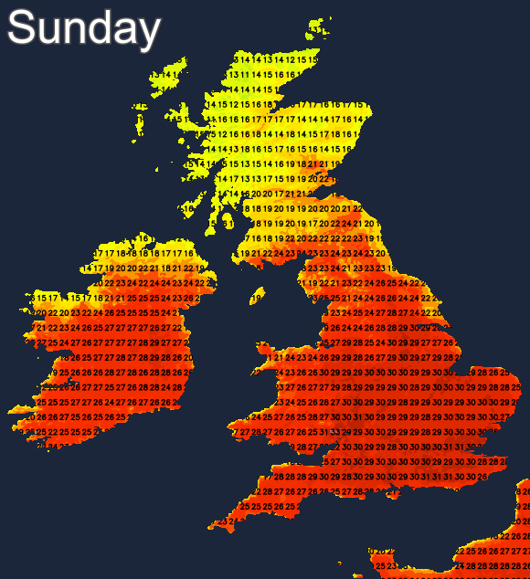
Summer has well and truly arrived this weekend, with high pressure well in charge of the UK's weather. Temperatures are set to rise into the thirties Celsius, particularly tomorrow (Sunday), where 32-34c isn't out of the question in one or two places.
Into next week, the high will still be with us, and some of this morning's forecasting models are suggesting that 30c will be reached in at least one part of the country every day right up to Wednesday. Beyond that, and particularly in towards next weekend, it does look like a change to less settled weather may be on the way, as low pressure moves back in towards our shores.
As is often the case with the UK's weather, though, not everyone is going to be in exactly the same boat. This weekend, the north and particularly northwest of Scotland will see more in the way of cloud, and even some bits and pieces of rain. That'll keep temperatures well down on the rest of the country. Into next week, with the high shifting further north, it's likely to be eastern coastal counties that are a touch cooler, thanks to onshore breezes, while those in the far north and northwest get in on the warmer, sunnier act.
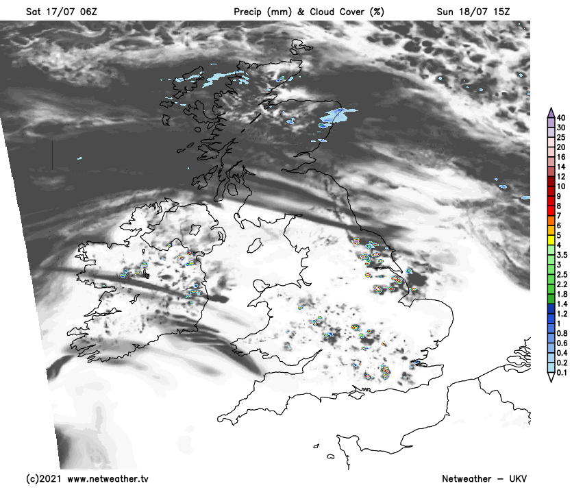
Another slight complication after today will be the threat of one or two isolated showers or thunderstorms popping during the heat of the day. They're not likely to be especially widespread, but any that do develop could pack a punch, thanks to the energy the heat will be feeding into the atmosphere. Looking at Sunday as an example, the latest UKV develops some across England and Wales into the afternoon.
For the majority though, Sunday will be like today, with lots of hot sunshine on offer, away from those parts of Scotland and Northern Ireland prone to a little more cloud, that'll be moving down from the northwest.
Into next week, the best of the sunshine and the heat will be squeezed south and west on Monday, as those further north and east see more cloud - especially near to eastern coasts.
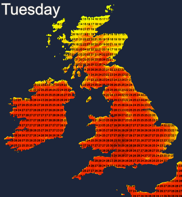
Tuesday is likely to see the heat spread north again though, away from eastern coastal counties. All the while, there will still be the risk of a few sharp, thundery downpours developing. More of the same is then likely into midweek. But as the high pressure is likely to be slowly shifted further east towards the end of the week, it'll open the door to low pressure moving in from the Atlantic.