Quite a mixed bag of weather as still, steady conditions midweek give way to Atlantic showers. Still feeling warm in the strong July sunshine but the air isn't hot or humid.
For the UK we have a quieter midweek, weather-wise. Some steadier weather for Wimbledon before a whole host of showers get going across the UK for the weekend. The temperatures remain in the mid to high teens and mostly, the low 20s Celsius.
Meanwhile, western Canada continues to do battle with the incredible heatwave. After seeing nearly 50C earlier this week, there are now more wildfires breaking out along with falling ash and burning buildings. Lytton, the location of Canada's new maximum temperature record 49.6C, is now under an evacuation order. The intense heat and fires are resulting in CB Flammagenitus (Pyro-Cumulonimbus) clouds. Stunning yet terrible, huge clouds which then produce lightning strikes and so the risk of new wildfires.
Here in the UK our highest ever recorded temperature was 38.7C at Cambridge in July 2019 and 38.5C was recorded in August 2003. The UK summer still has a way to go as July begins today, although there is nothing to suggest this summer will see extreme heat here. Discussions continue about when, not if, the UK could reach 40C due to our changing climate and warming planet.
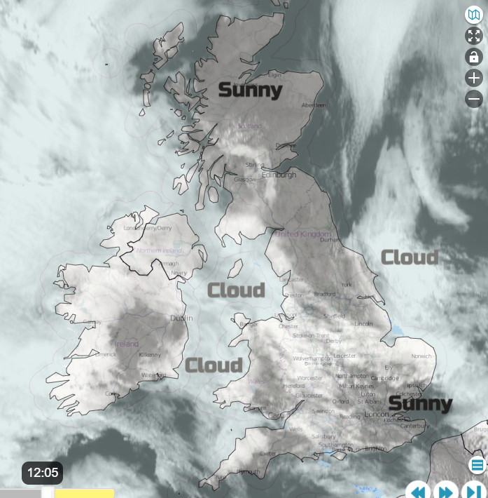
The air isn’t hot or humid for the coming week, but the sun is still very strong. So do slap on your sunscreen. This morning, there are murky and misty conditions with low cloud giving a grey, damp feeling start in places. For others, there is sunshine but just with a coolness in the air. One or two showers break out for inland England later in the day, mainly in the south and east but most places stay dry. Most of the UK will feel pleasantly warm where it is bright at 17 to 22C and hardly any wind. There will be a light north wind for coasts, with the North Sea shores feeling cooler, at around 15C.
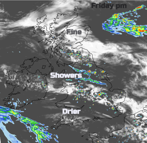
This evening and overnight, low cloud with patchy rain will creep in from the North Sea and cloak eastern England. It will be damp here by Friday morning. There will also be haar for eastern Scotland up to the Northern Isles, with more cloud for western Britain, Northern Ireland through the Irish Sea. By Friday day, northern Scotland should see more sunshine by lunchtime and Wales with southern England also brightening and becoming sunny. In between, for a swathe of Britain and perhaps later Co. Fermanagh there will be showers breaking out with some sharp downpours. Not for everyone but they could catch you out. It will be warmer for SE England on Friday.
A shift occurs from the midweek col, the no-mans land space between two highs, which are north-south from the UK this week. A low pressure out in the Atlantic whose fronts won’t manage to reach the UK until Friday night, held at bay by the highs. And to the east, a low pressure over northern Poland is bringing heavy rain and strong winds. This low moves north-westwards towards Shetland as the Atlantic fronts swing towards SW Britain.
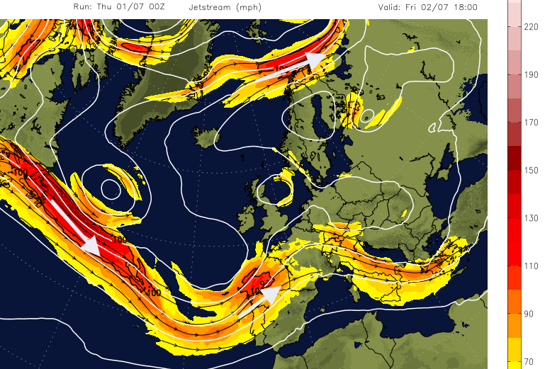
The Jetstream is no longer to the north of the UK but diving further south. This keeps the UK in less warm air and propels numerous low pressures towards western Europe.
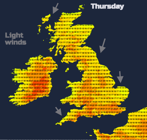
Over the few days, the top temperature for a few spots in the UK should reach 24 or 25C (London maybe 27C on Friday) but there will be more unsettled and blustery weather by next week as the Atlantic brings low pressure our way. This means a mixture of showers or rain with bright even sunny spells in between. And after light winds at the weekend, it will be more breezy with slightly cooler Atlantic air.