The June sunshine and warmth continues although mixed with low cloud, a few showers and frontal bands from the west as the SW wind picks up. Temperatures into the mid 20s Celsius
Our south-westerly flow this week brings a Tropical Maritime airmass over the UK. This is warm air, lifting temperatures into the low to mid-twenties Celsius. It is also humid air, having travelled over the Atlantic Ocean. It brings more cloud to the UK this week. Today there is low cloud to the south coast of Britain a change from the easterly flow of last week. There will be areas of cloud inland with regions of sharp showers. These miss most places and there will be more strong sunshine. Atlantic low pressures are still trying to sidle in from the west but struggle over the UK as they meet the ridge of high pressure extending up from the Azores.
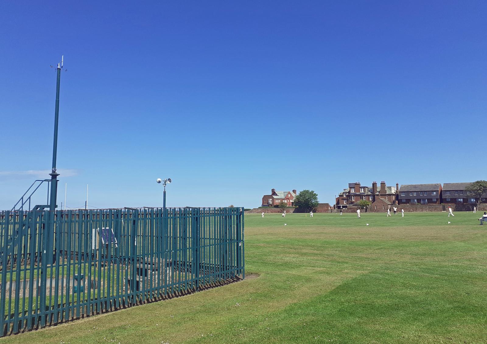
This results in fine weather, light winds and temperatures into the mid 20sC for SE Britain but more blustery conditions for Northern Ireland and NW Britain with more cloud at times and weakening frontal bands.
The English Channel is full of low cloud extending over southern counties of England and Wales. Today there are a few lingering showers over northern England down to The Wash. This threat of a sharp downpour, even a thunderstorm remains for the Pennines into eastern England. There is quite a slack flow today, so slow-moving showers and although the sunshine will get to work on the low cloud, there won’t be much breeze to stir it up. So just taking its time to lift and break. Don’t worry if you are waiting for the sunshine it will re-appear.
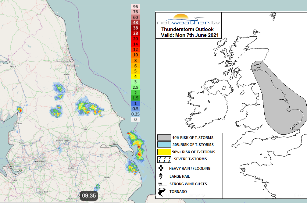
"Greatest instability today will be towards eastern Britain... Sea breeze convergence will develop inland along these eastern areas through the day too, which combined with the instability building and weak lift from cyclonic flow aloft, will support the development of scattered heavy showers and isolated thunderstorms." Convective Forecast
Temperatures
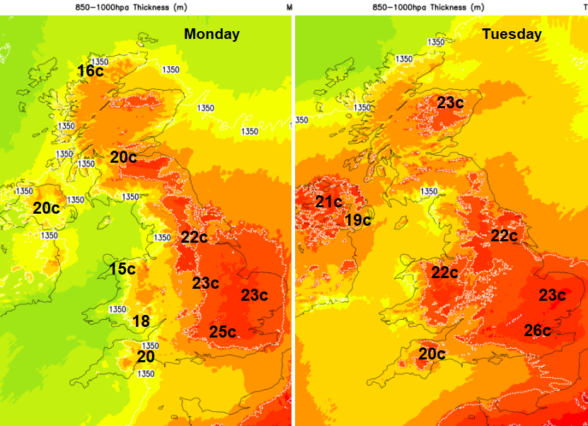
Last week the top temperature was 28.3C at Northolt, Gt. London. This week with the slightly different flow but still strong June sunshine 26C maybe 27C look to be the maximum, focused for SE Britain. This will feel very warm but is not yet the high heat we can see in summer when temperatures tip over into the 30sC and the nights become uncomfortable.
For the start of June east coast resorts had a cool, damp breeze off the North Sea, often with sea fog. This week in the south-westerly flow it will be the coast of west Wales, Cornwall and around the Solway Firth feeling cooler in the breeze.
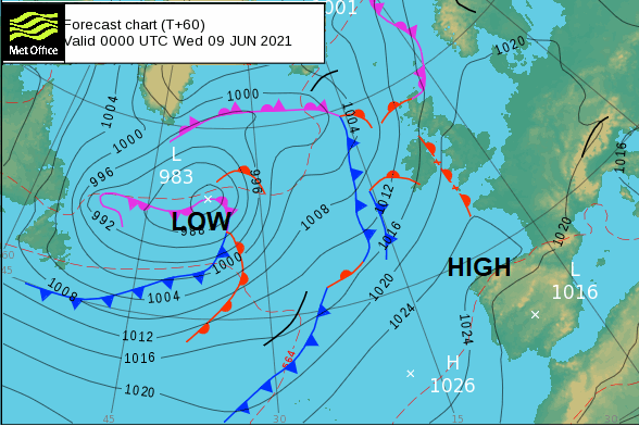
Midweek synoptic chart showing pressure and fronts, including a weakening warm front over the Irish Sea. (frontolysis)
The first of the frontal bands in the northwest appears later this evening with light and patchy rain. Western Counties of Northern Ireland and NW Scotland turn damp overnight and there is a shift eastwards of any lingering showers. Fading but located over East Anglia to end the day. The high pressure continues to hold on, just too far east to prevent more unsettled weather from reach Ireland and western Britain.
Through Tuesday there will be more cloud and some patchy light rain spreading over more of Northern Ireland and western Scotland with a moderate southerly wind. Ahead of that fine, sunny and warm. Overnight Hampshire and surrounding counties could feel cooler with temperatures dipping into single figures.
By midweek and onwards SE Britain will be seeing temperatures in the mid 20sC, sunshine, light winds and fine weather. Moray & N.Aberdeenshire will do well in the southerly flow with warmth thanks to the Fohn Effect, where air dries out and warms after lifting over a mountain range (the Grampians here)
The south to SW wind will bring in further frontal bands of cloud and patchy rain and then make more progress inland across Britain from the west. The wind will be noticeable for the NW half of the UK, but it veers to westerly over Scotland by Friday and the high temperatures will disappear as the air comes straight off the Atlantic.
June is doing well, there is lots of fine, sunny and warm weather for the next week, just eroded somewhat from the NW.