The rain over SE Britain today will clear this evening if you have Friday evening outdoor plans. It's not quite as warm now and it will feel cooler overnight but still a lot of fine weather for the weekend.
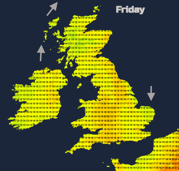
There is still a lot of fine, bright or sunny weather to come over the weekend. It won’t be as hot as it was on Wednesday, up to 28.3C but still feeling warm in the sunshine. Yesterday, the top UK temperature was 24.7C and temperatures will continue in the high teens or low to mid-twenties. It isn’t a completely dry forecast and there is rain for the SE this morning. However, it does look like the first half of June will provide plenty of warm summer weather.
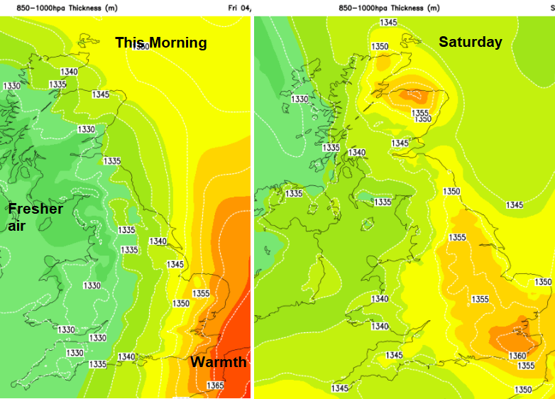
There has been a shift in the air over the UK. The heat of midweek is still surging up through western Europe but a nose of high pressure from the Azores is keeping the UK in a fresher flow. You can feel that this morning for western areas where the temperatures have dipped into single figures. For the next two nights, there will be a coolness by dawn, away from the SE and this could result in mist or patchy fog.
By day temperatures could still reach 25C for the Midlands and Greater London. It will often be eastern and southern parts seeing the higher temperatures. Western areas not as warm but the winds will be light throughout the weekend. Today there is a southerly breeze through the Irish Sea, over Northern Ireland, western Scotland which is moderate for the Western Isles. For East Anglia, there is a northerly breeze with a noticeable onshore wind for Norfolk.
After a week with moderate to very high air pollution being recorded, the levels are now forecast to be low except for the Northern Isles. The grass pollen season continues to crank up in the warmth and sunshine. UV levels are high even if the air isn’t quite as hot. Slap on the sunscreen this weekend.
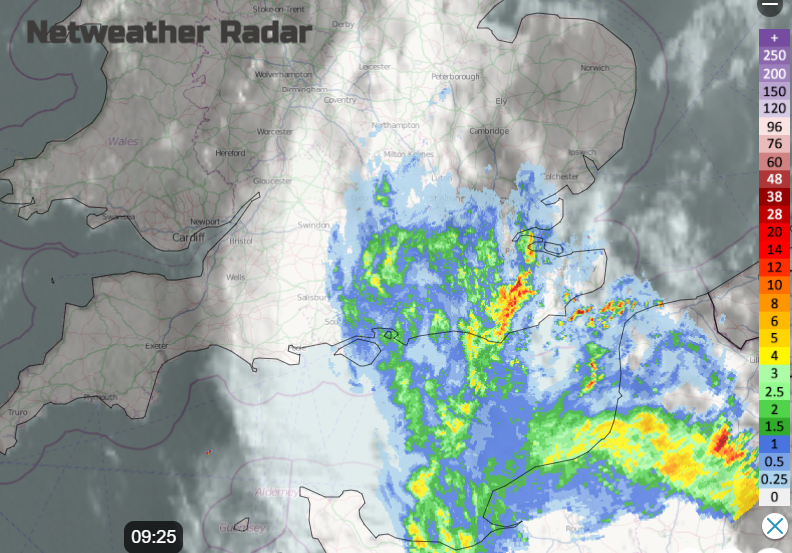
That northerly flow is around a low pressure which is bringing showery rain this morning to southern England with more cloud. There is more cloud west of Ireland from a weak weather front but for most of the UK, there is a lot of fine weather this morning and a good deal of sunshine. The showery rain over the Isle of Wight, Hampshire and SE England is linked to more thundery weather over northern France. The showery rain will nudge northwards over SE Britain where there is still warm, moist air as the thundery clusters creep NE towards Brussels for mid-afternoon.
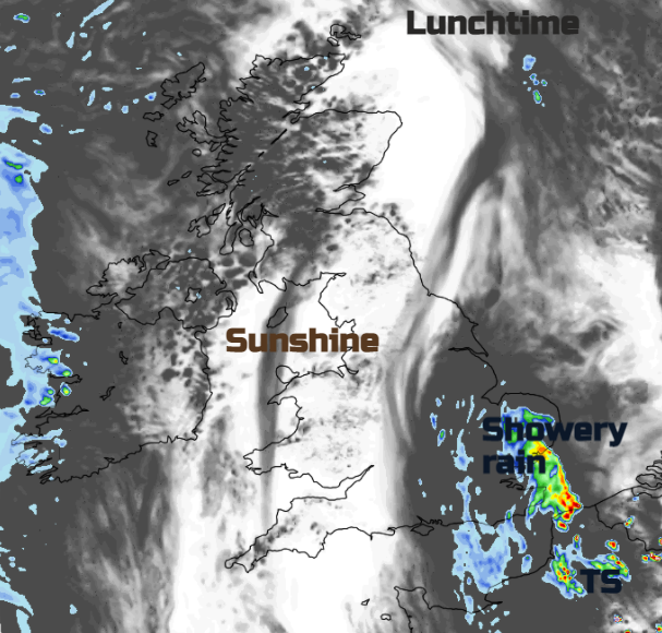
There is some uncertainty about this rain over SE Britain, where the heavier bursts will be and if any of the thunderstorms will manage to clip Kent, maybe even Essex. The focus of the rain models has been too far east looking at the radar imagery from earlier this morning, although the whole lot does still edge away over the North Sea and Low Countries by teatime. The showery rain edges away over the North Sea this evening leaving a fine, but not too warm evening for Britain. Further west the weak weather front will bring a few evening showers to Northern Ireland but not many if you are sitting outside tonight.
The weekend
For Saturday, there will be a scattering of showers over Northern Ireland, Scotland but mainly for Highland. Through the afternoon these could include some sharper bursts of rain. Later in the day, showery rain will approach western Wales and Cornwall from the SW. This is from a struggling front as pressure continues to build in from the SW. So, by Sunday there will be a lot of fair weather. Some early fog or low cloud and just the odd shower but overall a fine Sunday with more sunny spells.