For once, a Bank Holiday Monday that's dry, warm and sunny for most. The fine and warm weather continues tomorrow, which could see highest temperatures of the year so far, breakdown in the south Wednesday, then cooler and fresher thereafter.
Bank Holiday Monday will be another dry, warm sunny day and with a southeasterly breeze developing from a warm near continent, temperatures will be a degree or two higher too. Tuesday promises another warm and sunny day for most, however, Wednesday will see a breakdown of the fine weather, as an area of low pressure moves north from the Bay of Biscay across Ireland – spreading thundery showers northeast across England, Wales and N. Ireland. Cooler and fresher from Thursday, with showers continuing to spread northeast across northern and eastern areas, drier and brighter in the south and west. Friday, for now, is indicated to see more in the way of cloud with showers affecting the north and west, dry and fine elsewhere.
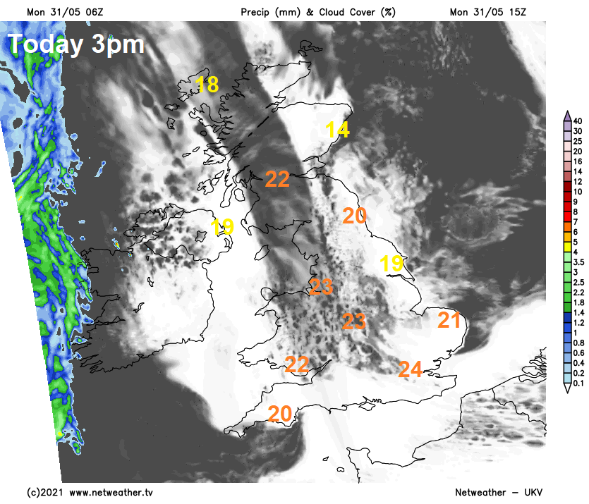
For now, low cloud and mist has rolled inland from the North Sea across central, southern and eastern England, with sea fret / haar affecting eastern coastal areas of Scotland and England. Elsewhere it’s a sunny start. The cloud, mist and fog will eventually burn back to North Sea coasts through the morning – where it may linger all day – particularly coasts of eastern Scotland. Most will see predominantly blue skies and plenty of sunshine by the afternoon, and staying that way well into the evening. A weather front to the west of Ireland will bring high cloud to N. Ireland. Temperatures reaching 21-24C widely inland, cooler near coasts, perhaps 25C in a few spots.
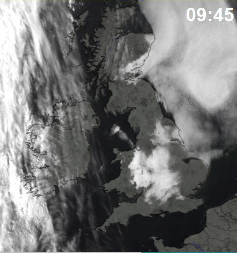
Dry overnight, low cloud and mist will roll back inland across eastern areas from the North Sea tonight, otherwise clear spells in the west.
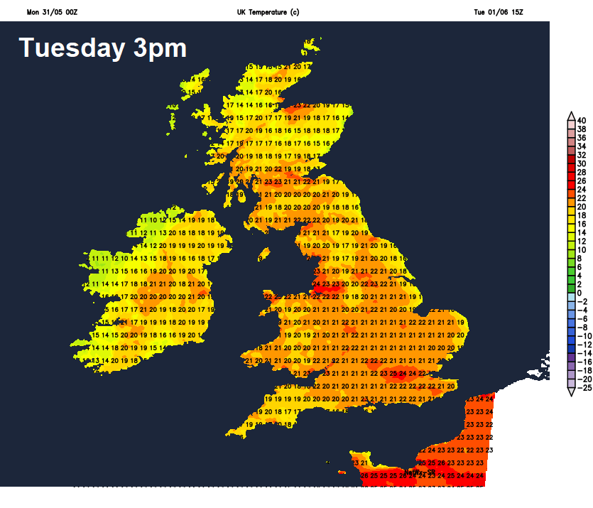
Another fine and largely dry day on Tuesday, with plenty of sunshine for most, once early low cloud and mist in eastern areas burns back to North Sea coasts through the morning. A weather front pushing in across the island of Ireland will bring cloudier skies to N. Ireland and the Western Isles with some showers and high cloud across northern and western areas making sunshine hazy. Temperatures reaching 20-24C inland, perhaps 25-26C in the southeast. Cooler around coasts with sea breezes.
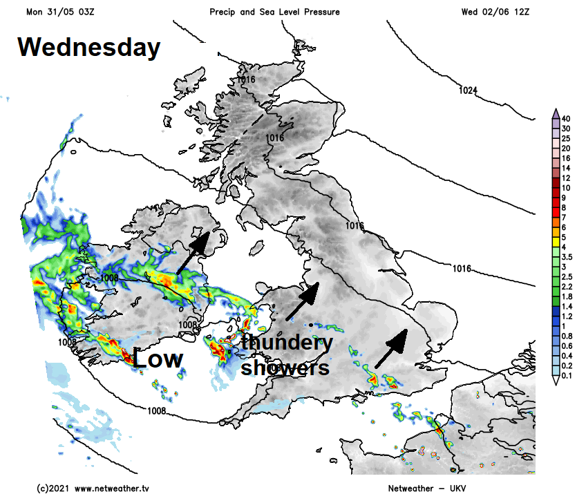
Low pressure edges closer to the southwest on Wednesday, some uncertainty on timing, but perhaps after a dry and bright start across southern England and Wales, cloudier skies with heavy and perhaps thundery showers look to spread northeast through the morning and early afternoon, reaching N. Ireland, NW England, the Midlands and eastern England through the afternoon and early evening after a dry and sunny morning. Scotland and NE England likely staying dry and sunny for much of the day. Another warm day, highest temperatures likely across central and northern England – where they may reach the mid-20s Celsius, low 20s further south with cloudier skies and showers arriving and to the north over Scotland, cooler around coasts.
Turning cooler and fresher from the southwest on Thursday following a band of thundery showers continuing to edge north across Scotland and northern England. Wales, N. Ireland, central, southern and eastern England it should become mostly dry and bright after early showers, cooler with temperatures reaching the high teens to low twenties Celsius. In the north, the mid-to-high teens.
Some uncertainty between weather models for Friday, but temperatures will be lower than earlier in the week but around average for early June, there could be more in the way of cloud and breezy across the north and west, with some showers, dry and fine for central, southern and eastern parts.