


A familiar story to start the week, with low pressure in charge (two of them, in fact), bringing an unsettled theme to our weather. But pressure will be on the rise through this week, starting to settle things down.
We're starting this week with two low pressure's over the UK, which as I'm sure you know by now, means the weather is going to be unsettled with showers or longer spells of rain in the mix. But, at long last there is a change starting to brew - it's going to be something of a slow-burn but ultimately pressure will begin to rise which should mean more sunshine and fewer showers.
In the meantime though, we're all well used to the drill by now - temperatures are generally below average, there will be some sunny spells to be had but there will also be some sharp showers and some more prolonged spells of rain.
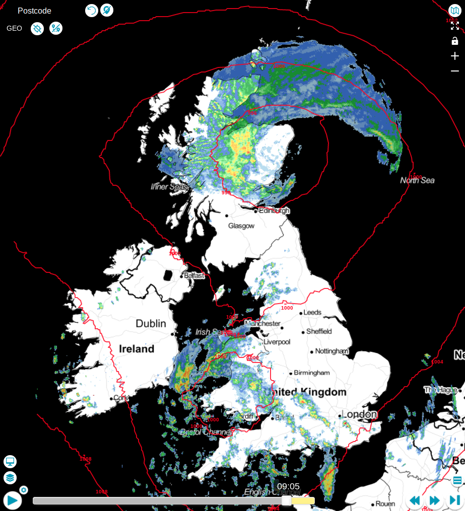
The radar image from this earlier this morning shows what's going on: There's one area of low pressure over Scotland and another of Wales. They both have fronts wrapping around them, bringing spells of persistent rain nearer to their centres, with showers fanning out from them - these will become more widespread into the afternoon across England and Wales with some heavy, thundery downpours likely. The low in Scotland will tend to weaken a little though, with some of the rain easing and becoming more patchy.
Between the two lows, parts of Northern England and Southern Scotland may fair a bit better today though, with far fewer showers and some decent spells of sunshine coming through. Temperature-wise, we may squeeze to 15c or so in that drier, brighter zone, but elsewhere 9-13c will be more typical. All quite disappointing for the final week of May.
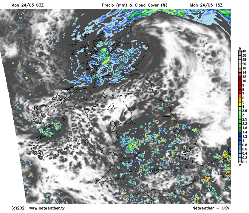
This evening and overnight, a lot of the showers across southern and central England will die back, with just a few continuing. A more organised band of showery rain is likely to start to move southeast through, and eventually out of Scotland though, making its way into eastern and southeast England by Tuesday morning.
Tuesday will be another day of sunny spells and sharp showers - the most widespread and frequent downpours will affect eastern regions, with low pressure out on the North Sea. Further west, there'll still be the threat of some showers, but they'll be fewer and further between. Temperatures won't be too far from what we'll have seen on Monday, but 16c or so isn't out of the question during the sunnier spells in some southern and central regions.
With pressure on the rise into midweek, there should be less wind and less showers - it still won't be completely dry with some big downpours still possible, but they should be more localised than we've been used to of late. With less wind and more sunshine, temperatures will start to respond as well, reaching 14-17c quite widely on Wednesday, with 16-20c a likely target on Thursday.
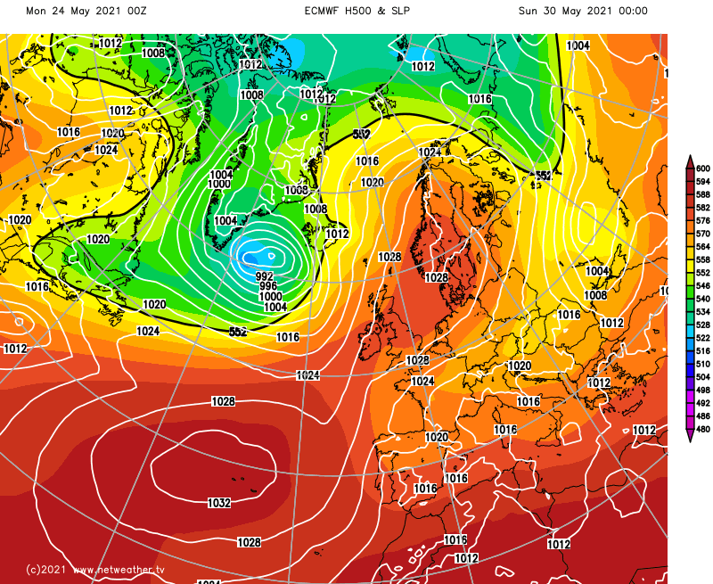
It would be nice to say that it'll then be plain sailing into the long weekend, but this is the UK and it is a bank holiday, so although there is going to be a lot of settled weather to be had, it's not going to be 100% straightforward. There is some indecision across the forecasting models as to how everything will play out at this point, despite the overriding theme being of rising pressure.
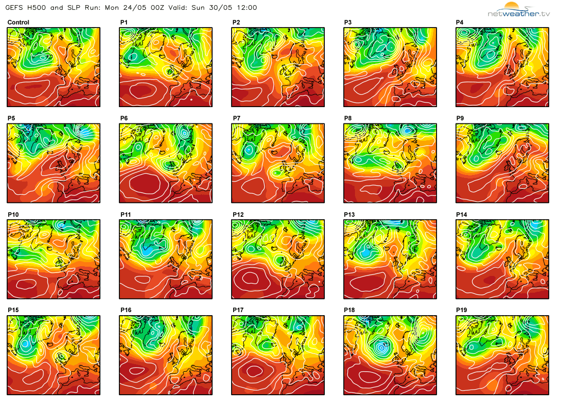 Some, mostly patchy rain may move in from the southwest later Thursday and into Friday, thanks to a front associated with a low pressure system that's likely curve up close to the west of Ireland. Then the most likely picture is that high pressure takes charge into the weekend, but there are one or two possible flies in the ointment. One is a quite common threat in these situations, in that the high may move far enough east to allow fronts to try to get into the far northwest, the other and much lower probability is that the low from the end of the week moves over or near to the north of Scotland and then hangs around fairly close by - probably in the North Sea, bringing an increased shower risk, especially to eastern parts. The next couple of days will see the outlook for the weekend firm up though, so we'll keep you up to date.


