Yesterday's low pressure system has now moved out into the North Sea, but it's still going to heavily influence the weather across the UK during the next couple of days.
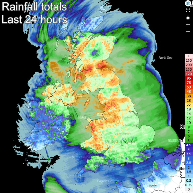
Yesterday's low pressure system has now moved out into the North Sea, but it's still going to heavily influence the weather across the UK during the next couple of days. As it rolled across the country on Monday, wind gusts peaked at 76mph at Capel Curig in Wales. Rainfall wise, Capel Curig was also the wettest place, with 50.8mm falling, many areas saw more than 25mm (1 inch).
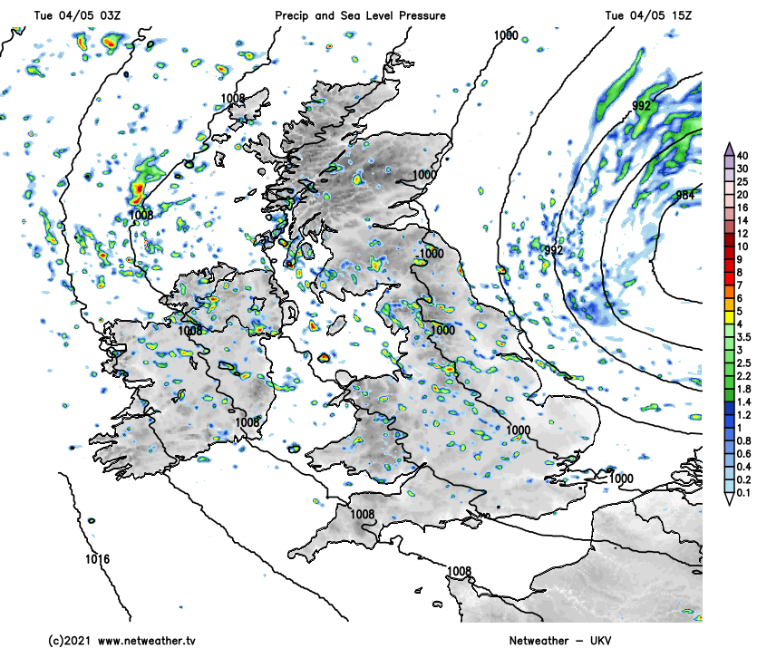
Today (Tuesday), we're back into the familiar theme of sunny spells and showers. The winds are still blustery and will stay that way through much of the day, just slowly easing back. They're blowing down from a cold north or northwest direction, so there'll be a distinct chill in the air. However, the more sheltered south of England will see temperatures in the teens.
The showers will become increasingly widespread into the afternoon, with some potentially merging into longer spells of rain. Some of the showers will be heavy and thundery with hail, plus over the high ground of northern England northwards, it'll be cold enough for them to fall as sleet and snow.
This evening and overnight will see a tail of showers clearing through Wales, central and southern England, but away from northern and western facing coasts, many parts will become dry with a widespread frost forming from the midlands north. Increasingly cold air will also be reaching down from the north into Scotland as the night wears on, bringing showers further inland, with many of them falling as sleet and snow.
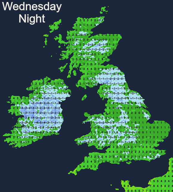
Another day of sunshine and showers then follows on Wednesday, with a wintry flavour to many of them across northern Britain and particularly up over the hills. It'll be another cold day for the time of year, with maxes of 7-12c generally, with a chilly northwest wind knocking the edge off of those values. Another cold night will follow, with a widespread frost as most showers die back to the coasts.
We then continue with the theme of sunshine and showers through Thursday and Friday. However, they may become less widespread across the southern half of the UK on Thursday and potentially well-scattered countrywide on Friday.
Looking ahead to the weekend, another spell of wind and rain is set to move in from the Atlantic by Saturday, with showers following on Sunday as another low pressure system swings through.