Heavy downpours for southern parts today as the showers in the north take on a wintry tinge over the hills. Feeling colder in the frostiest April on record.
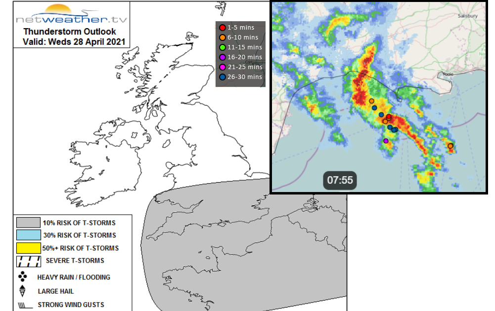
This week has brought the excitement of rain after a very dry month. Showery rain has gradually nudged southwards with some heavier downpours this morning over SW Britain. It is very welcome rain for farmers and growers after such a long dry spell although, overall, it isn’t amounting to much being rather showery in nature, swirling around a low centre. Southern England however is getting some hefty showers with thunder and lightning just offshore and that low risk extends over southern Britain today with a chance of hail.
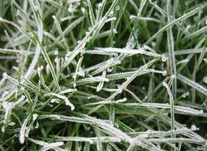
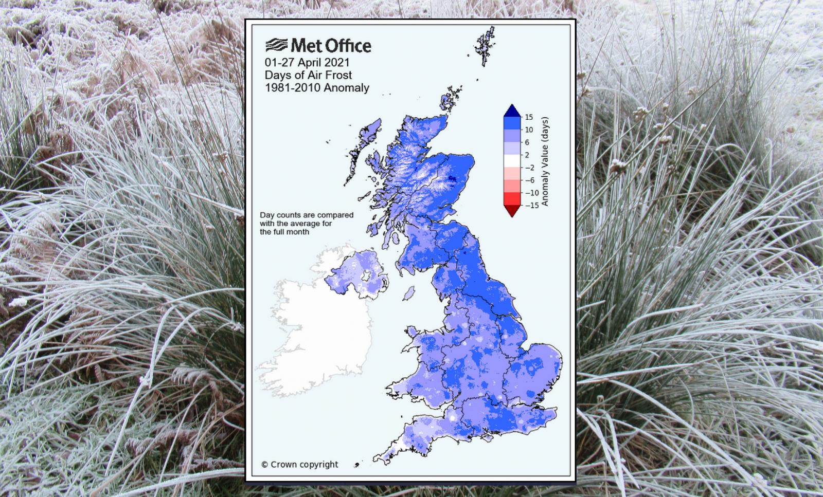
It is a change, a novelty it seems from the dry, chilly April so far. The UK Met Office has just announced that this is the frostiest April on record for the UK, records date back to 1960. There has been an average of 13 days of air frost across the UK this month, beating 1970 with an average of 11. Northern Ireland didn’t beat its record but Scotland, Wales and England had their frostiest Aprils and there has been damage to fruit tree blossom. Temperatures this week take a dive and there will be a risk of frost once more as we head into the weekend and the start of May.
Yesterday Wisley in Surrey saw a top temperature of 18.6C, warm in the sunshine over southern England. The cloud which was further north bringing outbreaks of rain has shifted southwards and as the low moves over central Europe, it leaves the UK in a colder east then NE flow. Temperatures for the end of the week will only be around 9 to 13C.
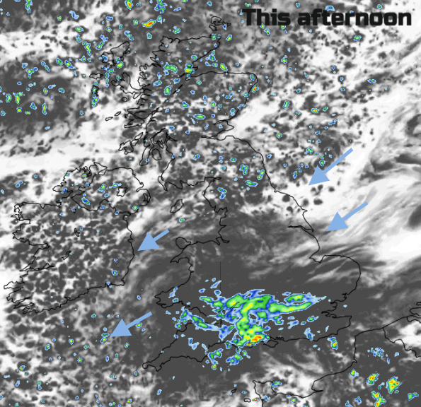
Is it going to rain today? There will be a scattering of light showers over Northern Ireland and northern England today but more fair, bright times although filling in with more cloud. Over Scotland, there will be a feed of showers from the northeast which will include sleet and mountain snow. The heavier rain over Wales, the West Midlands and SW England this morning is bringing some proper downpours to start Wednesday. This extends along the M4 and will reach more of southern England but not everywhere and it clears from north Wales and much of the Midlands by the afternoon.
So, a drier swathe across central parts of Britain although with showers feeding into the far NE of England with some wintriness over the tops of the Pennines. There will be a moderate NE wind across this middle section making it feel colder. Daytime temperatures will mostly be around 10 to 13C although a sheltered spot that sees the sunshine break through could get into the mid-teens, inland for SE Britain.
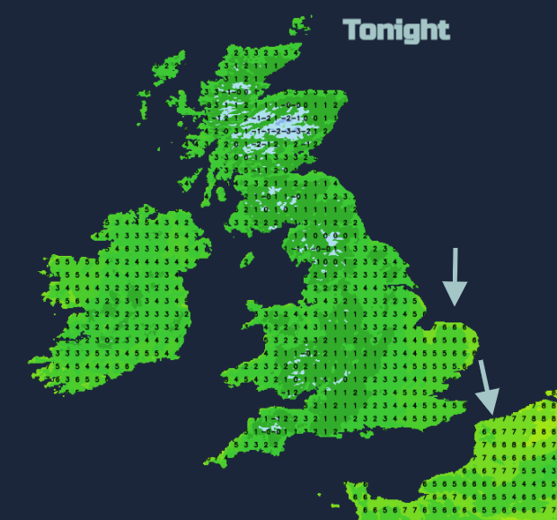
The dig of colder air will affect NE Britain and right down the North Sea coast to Norfolk. A north wind over East Anglia and the Home Counties will stir the air enough to keep temperatures around4 to 6C. For inland Scotland, NW England, inland Wales, the Midlands and parts of the West Country temperatures will dip near to freezing, even a degree below so there is a frost risk tonight for western Britain. Northern Ireland should stay a few degrees above, but rural areas could see an air frost. Another for the list. Overnight the rain over southern England will have rotated away past SE England and London, clearing away from Kent on Thursday morning
For Thursday the winds will be light but temperatures at only 10 to 12 C widely. There will be a slow flow of well-scattered showers for NE England, Scotland from the North Sea and reaching Northern Ireland. There will be an icy tinge at times and wintriness over the hills. Through the day more showers break out with quite a scattering across the UK although fewer reaching SW Britain.
This mixed, unsettled and colder pattern continues through the long weekend.