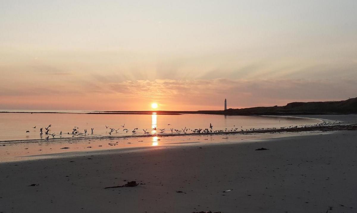
The fine, sunny dry weather continues this weekend. It brings with it high tree pollen levels, the need for sunscreen and warnings about the risk of wildfires. No rain until next week and a bit of frost.
More of the same, weather-wise. Dry and sunny or bright. Cold with patchy frost by night but warm in the sunshine by day. Slap on the sunscreen and dig out your sunhat.
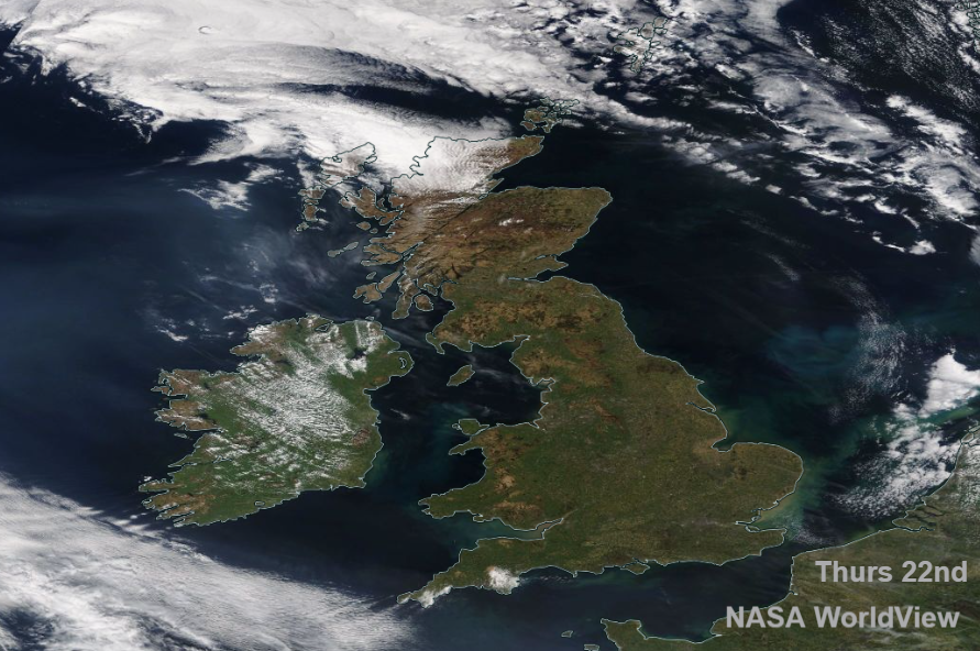
The NASA image from yesterday shows the clear skies allowing the sunshine, with just a few patches of cloud. A little over SW England and more in the far north of Scotland although it was warm near Loch Ness at nearly 18C, Edinburgh not far off either. Many places will be warmer today with temperatures in the mid to high teens but once more a chill for areas with a cold wind off the sea.
If you are wondering about when the UK weather will change or looking for some rain, it looks like a little low will finally interrupt the ongoing high pressure on Monday from the north. That will bring a bit of rain for some by the start of next week, so a change from blue skies but Northern Ireland, and much of southern Britain won’t see much rain at all, if any. April 2021 has been very dry indeed.
The holding pattern of our current high has resulted in unsettled weather for Iberia with a low pressure continuing to throw cloud and rain over Portugal and parts of Spain through the weekend and also some high cloud over Ireland today.
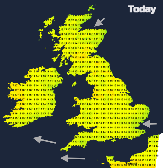
Inland parts of Scotland will fare well with temperatures well up into the teens. Glasgow up to 17C. Along the coast and for the islands it will be cooler at 8 to 12C. For Northern Ireland temperatures will be 14 to 17C, still with a cool SE breeze coming off the sea for Belfast. Sheltered parts of Wales will do well in the sunshine today with temperatures of 16 to 19C, so feeling warm for Friday. For England, there will be a variation of 9 to 19C. Again, the north Kent coast and Thames estuary will be cold with the east wind off the sea. The Channel Islands should manage 17C even with a fresh wind but for Cornwall and south Devon, 15C will be the maximum in the brisk east wind. Counties along the M4 into the West Midlands, Merseyside and Greater Manchester should all feel warm at 16 to 18C today. Other parts of England will see the mid-teens just with the cold breeze for the east coast.
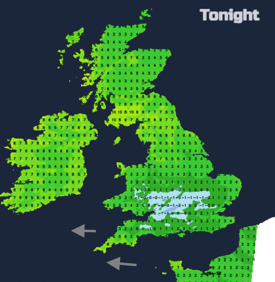
There will be some lingering cloud over Grampian today and the high cloud from the west will save the temperatures from falling too far tonight, so many parts won’t have a frost. An inland swathe of southern Britain still could see temperatures down to or just below zero overnight.
Another fine, sunny day on Saturday but low cloud is forecast to creep along the Forth and over coastal counties of SE Scotland and NE England so temperatures here will stay down. The haar or sea fret is lurking out in the North Sea already. Temperatures will be 15 to 17C but still with the cool east wind along the English Channel. NE Britain will feel colder in the breeze off the sea and with more cloud but as always warm in any sheltered sunny spells. Colder air along the North Sea coasts with the wind straight off the sea.
More cloud for Britain to start Sunday, but most of it will dissolve away in the morning leaving another fine, sunny and dry day. Moderate to high levels of tree pollen this weekend and a plea from the fire brigades about not lighting fires or BBQs on the ground as this dry spell continues.