A weakening cold front slipping south will bring a band of cloud & rain for Scotland today then a cloudier day in the south Wednesday. Otherwise it will be sunny & dry by day rest of the week as high pressure builds, though overnight frosts returning.
April has been a very dry month so far and Tuesday and the rest of this week is looking to remain dry for many. There will be a little rain around in the north today, while elsewhere there will be a few well-scattered showers, but you’ll be unlucky to catch one, with most in the south staying dry and sunny. It will be mostly dry for the rest of the week, but turning a little cooler from the north. Wednesday will be cloudier across the south as a weak cold front clears here, with a few sharp showers in the southwest. Sunnier skies spreading south across the north. Thursday and Friday settled, sunny and dry for all, as high pressure drops down over Britain. But with the cooler airmass moving down too, clear skies will lead to a return of widespread frosts overnight.
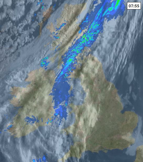
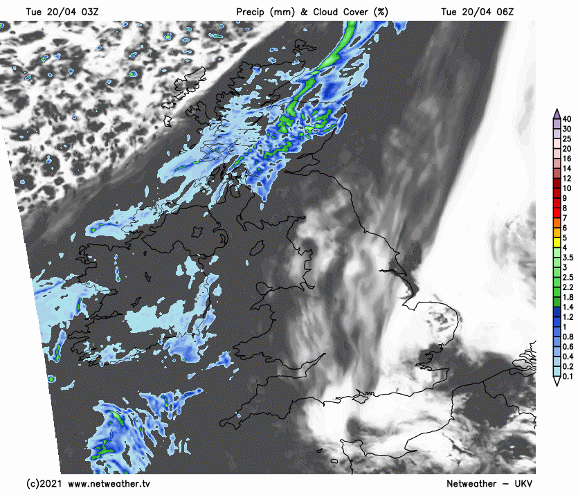
For now, a cold front slowly drifting in from the northwest will bring cloudy skies and band of rain southeast across Scotland and N. Ireland today, turning increasingly patchy as the front weakens, dry, brighter but cooler conditions following across northern Scotland and N. Ireland, though a few showers possible in the Northern Isles. Winds picking up later and with cooler air spreading south – temperatures in the afternoon reaching 9-11C at best.
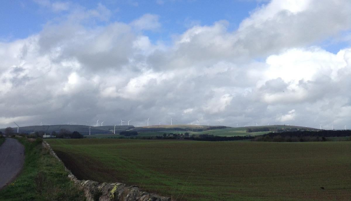
Further south, low cloud and sea fog around some North Sea coastal areas will burn back through the morning to join much of England and Wales to decent spells of sunshine through the morning. Cloud will bubble up through the afternoon, producing a few well-scattered showers in places, but most places staying dry with sunny spells. Thicker cloud spreading from the northwest across the northwest of England and west Wales through the afternoon. Winds will be generally light, so feeling pleasant in the sunshine, temperatures reaching 13-16C generally.
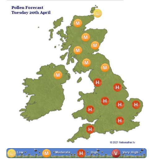
Pollen levels are forecast to be high across much of England and Wales today, medium across Scotland, N. Ireland and NE England:
The remnants of that weakening cold front across Scotland today will continue south across northern and central areas of England along with Wales overnight, bringing cloudy skies and patchy light rain or drizzle. Colder and clearer conditions spreading down across Scotland – leading to a patchy frost by dawn. Turning chilly across SE England too with clear spells here, but likely remaining frost-free generally.
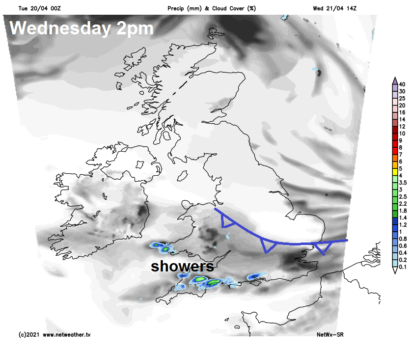
The weak cold front will continue south across Wales and southern England on Wednesday, bringing a cloudier day here, with the odd spot of rain or drizzle here and there. Devon and Cornwall could see some localised heavy showers break out though in the afternoon. Drier, sunnier but cooler conditions already across Scotland and N. Ireland spreading south across northern, central and eastern England. A chilly onshore wind along North Sea coasts will keep temperatures pegged back to highs of 9-10C at best, elsewhere reaching 11-14C.
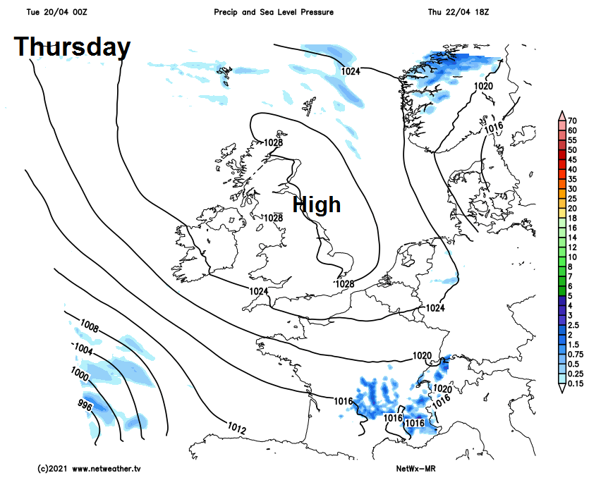
Cloudy skies will clear southern areas tomorrow evening leading to a widespread overnight frost. Then a dry day on Thursday with lengthy sunny spells, thanks to high pressure sat on top of the UK, temperatures recovering to near average values after the cold start. Highest temperature towards the west, where we could reaching 16C in places, otherwise the low to mid-teens Celsius, cooler along North Sea coasts.
Staying dry and sunny on Friday with mostly clear skies for southern and eastern areas, though perhaps turning cloudier in the far west. After a cold and frosty start temperatures recovering into the low to mid-teens Celsius generally. Perhaps becoming windy across the far southwest though.
High pressure remaining in control through the weekend too, so staying generally dry. A brisk easterly or northeasterly breeze developing, especially in the south, taking the edge of temperatures reaching the low to mid-teens, perhaps locally high teens in sheltered areas of the west. There will be areas of cloud floating around too, so not wall-to-wall sunshine. Where skies clear overnight, there is a risk of a ground frost.