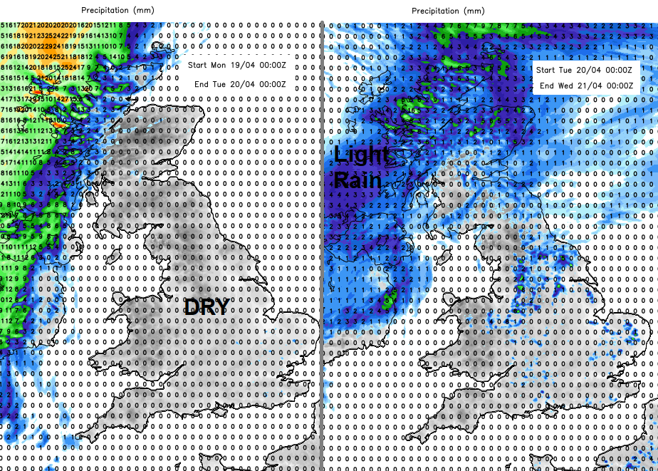
Another week with high pressure, settled conditions, frost by night but mostly dry. Warm, strong sunshine by day once the front in the NW and any early fog fades.
This week sees high pressure bringing more steady, settled weather to the UK. Last week there was a nip in the air thanks to chilly air but offset by strong sunshine. Also, the risk of frost by night but plenty of blue skies and hardly any rain. This week is similar but there is a frontal band in the NW to start the week. This will bring some rain today but as it creeps over more of Britain in the next few days it will be fade and introduce just cloudy skies as it passes by. Many areas have light winds, there will be more frost and early morning fog, but the sunshine is strong now so do consider sunscreen, especially as more children return to school.
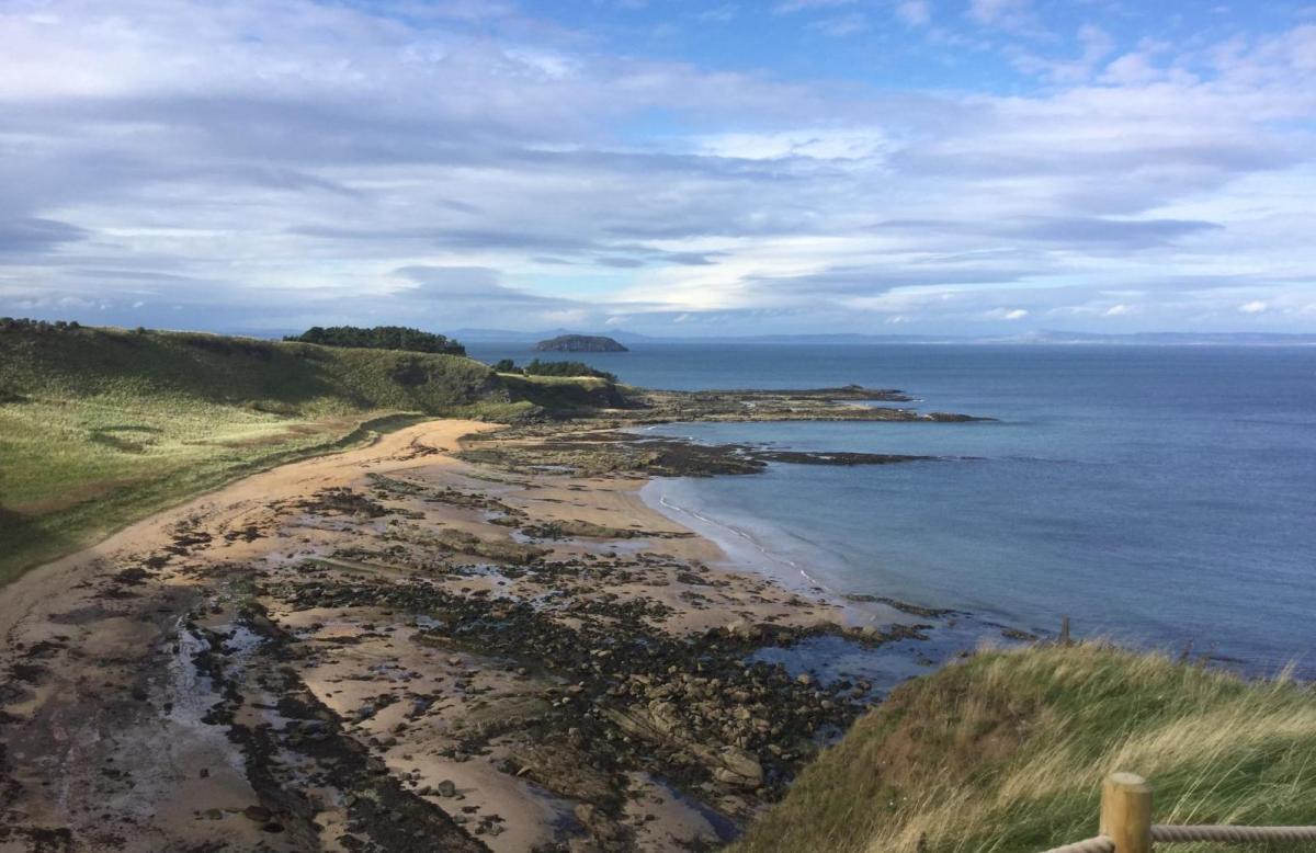
Some areas of the UK have seen very little rain this month, others a lot of frosty mornings, more than usual for April. The ground is dry, such a change for those out walking or riding at the weekend with routes accessible now after the muddy bath conditions of early months.
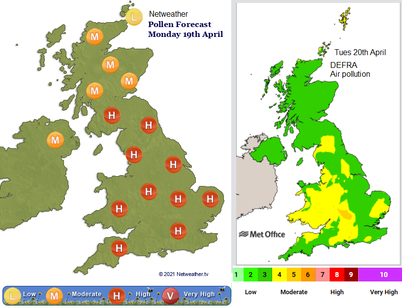
We are now seeing high pollen levels from tree pollen. The grass season hasn’t started yet so the levels for grass and spores remain low. With the light winds and slow descending air under the anticyclone, conditions do stagnate and so there will be Low to Moderate levels of air pollution for England, Wales and eastern Scotland “due to light winds and settled conditions” DEFRA. Low levels are forecast for the rest of Scotland and Northern Ireland.
Temperatures
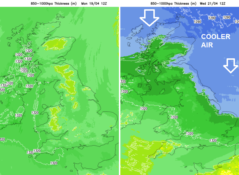
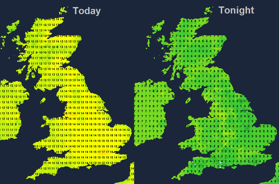
Although the risk of frost remains, with overnight temperatures sometimes dipping below zero (more so later in the week), by day the sunshine will do its work. Most places will be double figures by day, with top temperatures this week around 17 or 18C. The Scottish islands and north coast Northern Ireland will struggle early on at only 9 or 10C on Monday and Tuesday with more cloud and patchy rain. This frontal band will gradually push south as a cold front and cooler air then filters down from the north midweek.
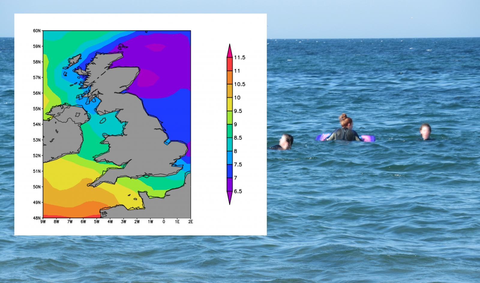
For anyone who has ventured into the sea this past week, you’ll know it is not yet warm. Water is not as responsive as the air in its seasonal shifts in temperature so the seas around Britain and Ireland are still chilly, particularly towards the NE at only 6 or 7C and 9 or 10C away to the SW. Get your Vitamin Sea but you might still want a 5mm wetsuit and boots on.
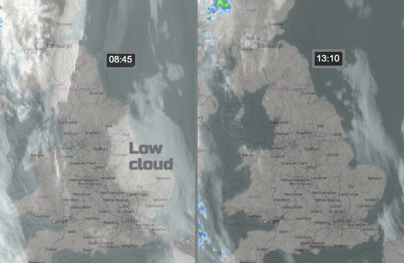
Clear skies overnight have given a chilly, frosty start but with sunshine again and blue skies, over much of England and Wales but with patchy fog early on that will disappear. There is a large area of low cloud over eastern England. This will break up during the day allowing more sunshine and warmth, but it will re-appear overnight ready for Tuesday morning. The front in the far NW will bring a different start to the week for the Western Isles and NW coast of Scotland, also later into Counties Derry, Tyrone and Fermanagh. The cloud from this will still allow sunshine for eastern/southern Scotland, more appearing for Cumbria, Anglesey and the Isle of Man.
By Tuesday morning the frontal band will be over northern mainland Scotland but light and patchy, also Northern Ireland with cloud across the Irish Sea and west coast Britain. The low cloud will have seeped into eastern England but again there will be a tranche of sunshine from southern England northwards. This fills in with fair weather Cumulus during the day but stays bright. The frontal cloud covers more of the UK by Tuesday evening with sunshine in the south and brighter skies appearing in the far north although with the cooler air.
Then it’s dry and settled, feeling cold under any cloud or fog but warmth in the strong sunshine. Worth staying out of the nippy east breeze as that picks up from midweek onwards.