The cold weather continues with sunshine and wintry showers again on Tuesday - and the showers will become more widespread for a time later.
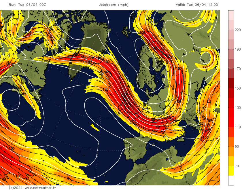
In recent decades snow has tended to fall at Easter rather than Christmas, and so it has proved again this year due to a blast of air straight from the Arctic. This often happens when we get large meanders in the Jet Stream, which has taken us straight from summer in late March, when we were on the warm side of the meander, into winter in less than a week.
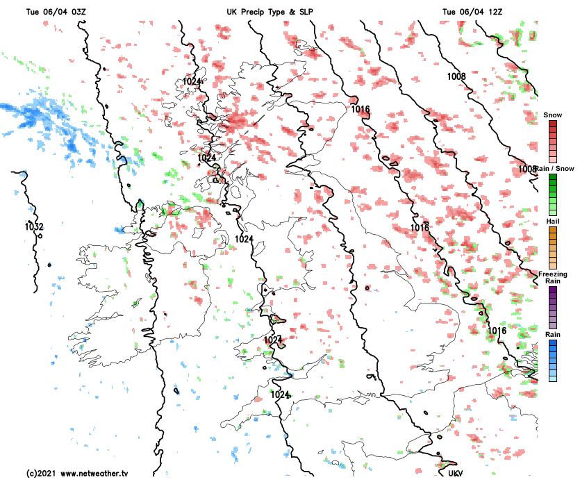
So this morning, we have a widespread sharp and penetrating frost, with parts of Scotland in particular waking to a covering of snow. But like yesterday, after an icy start, there'll be good sunny spells, especially in sheltered inland parts when it'll stay dry. Later in the morning, however, cloud will build, with wintry showers already over Scotland, Northern Ireland and towards exposed coasts, developing inland. Not everywhere will see them, but where you do, the showers will be a mixture of either rain, soft hail, sleet or snow, with further blizzards likely over hills in the North.
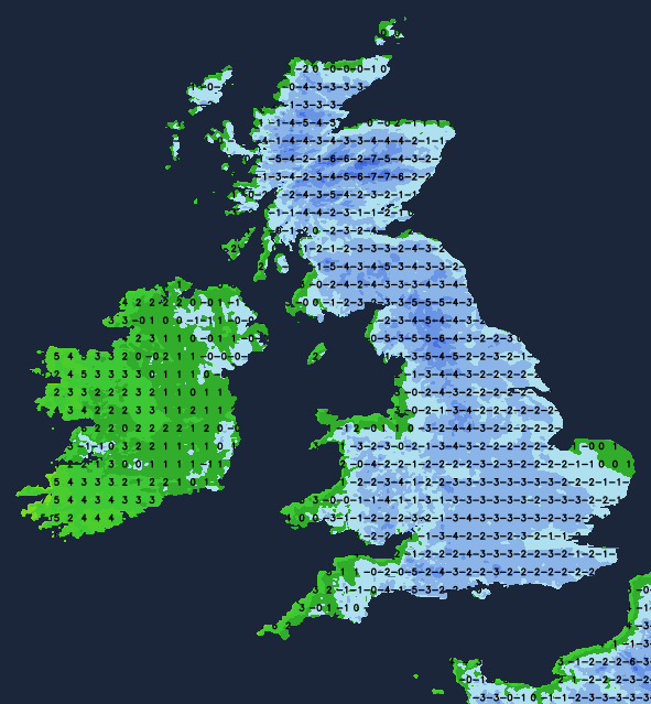
It'll continue to feel bitterly cold in a North West or northerly wind, which'll be gusty, especially in showers. Top temperatures only 3 to 5C in the North and 6 to 9C further South, but it'll feel more like freezing, particularly if you a catch shower.
The blustery wintry showers fade into the evening, becoming mostly confined to the North and exposed coasts overnight, as a North-West wind begins to decrease. Clearing skies will lead to another sharp, penetrating frost, as temperatures fall mostly to between zero and -5C but perhaps as low as -8C in some Scottish glens and the coldest, more sheltered rural spots further South. But over parts of Northern Ireland and in the West, you may see more in the way of cloud later in the night.
Wednesday begins very cold and frosty, but temperatures will soon rise through the morning in the now quite strong spring sunshine. Apart from a few wintry showers, mostly towards coasts exposed to a North West or Westerly breeze, it'll be mainly dry. But cloud will tend to build in the West into the afternoon, with Northern Ireland seeing patchy rain later, perhaps preceded by a little hill snow. It may end up slightly less cold, but it'll still feel quite raw in the wind, with top temperatures across the country mostly in the range of 5 to 10C.
You may see clearing skies into the evening across East Anglia and the South East, perhaps allowing a touch of frost for a while, but temperatures will rise a little during the night as cloud in the West eventually spreads to most parts. With it will be some rain or drizzle preceded by a little snow on northern hills, but any rain in the East and South should be light and patchy. But over the North and West of Scotland, heavier bursts of rain will probably come along later in the night as a West or South-West wind begins to freshen. Lowest temperatures 1 to 6C.
Although not feeling so, Thursday will be somewhat milder. But the respite from the cold will be brief, with another less severe blast of Arctic air likely by Friday and into next weekend.