The steady, settled UK weather will fade this week as the Atlantic takes hold and brings us blustery winds and rain from the west. Still some warm spring sunshine though.
This week we see a gradual change from steady high pressure to Atlantic low pressure. We have a cool start this morning, but temperatures generally will be just into double figures for the next few days with a lot of dry settled weather, often a lot of cloud. Later in the week, we’ll see rain from the west and blustery winds and colder air on Friday in a more changeable setup.
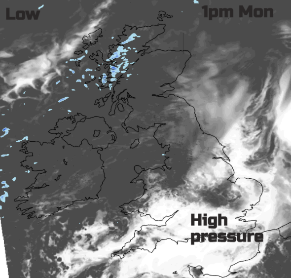
High pressure is to the south and it will edge slowly eastwards over mainland Europe. This allows Atlantic weather fronts to come our way, the first one doesn’t quite make it, up against the high. There will be more cloud from the northwest today and some patchy rain for the far NW of Scotland in the damp flow but the front just waves about, kept at bay. There will be a brisk SW wind here but for most of the UK, Monday will be quiet and settled and dry. More cloud in the north and west but still bright and more sunshine south and east with hardly any breeze closer to the high pressure for southern Britain.
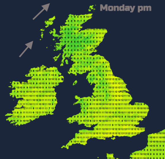
Temperatures will be between 10 and 14C. Northeast Britain could do well in the west/SW flow up to 13 or 14C in sunshine. London could see a few degrees higher with still air and sunny weather. However, from DEFRA air quality forecast
“Parts of southern Britain may see isolated Moderate levels [of air pollution], more likely near larger urban centres as locally-emitted pollutants may prove slower to disperse in lighter winds.”
Tonight, there will be cloudy skies for Northern Ireland, Scotland and NW England so temperatures stay up here around 7C. For the rest of England and Wales it depends on the variable cloud cover with some spots dipping near to zero under clearer skies with very light winds. There could be a touch of frost, patchy fog in the far south but nothing much.
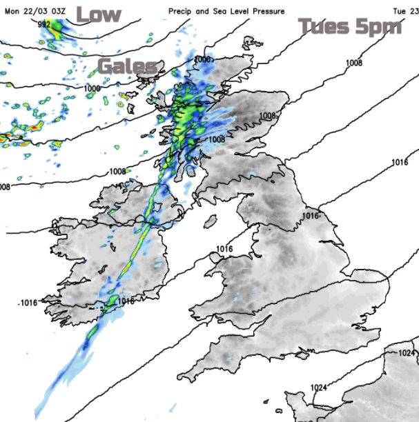
During Tuesday, cold front rain will reach Northern Ireland and the Western Isles by mid-afternoon. Ahead of this there will be fine sunshine for SE Britain, more cloud for Wales and western Britain, sometimes with dampness and murkiness, particularly for the coasts.
Temperature again will be 10 to 15C. The SW to S winds will pick up with gale, even severe gale force winds for the Scottish islands and far NW coasts. This is as a low centre sweeps by to the north of Scotland later on Tuesday.
The winds pick up across the UK, still light for the Home Counties but fresh for mainland Scotland and Northern Ireland and around the Irish Sea. Overnight the cold front will move SE over northern England into Wales, as a narrow band of rain reaching SW England and the Midlands by morning on Wednesday. Ahead of this, it will still be cloudy but clearer skies behind and so sunshine midweek. It will feel a bit fresher by Wednesday with clusters of showers arriving from the west on the wind. These showers pepper Northern Ireland and Scotland (mainly the west) along with bright spells as the weak cold front trundles on to SE England by Wednesday evening.
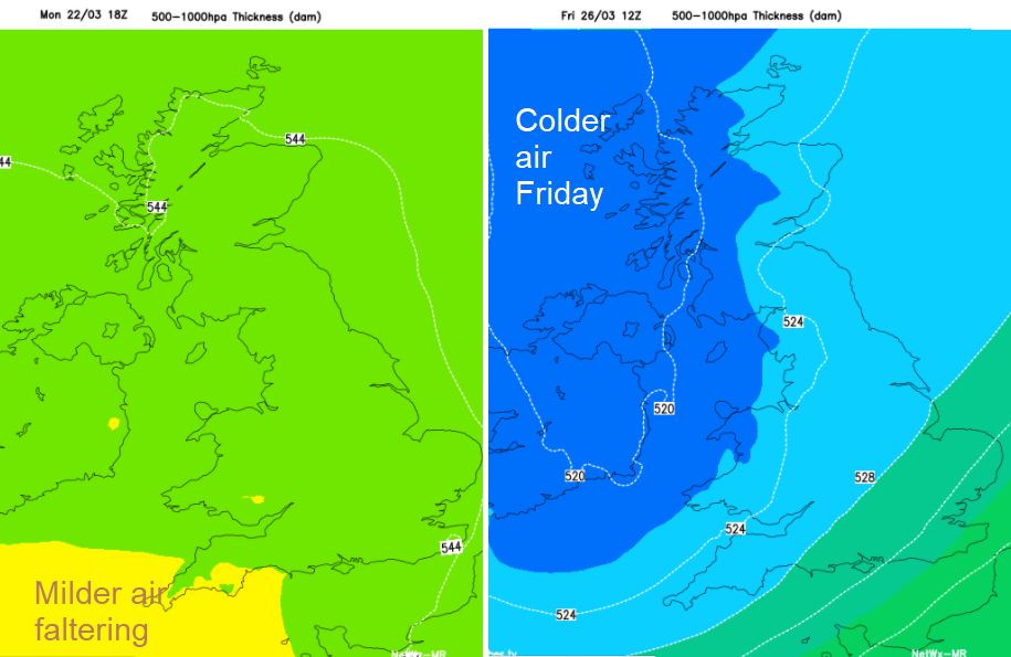
The rest of the week will be blustery or windy with showery rain from the west as Atlantic low pressures head our way.