High pressure is staying well in charge of the UK's weather this weekend, but there are hints of a change to a more mobile pattern as we move through next week, with Atlantic systems potentially starting to make some inroads again.
High pressure is staying well in charge of the UK's weather this weekend, but there are hints of a change to a more mobile pattern as we move through next week, with Atlantic systems potentially starting to make some inroads again.
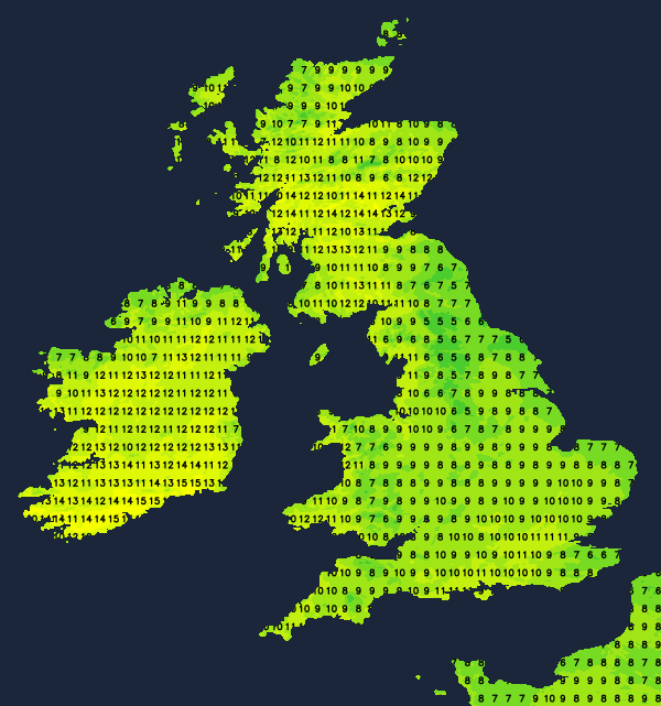
After the showers of recent days in eastern areas, the good news is that they're mostly gone now, but we're still going to be chasing breaks in the cloud around with sunshine often at a premium over the next few days. Today, the best places for extended sunny spells will be the southeast of England and the west of Scotland. In between, it's a cloudier picture with some of it thick enough in eastern and central parts to bring a few spits and spots of rain. Even so, there should be some breaks in places, and where the sun is out, temperatures will rise into double figures, with the warmest spots again likely to be in Scotland, where the mid-teens are possible. Near to eastern coasts, and especially in the southeast and through southern England, a fairly keen northeasterly wind will keep it feeling cooler, though.
Overnight tonight, the clear skies in the south will linger for a while, at least, giving a chance of a few frost patches. The northern half of Scotland will see plenty of clearer skies too, but elsewhere there'll be a lot of cloud and murk around with some drizzly bits of rain possible here and there.
Into Saturday, and it'll be eastern and central Scotland, along with northeast England in line for the best of the sunshine, with parts of Wales may be getting in on the act at times as well. Elsewhere, there'll be a lot of cloud around again, with some drizzly rain possible at times. It'll be in those sunnier zones where it's warmest, with highs again into the mid-teens. Elsewhere 8-12c will be more like it.
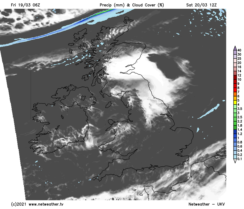
After a patchy frost in places, Sunday, shock horror will be another similar day with many parts of the country cloudy. Where the sun can breakthrough for any length of time, it'll feel warm again, but there's no clear picture in terms of where may be best placed for any lengthier sunny periods at the moment.
Looking ahead to next week, to start, the pattern will continue, with high pressure still dominant. Tuesday may see a weather front moving down from the northwest, bringing some patchy rain along into Scotland and Northern England. Ahead of it, there'll be more of the same, behind it, clearer skies and some showers. The front is likely to continue to slip southeast into midweek, with fresh, chilly, but sunnier weather behind it for a time.
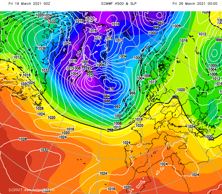
Beyond that, it does look like low pressure could become a more dominant player in our weather again, with the northwest of the country likely to bear the brunt of the wetter, windier weather at times, as the southeast stays more sheltered and closer to high pressure still.