After a showery, blustery and chilly weekend there are some changes to the UK's weather on the way over the coming days, as high pressure returns to our shores again.
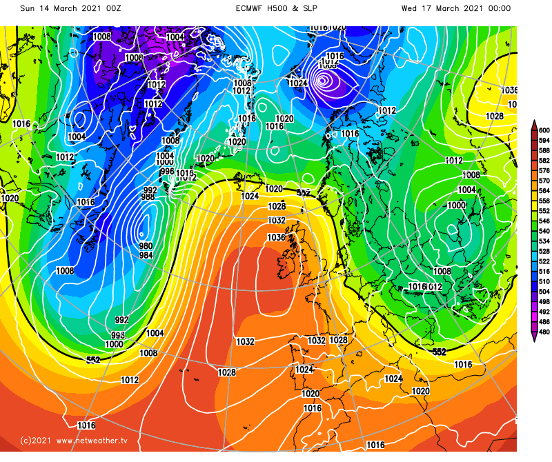
After a showery, blustery and chilly weekend, there are some changes on the way over the coming days as high pressure returns to our shores again. There will be some complications and hurdles to get over, though, so don't expect a full-on blast of non-stop Spring sunshine, but the weather will generally become more settled.
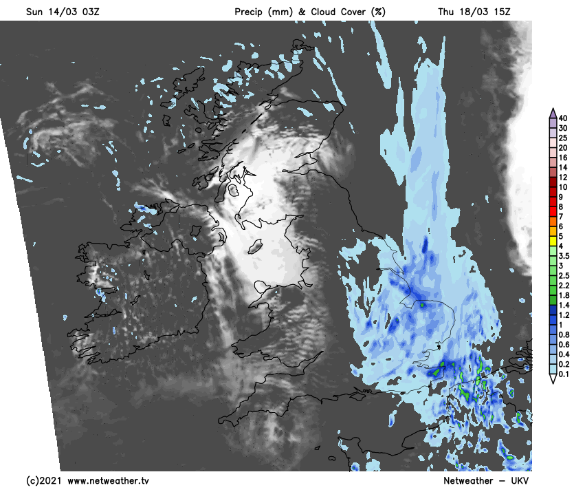
Monday will be a quieter day than we've seen of late, with lighter winds and less in the way of showers. There may be a few leftover in the southeast during the morning though, and some running into western regions through the day. But for most, it'll be dry with varying amounts of cloud, allowing sunny spells to develop. The best of the sunshine will be in eastern and central areas, with more cloud in the west, especially over Ireland, where there will be some showery rain here and there through much of the day. Temperatures on Monday will be a touch milder than we've seen during the weekend, with most parts reaching 9-12c.
Later in the day and overnight, some more organised rain will cross into western Britain - most persistent and heavy in the west of Scotland. That and another band which'll join from the northwest later will trundle their way southeast overnight and into the start of Tuesday, gradually becoming lighter and more patchy as they do. There'll be some good sunny periods to be had behind that, as high pressure ridges in from the southwest, with just the southeast likely to cling on to more cloud and some rain into the afternoon. Temperatures will rise to 13-15c fairly widely in the sunshine.
After a chilly start with a touch of frost and some misty or foggy patches in places, Wednesday stays dry for the vast majority. There'll be some good sunny spells on offer again as well, but as the day wears on, cloud is liable to build in eastern areas, with the odd shower not entirely out of the question.
The reason for the change through the day on Wednesday is that the high pressure is set to shift a bit further west, and that process is then likely to continue on Thursday. The shift is likely to open the doors to north or northeast winds in eastern counties, bringing plenty more cloud, a colder feel and the potential for more widespread showers during Thursday. Further west, though, it stays drier, sunnier and milder.
The latter part of the week is expected to keep a similar trend going, with east or northeast winds affecting eastern and particularly southern England. Whereas further north and west, with high pressure closer by it's drier and sunnier, but even so it is likely to be colder by this point, with overnight frosts. Looking ahead to next weekend, the high pressure is currently forecast to sink over the UK, cutting off the chilly easterly winds, but cool air may well stay trapped underneath it, leading to overnight frosts.