


High pressure is retreating from the UK today, with two deep areas of low pressure on the way over the next couple of days. The unsettled weather will then continue into the weekend.
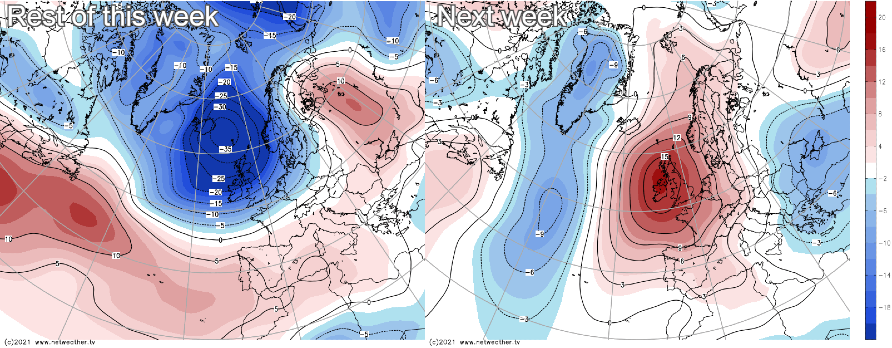
High pressure is retreating from our shores today, with two deep areas of low pressure on the way over the next couple of days. The unsettled weather will then continue into the weekend. If you're hoping it'll be a fairly brief blip, you're likely to be in luck as high pressure does look set to return from the southwest next week.
For today, many parts of the country will have another dry day with some sunny spells. Some showers are affecting a few regions of northern England and Scotland, though, plus we have the first of the low pressure systems this week approaching from the west. Rain will cross into Ireland (North and South) this morning, reaching western Scotland this afternoon, northwest England and Wales this evening, before pushing on further east overnight.
With the rain, there'll also be increasingly blustery, strong winds initially in the northwest, but spreading across into other parts of Northern and Western Britain this evening and overnight. Severe gales with gusts of 65-80mph are possible in exposed parts of Northwest Scotland later, with other regions also seeing some gusts of 60-70mph. Into Wednesday, the winds will ease across the northern half of the country but will stay on the blustery side across a good part of England and Wales, particularly near to coasts.
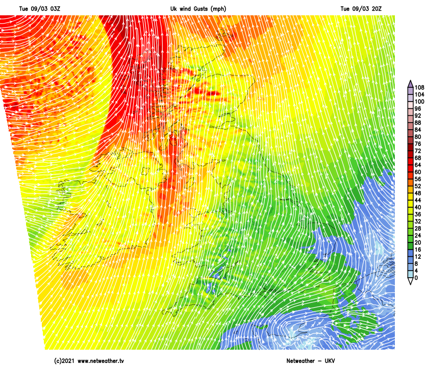
Wednesday will also see the initial band of rain continuing to move through to the southeast, but at the same time, with the next low pressure system nearing from the Atlantic, another band will be pushing up from the southwest through the day. By this point, the original low pressure, which arrived today (Tuesday), will be up close to Iceland, but the next one will zip in and be not too far from the northwest of Scotland by the evening. As well as its rain bands, it will also re-introduce strong winds, with England, Wales and the southern half of Scotland likely to see the strongest gusts of 55-70mph or so from the evening onwards.
Up to Wednesday, the weather this week will have been on the mild side, but as that low pressure moves east into the North Sea, that's going to change as much fresher, colder westerly winds arrive. The last of the persistent rain should clear the east early on Thursday, and the strongest winds will start to ease into the afternoon as well. It'll be a day of sunshine and frequent blustery showers, blown in on that strong westerly wind. The showers will be wintry over the hills of northern Britain in particular and will be most frequent in the north and west. Eastern England may still see temperatures scraping into double-figures, but elsewhere 4-7c will be about the top limit, with the wind making it feel colder than that.
Friday is then set to follow along a very similar theme. Another small area of low pressure is likely to cross from the west later Friday and into Saturday. This may well pep up the winds for a time and bring some more persistent wet weather in places. Then, with the air turning a touch colder still, Saturday will be another day of sunshine and blustery showers, with more areas potentially seeing a wintry flavour to them as well.


