Grey, cloudy skies linger over the next few days with a scattering of showers in the south today, then a colder NE wind and widespread frosts to end the week. High pressure keeping things steady.
High pressure brings settled steady conditions but quite variable weather. There can be warm sunshine for some, as seen on Tuesday in the west where it felt mild enough at 10 or 11C or grey, low cloud enveloping everything and making it feel cold. The maximum temperature for NE England was only 5.3C. Those who ventured out in the sea fret or haar along the North Sea coasts will know of its chill this week.
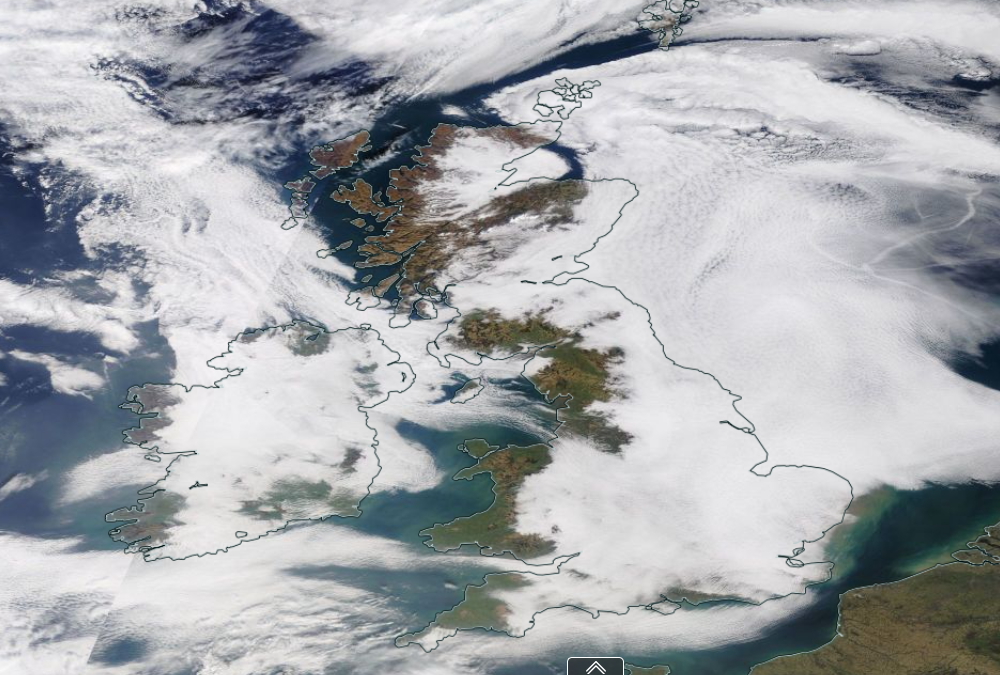
NASA World View Tuesday 2nd March white low cloud from the North Sea and clear skies with sunshine to west.
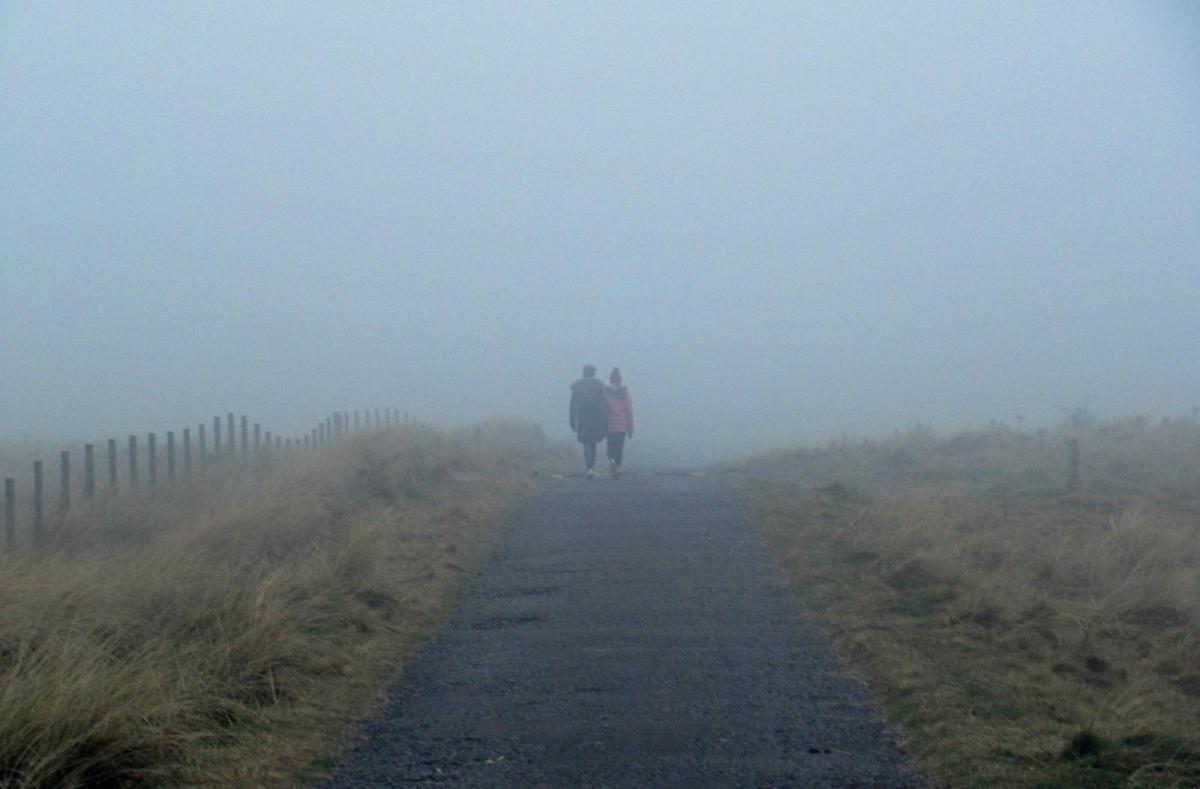
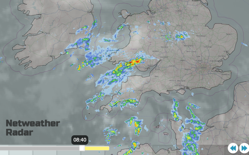
This morning there is a Met Office fog warning for SE England including London and out along the M4 with “thick patches of fog reducing the visibility to 100 m or less in places.” So difficult conditions for essential journeys. There will be a lot of cloud about today, low and murky from the east or just a featureless covering above. One thing mixing the midweek weather up a bit is a scattering of showers heading over southern Britain. At height, it is easier to see the disturbance, a circulation that brings showers over SW England, into Wales and over more central southern parts of Britain. Some will be heavy, possibly thundery. Tonight, the showery outbreaks, with the odd heavier burst, will be over SE England and East Anglia.
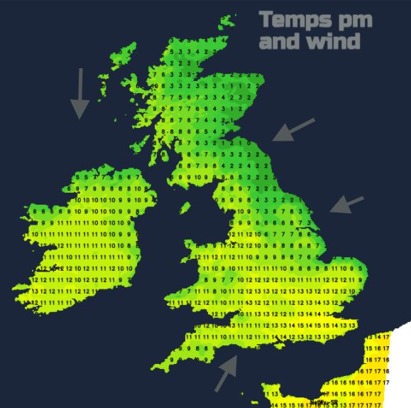
Within this, there will be bright spells, chinks of sunshine managing to break through the cloud cover at times. NW Wales, NW England and western Scotland should see fine sunshine again and a bit of brightness for Northern Ireland. Again, temperatures vary wildly, in the sunshine reaching into double figures but under the damp cloud 2 to 5C at best. In a brief light southerly flow today for southern England, temperatures in any sunnier spots could leap up with 14 or 15C possible.
The low cloud will break and retreat again today but stay for NE Britain as the winds remain light.
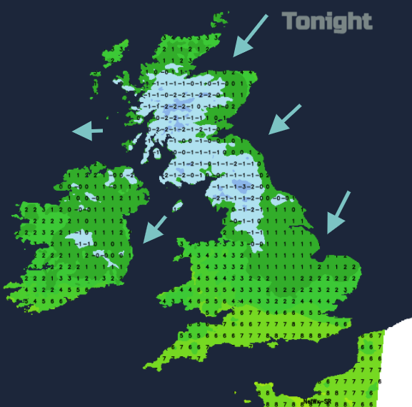
Overnight with the cloud taking over again, it will be cold in the north with a frost as a cold NE wind sets in. A cold front pushes down from the north around the flow of a high pressure between Iceland and Scotland. This brings wintry showers, a mixture of icy rain at lower levels, sleet inland and a bit of snow over the Grampians and NW Highlands.
During Thursday, the east to NE wind will bring a colder feel to the day to more of the UK. The last of the showery bits over SE Britain up to the Humber clear away on Thursday morning and the frontal band of showers with wintry bits will edge down from southern Scotland into northern England at lunchtime. It reaches Northern Ireland and Norfolk by late afternoon but will be rain by then. Behind the front there will be a distinct clearance, broken cloud and sunshine rather than the misty low cloud in the Arctic Maritime air. A few wintry showers feeding in off the North Sea, not many though.
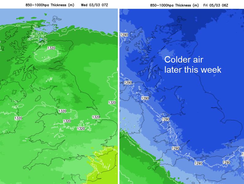
Another cold night as the high slips down over Britain for Friday as the winds ease off with a few sunny spells. A moderate south-easterly for Northern Ireland with a frontal band lurking out west. Still settled and cool this weekend often cloud but with widespread frosts by night.