Fine but blustery weather and mild for the southeastern half of the UK. Further NW it will be very windy with gales and high gusts and very wet as rain just keeps on coming. Risk of flooding.
A divide across the UK today; wet and windy for the NW and drier, sunnier and mild to the SE.
For much of England and Wales after a misty, murky start it will be fine and bright with sunny spells and temperatures widely in double figures up to 14 or 15C. It will be blustery today with brisk southerly wind which will be strong and gusty for Cornwall, western Wales and over the high ground of SW Britain. More cloud will appear from the west with showery outbreaks, but eastern Britain remains really quite sheltered with more sunshine.
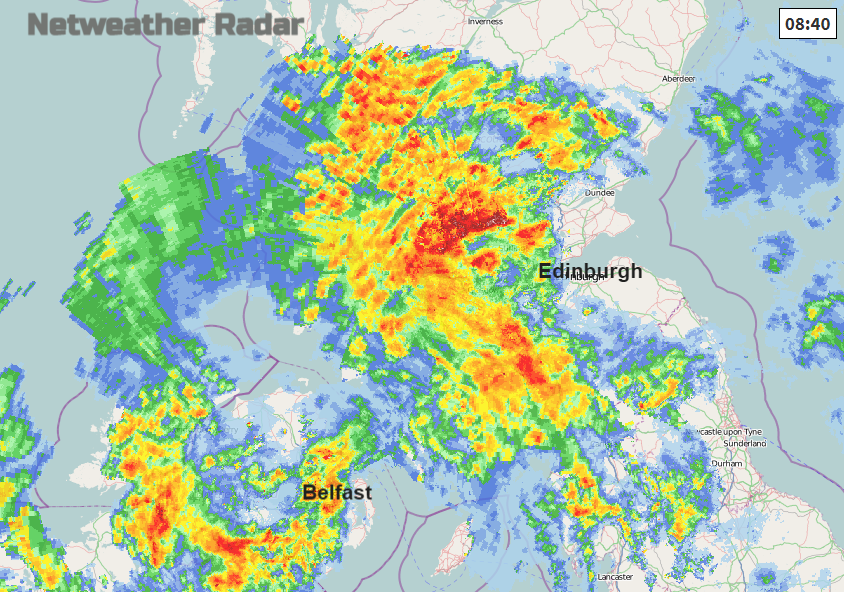
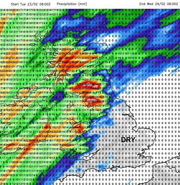
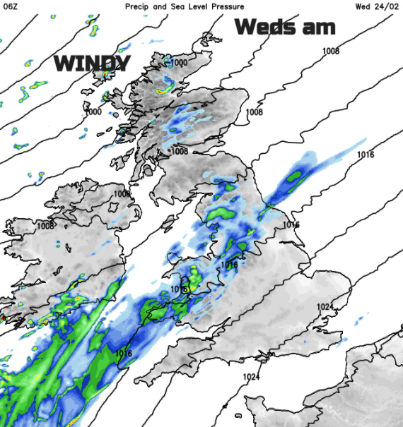
The forecast had shown a band of rain which just kept feeding up from the SW over Ireland, Northern Ireland into Scotland, clipping Cumbria. Today the heavy rain looks more concentrated for the Southern Uplands and Cumbria with heavy rain over more of NW England and NW Wales including Snowdonia. Northern inland Scotland it still very sensitive with 9 flood warnings for Tayside to start the day and the heavy rain is already over Scotland and Northern Ireland. One of many frontal bands is bringing a damp, grey start for northern England but the NE should brighten up.
Pulses of heavy rain continue to move up, some over Northern Ireland and NW Scotland closer to a small developing low centre and later today another band heads towards the Irish Sea feeding in more and more rain which looks to get stuck over Wales and NW England overnight. It won’t be as heavy as the daytime downpours across the NW half of the UK but still, it’s all ongoing rain.
Due to the already sensitive ground conditions and high river levels in Scotland with the snowmelt there are Amber warnings for Rain today with widespread flood alerts over mainland Scotland.
“Persistent heavy rain on saturated ground bringing further flooding.” MO
There are concerns for surface water and river flooding for Cumbria. Do keep an eye on the flood warning services.
It is not only the rain causing upset today but also the strong winds and high gusts. The yellow wind warning has been extended from Scotland and Northern Ireland to north Wales and the Pennines. There will be strong south to SW winds with gusts of 50 to 70mph. Sudden lee gusts north of mountains and difficult conditions on exposed or high routes for essential journeys.
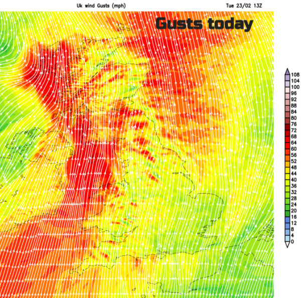
Northern Ireland is starting the day with strong winds and coastal gales for Co. Down, but the winds do ease off this afternoon. There will be wild conditions for western Britain with gales, even severe gales for exposed coasts and over the mountains. It remains windy across the UK into the night, but the worst of the gusts will have blown through.
It remains windy for the far NW of Scotland but elsewhere there will be the ribbon of cloud and rain continuing to feed in, mainly for Wales and NW England midweek. To the south of this in the southerly winds, it will be even milder than today with temperatures in the mid-teens, even up to 17C. Drier and brighter to the north of the frontal band, mild at 11 or 12C on Wednesday.