February UK weather can really vary. Deep snow and bitter cold, warm spring sunshine or huge amounts of rain. This week we have warm air with a sprinkling of Saharan dust but rain warnings and the risk of flooding.
February 2021 has already seen bitter cold and deep snow, a lot of rain and widespread flooding concerns. In a subtropical turn, there has been Saharan dust feeding right up through Europe resulting in stunning sunrises and sunsets, with dustiness on surfaces in southeast England.
Next up will be spring-like warmth as temperatures move into the mid to high teens but also heavy and persistent rain for parts of the UK and Ireland with gusty winds and gales as another Atlantic low moves in and adds to the already saturated ground and high river levels.
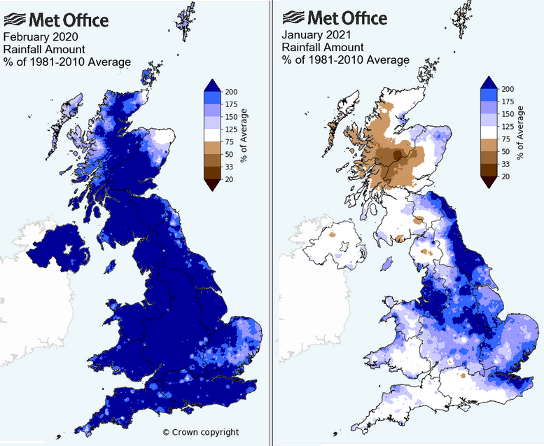
This month has brought quite a variation in weather, but it follows February 2020 which was the wettest on record for the UK and February 2019 saw the warmest UK winter day, 21.2C (70F) in London on the 26th. That year had started off cold with Braemar down to -15.4C but that seems trivial compared to the -23.0C Braemar fell to this year. These swings keep us all on our weather-toes.
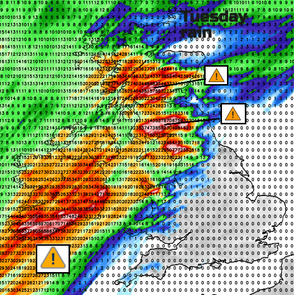
The comparison of wet and dry weather into mid-week is stark. Hardly any rain over the south-eastern half of Britain, nor the far NE of Scotland. And thankfully after such a wet weekend, the main rain avoids southern Wales. Southern and western Ireland sees rain and freshening southerly winds by Monday evening with even heavier rain before dawn on Tuesday morning. There are orange warnings for rain over southern counties and yellow rain and wind warnings over the rest of Ireland. Gusts up to 70mph and “rainfall totals of 50 to 80mm, higher in mountainous regions.”
The wind warning for Northern Ireland and Scotland starts during Monday night and runs through Tuesday again with gusts up to 70mph being mentioned by the UK Met Office. It will be windy everywhere, but strong southerly winds and high gusts will also affect Cornwall, western Wales, Snowdonia and the hills of northern England. These winds will add to difficult conditions on the roads and create a significant onshore push for areas such as coastal Dumfries & Galloway.
The rain pushes NE, over more of Scotland, clipping Cumbria and Anglesey on Tuesday, continuing over Northern Ireland and Ireland. And it just keeps on feeding in, heavy and persistent rain into early Wednesday. The band looks to sink south over more of NW England and Wales by Wednesday and not as windy.
The Environment Agency says that river and surface water flooding is probable for Cumbria in this event. SEPA, the Scottish Env. Protection Agency has barely recovered from concerns this past weekend with rain and snowmelt. It is those existing conditions that now bring the Amber warning and the forecast impacts from this next batch of rain.
“Rainfall accumulations of 40 to 60 mm are expected quite widely across the (Amber) warning area with a few places possibly seeing 80-120 mm in a 24 to 36 hour period, although there still remains some uncertainty in peak totals. “ MO
This rain pattern is more typical, but it follows an unusual January when eastern Britain into the Midlands saw a soaking and western Scotland was drier than average. This month we’ve had the easterly flow rather than the prevailing southwesterlies so far. The huge amounts of snow which northern Scotland experienced is still affecting ground and river conditions.
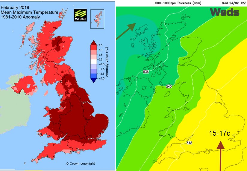
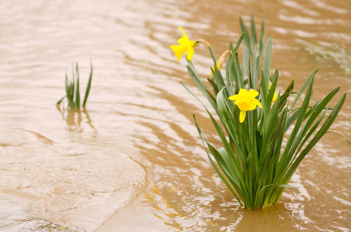
This mild southerly flow continues with temperature on Tuesday widely in double figures 10 to 15C and then by Wednesday 17C is forecast for inland SE Britain and also doing well for areas to the lee of high ground, with Foehn Effect to the east of the frontal rain. It has been so cold for much of February, this change to blue skies, sunshine and warmth suggests a great shift. But remember in 2018, the well signalled Beast from the East only arrived at the very end of February 2018 lasting into the start of March. Such great variations in the month of February for the UK, as the snowdrops fade, and crocuses and daffodils begin to appear. For the end of February into early March, high pressure builds in, so that would indicate dry weather and temperatures perhaps nearer to average, fine spring sunshine but with a few nippy nights.