There'll be some more wet weather for the north and west of the UK, in particular, this week, but change is on the way later as the jet stream moves north and high pressure builds in over the British Isles.
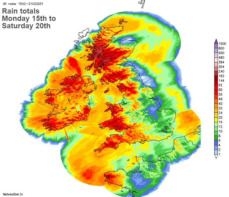
It's been a wet 7 days, especially in western areas, and there's some more of that to come, but a change is on the way by the end of the upcoming week, with high pressure set to move up over the UK, bringing a quieter, drier spell of weather as the jet stream heads north.
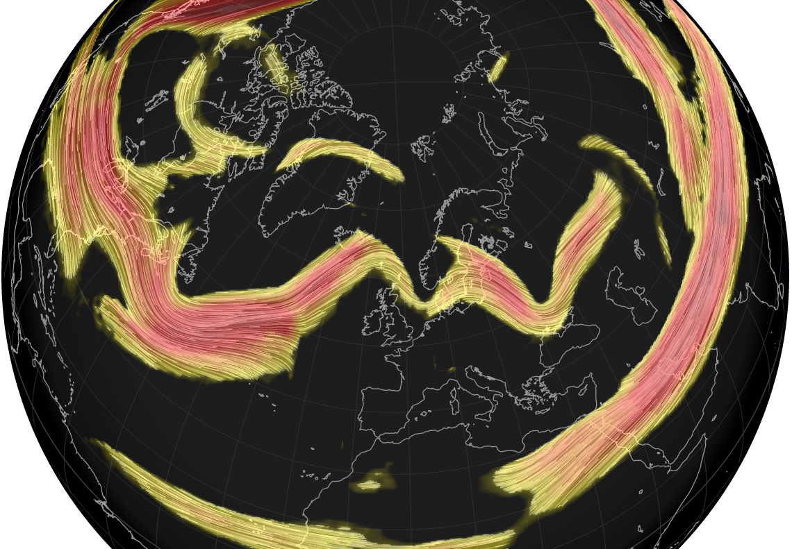
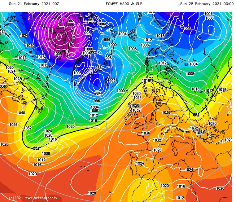
For now, high pressure is still over the continent. Although it's not directly over the UK, it influences by shielding the east and particularly southeast of the country from the wettest weather. In doing so, it is stopping weather fronts from making quick progress west to east. That theme will continue through the next few days, with the jet stream deflected up the country's western side. Still, as the continental high pressure extends its influence further west, rather than a west-east split in the weather, it'll become more of a northwest-southeast split, with the wettest weather in the north and particularly northwest.
Then, later in the week, as the high pressure begins to ridge up over the UK, the jet stream moves north and away from the British Isles for the time being.
After the very wet start to the weekend in western regions, it's a drier day today, but there is still one weather front in play, which will take a couple of days to finally clear off. It's running up from the southwest and central southern England, through southern and eastern Wales, the Midlands and out into the North Sea through Yorkshire and won't move much during the next 48 hours. Pulses of heavier more persistent rain will tend to run up from the south along it, as it edges a little furthest east before finally moving away and dying out later on Monday.
Elsewhere, barring a few showers in the northwest of Scotland, today and Monday will be mostly dry with some sunny spells. It'll be fresher to the north of the front with maybe a few frost patches overnight tonight, but to the south of it, temperatures will again head into the mid-teens today and not far from that on Monday either.
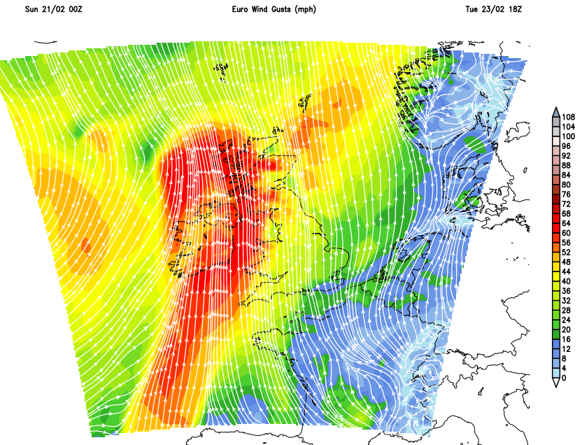
Late Monday and into the start of Tuesday, the next Atlantic system will approach, with rain and strong winds arriving in from the west. Ireland, along with the north and especially northwest of the UK, will see some heavy rain at times, along with gales, even severe gales in exposed places. It stays mild to the southeast of all of that, mostly dry and bright with sunny spells, although even here, it'll be windy.
The rain will try to move southeast during Wednesday, but it'll be a struggle, and it will fizzle out quite quickly the closer to the southeast that it gets.
The midweek front is still likely to be over England and Wales into Thursday, but by that point, it'll probably only be a band of cloud with some light bits and pieces of rain on it. It'll be fresh to the north, if not chilly but bright, with some showers blowing in from the northwest - which'll be wintry over the high ground of Scotland. As the front moves southeast, that brighter, cooler weather will move southeast behind it. Then, with high pressure starting to ridge up over the country from the south, any residual showers will begin to die out as settled weather takes hold into Friday and the weekend.
Temperatures by this stage won't be too far from average for the time of year but feeling pleasant enough during the sunny spells, with light winds. Clear skies will mean overnight frosts are likely at times, with fog patches not out of the question either. The very far northwest of the country may be far enough away from the high to see some outbreaks of rain and blustery winds at times, though.