The weather this weekend will be very mild, particularly in Eastern England, but it'll also be a wet one in western regions, particularly on Saturday.
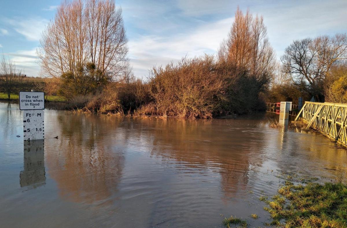
In what will be an exceptionally mild weekend for some, a meandering set of active fronts will struggle to work their way eastward across the country. These have prompted an amber warning of heavy rain for South Wales, with additional yellow warnings for parts of the South West, the remainder of Wales, and the South and West of Scotland. This'll bring the risk of further flooding to these areas, while parts of East Anglia and the South East see little if any rain at all this weekend.
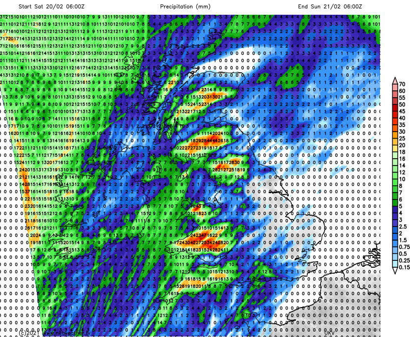 Rainfall totals on Saturday
It's been a very mild night over England and Wales, where temperatures in parts are already in double figures. But it'll be a very wet day in the South West and across Wales, with showery bursts of rain over northern England, working their way into Northern Ireland and to most of Scotland after a bright but chillier start in the North. Central southern England and parts of the Midlands, mostly the West also see some showers, but with brighter spells and maybe a little sunshine in parts by the afternoon.
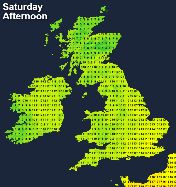
It'll be breezy with gales in the West, where a southerly wind will give gusts in excess of 50mph along exposed Irish Sea coasts at first. Although somewhat chillier in the far North, say about 8C here, temperatures generally reach 11 to 14C. Across the South East and in the East, where you'll see mostly watery or hazy sunny intervals, 15 or 16 maybe 17C locally is possible, making it an exceptionally mild day for February.
Rain clears from Northern Ireland soon after dark and from most of Scotland overnight, leaving scattered showers mostly over Northern Ireland and in the West where some could be heavy. After some rain, Cumbria and the far West of Wales may be seeing brighter skies by morning, with the rain East of the Pennines becoming lighter and patchy as the front weakens. The Midlands and central southern England see a few showers, while Norfolk, Suffolk, Essex and Kent stay dry with skies breaking at times. Although still quite fresh, a southerly wind will have decreased somewhat in the West by morning in another mild night, with the lowest temperatures between 5 and 10C.
Scotland, Northern Ireland and maybe Cumbria and Clwyd see some sunshine on Sunday, but with a few showers mostly in the West and towards Derry, Tyrone and Fermanagh. Most other parts see cloud giving patchy, mostly light rain, but towards Suffolk, Essex and the East of the capital, it should continue brighter and mostly dry. A South or South-West wind will feel chillier in the North and West, but temperatures still reach a mild or very mild 8 to 13C and 14 perhaps 15C in the South East.
Little changes after dark as the front giving mostly light rain or drizzle becomes slow-moving, while it should continue mainly dry towards the South East. Elsewhere expect clear spells, but with a few showers mostly in the West. A South to South West wind will be lighter over England and Wales, allowing temperatures to fall to between 2 and 6C, low enough for a ground frost in some sheltered rural places towards dawn.
With winds remaining in the South West or South, much of the coming week will be mild. There'll be further rain, mostly in the North and West, where it'll be windy at times. The East and South see fewer showers where it becomes dry later with sunny spells. But with light winds, the risk of night frost and patchy fog will increase.