Mild southwesterly winds look to continue well into next week, persistent rain across the west Friday and Saturday could bring some flooding issues, very mild in the SE over the weekend too.
No sign of a return of wintry weather for the foreseeable future, with winds continuing to generally blow from a mild southwesterly direction well into next week, with it a lot of rain for northern and western areas - which will likely increase the risk of flooding. Today will be a windy day wherever you are, a band of rain will sweep eastwards across eastern areas this morning, followed by brighter skies, but also showers in the west. Friday will be windy again, with gales in the west, while outbreaks of persistent and locally heavy rain will move in across northern and western areas, eastern areas dry and bright. The weekend will stay mild, in fact it’s looking very mild across SE England & Anglia – where we could see temperatures reach 17C in sunshine on Sunday, thanks to southerly winds pulling in warm air all the way from North Africa. However, many northern and western areas will be cloudy with outbreaks of rain through Saturday and into Sunday morning, before drier conditions move in.
For now, a dry, bright or sunny start across much of eastern England – but don’t be fooled, as a cold front across the western side of England at breakfast time will sweep eastwards, bringing a spell of rain by late morning. Drier and brighter skies and cooler air already across N. Ireland, Wales and far SW of England following across all parts of England during the afternoon, but there will be a scattering of showers across Wales and western areas of England. Scotland will see rain, snow over mountains, clearing most parts this morning, but there will be a few showers across SW Scotland, while NW Scotland looks likely to stay cloudy and wet on and off for much of the day.
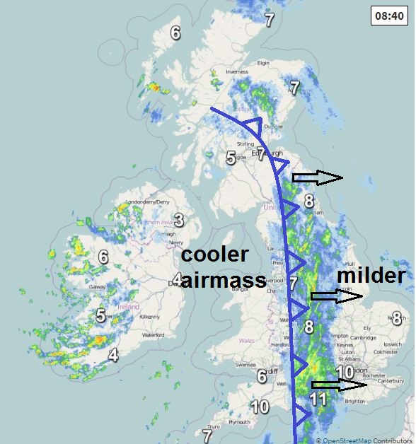
Windy everywhere, winds gusting to 30-40 mph in places. Cooler today than the last few days, thanks to returning Polar maritime airmass moving in following the cold front, temperatures reaching 6-9C.
Rain clearing NW Scotland, but a few showers lingering in the northwest for a time tonight, otherwise most areas becoming dry with clear spells overnight, before cloud and rain moves in across much of the west before dawn, falling as snow over the Western Highlands. Cooler than recent nights, with temperatures falling into low to mid-single figures before the cloud and rain arrives and the wind picks up in the west.
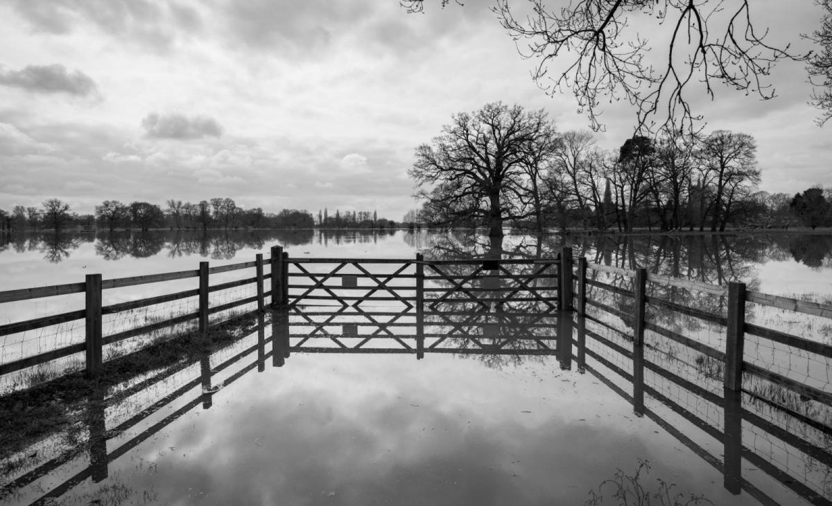
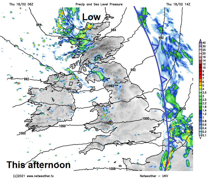
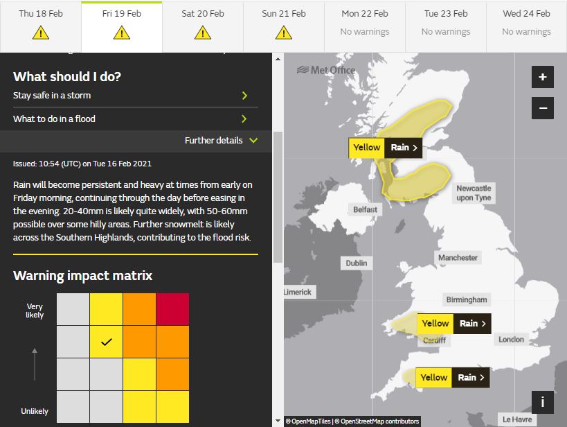
Another blustery day on Friday, particularly windy across the west, with gales up through the Irish Sea, along western coasts and hills. Wet from the word go across Scotland, NW England, N. Ireland, Wales and SW England and these areas will see outbreaks of persistent rain through much of the day, locally heavy, particularly over the hills. With the ground saturated and river levels high from recent snow melt, the risk of flooding in these areas likely to be on the increase, so worth checking flood warnings.
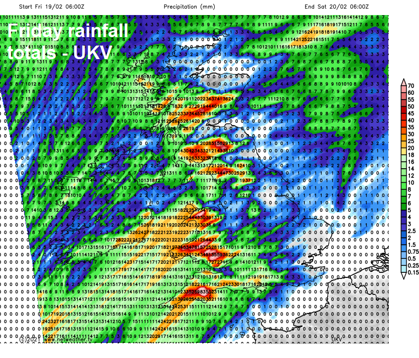
Met Office have yellow warnings for rain currently in force for parts of central and SW Scotland along with south Wales and Devon.
After a dry and bright start for northeast, central and eastern England – it will be a mostly cloudy day, with outbreaks of mostly light rain or drizzle increasing from the west through the day. Temperatures back up again everywhere after today’s brief cool down, reaching 9-11C generally.
The weekend will see low pressure extend a long way south to the west over the Atlantic, this will draw in southerly winds all the way from NW Africa by Sunday across eastern England, so becoming very mild for late Febraury. On Saturday, temperatures reaching mid-teens Celsius towards SE England and E Anglia – where it will be drier and sunnier, perhaps 17C somewhere on Sunday, 12-14C widely elsewhere.

Low pressure and weather fronts will be close to the west over the weekend, so outbreaks of rain will spread northeast along the fronts across northern and western areas on Saturday, while central and eastern England stays mostly dry and bright or sunny. Further rain likely for a time across northern, central and western areas Sunday morning, before rain looks to fizzle out, drier afternoon following, but with some showers in northern and western areas, SE England likely staying dry and bright all weekend.
Mild southwesterly winds look to continue well into next week too, so temperatures widely in the teens during the day, rain likely to affect northern and western areas at times, but SE Britain looks likely to stay mostly dry and bright.