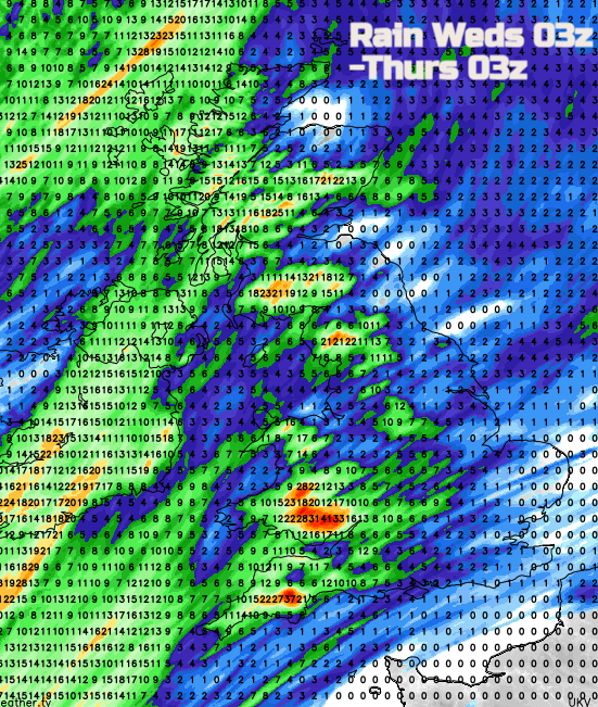
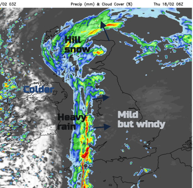
It's mild, windy and in the sunshine, more like spring but a cold front tonight will bring heavy rain and cooler air in during Thursday. Flooding concerns as rainbands keep on coming.
A series of low pressures from the Atlantic bring bands of rain, blustery winds even gales, hefty showers but still mild air. Many areas reached into double figures on Tuesday with Lancashire seeing 13.6C. In the sunshine, with a bit of shelter, it is feeling pleasant, more like spring if the bitter cold and wintry weather wasn’t your thing.
The snowdrops are looking happier, open and swaying and colourful crocuses are appearing as daffodil stems push through.

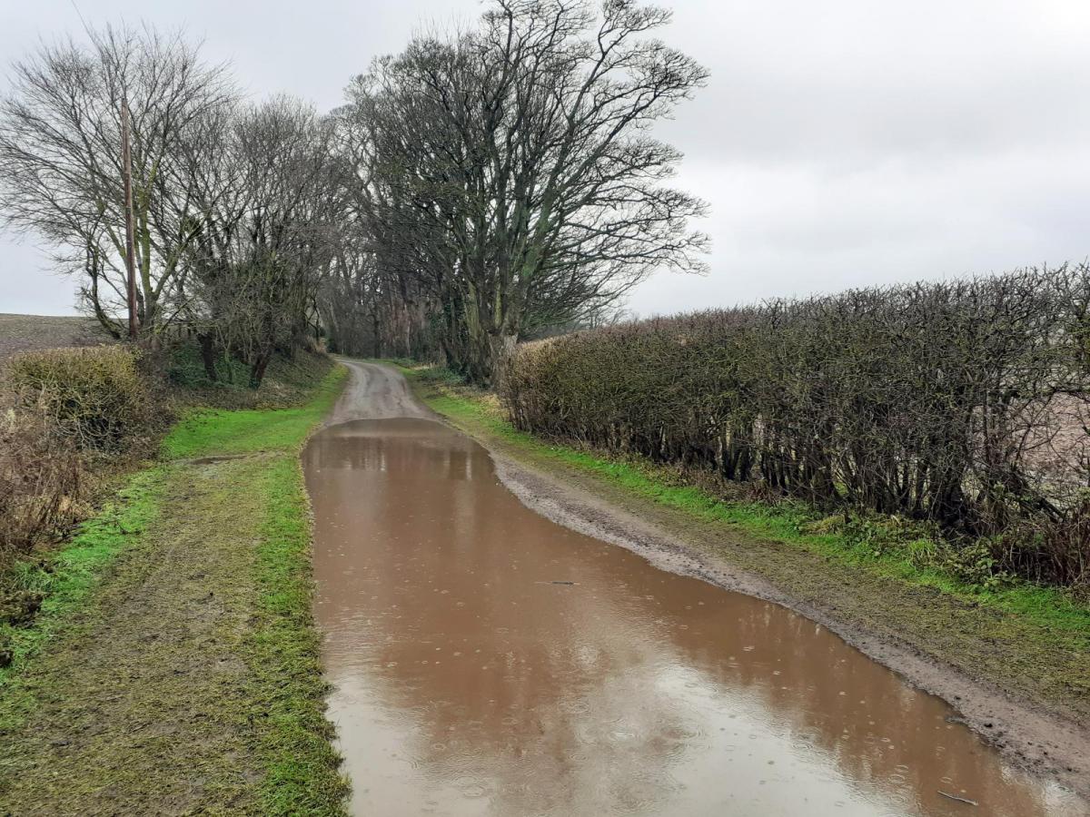
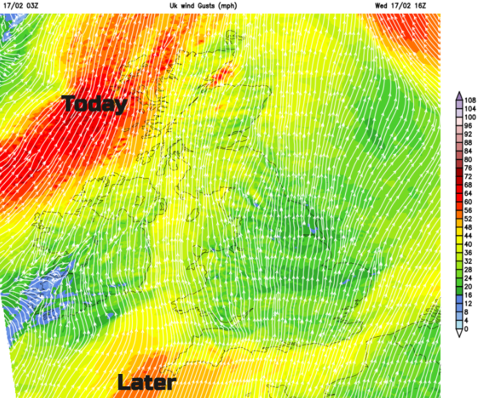
However, it will again become very windy during the day, for Northern Ireland and Scotland particularly the Western Isles and Skye where there is a wind warning from the Met Office with mention of gusts up to 75mph. There aren’t currently any rain warnings until Friday for SW Britain, but the ongoing rain and ground conditions do mean there is a lot of standing water, already high river levels and local flooding is possible.
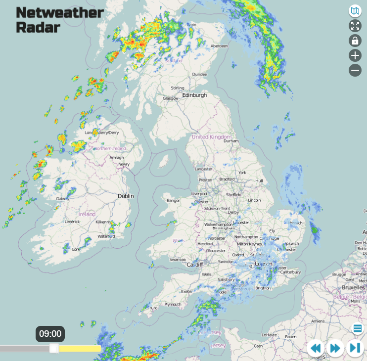
One frontal band has swept across the UK overnight, it is still over SE England this morning, curving back over Orkney and Caithness with showery bits following before the clearer, drier and sunny slot. The wrap-round occlusion will continue to bring heavy showers with snow over the Scottish mountains and with the low centre away to the NW this is where the strongest winds and gusts will be. The winter road teams and snow plough train are still at work clearing drifting snow in the Highlands.
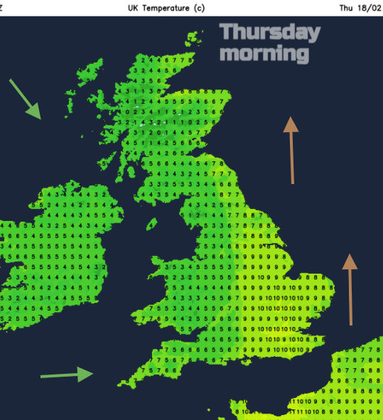
The rain band moves towards Shetland and becomes more showery over London and the Home counties, also East Anglia towards midday. However, this frontal band does link back to a waving front in the English Channel with more showery rain which will wave northwards into southern England this afternoon. This means a more unsettled day with sunny spells for a time this morning over Wales and the West Country but becoming cloudy again with more rain. The southerly winds pick up too becoming gusty for Cornwall and Devon and the Bristol Channel. For much of the UK it will be a fine, bright day with sunshine but blustery winds and gales in the far NW. Temperatures range from 7 to 9C for Scotland and Northern Ireland but higher for England and Wales, around 10 to 12C.
For the first half of February, it was eastern Britain and northern Scotland seeing most of the weather action particularly the snowfall. Now with the flow from the Atlantic, it is western and often southern areas seeing the precipitation. There is more rain to come.
The gales, high gusts and even severe gales ease for the Western Isles tonight as coastal gales pickup through the Irish Sea and the North Channel. The wave develops into a low pressure and again we see bands of heavy rain move over the UK. Tucked behind the cold front, there will be colder air, with temperatures falling near to freezing in Northern Ireland.
So, a change during the day, after a mild blustery start for much of Britain, the active cold front pushes eastwards bringing rain and mountain snow. A spell of heavy rain and then a noticeable decrease in temperature post front as the winds veer to the west. The frontal rain should be over eastern/SE England by early Thursday afternoon followed by sunny spells and again sharp showers from the west.
With pressure rising there will be lighter winds, clear skies and a colder night for much of Britain, away from the SW. Then another larger low pressure moves in for Friday with more wind and rain.
This continuing wet weather with already sensitive conditions brings a heightened risk of flooding and disruption to travel and utilities when combined with the strong winds on Friday into Saturday, even into next week.