As it turns unsettled from the West, the coming weekend will see milder Atlantic air eventually replacing the bitterly cold conditions.
As it turns unsettled from the West, the coming weekend will see milder Atlantic air eventually replacing the bitterly cold conditions. The severe winter weather will still be lingering on the nearby continent, however, and with my 'crystal ball' suggesting a return of the much colder air around the 20th, we await developments.
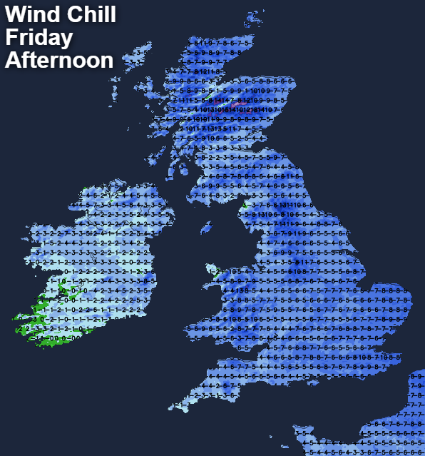
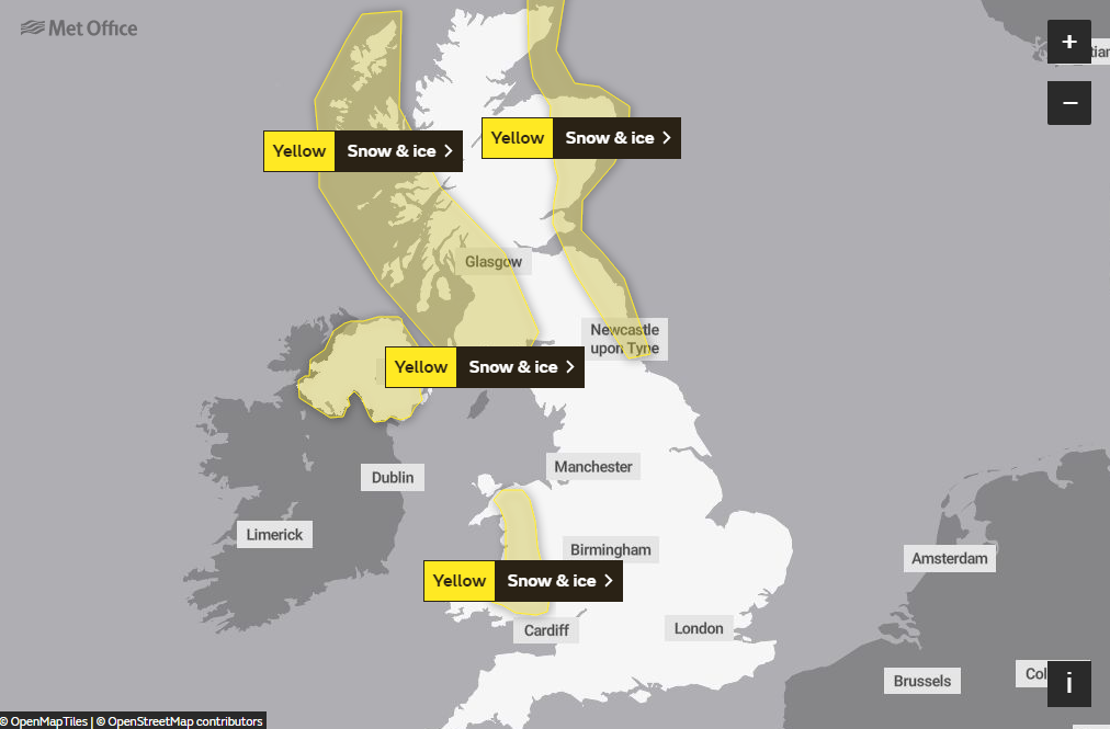
For today though if you wrap up well, it'll be ideal for your allowed daily walk, after another sharp and penetrating frost. Cloud amounts will vary, and while most parts stay dry with some hazy winter sunshine, it'll remain bitterly cold. As ever we have a few exceptions, with Met Office yellow warnings still in force for snow and ice over the North East of England and the East of Scotland, where there'll be further snow showers.
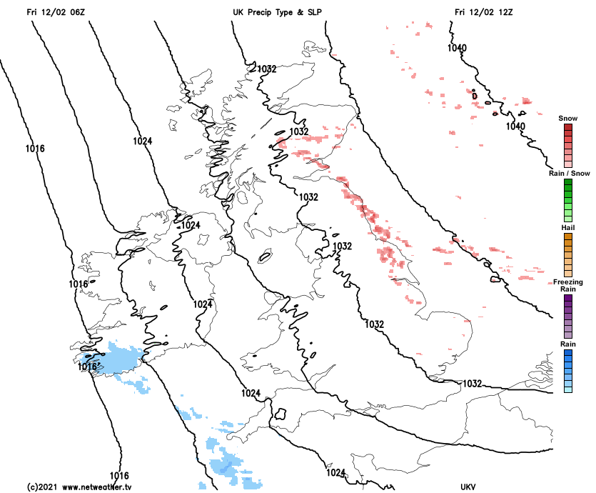
The South West, South Wales and Northern Ireland also see a little sleet and snow in places at first, but this'll clear to leave much of the day dry as well. A bitter East or South-East wind will freshen, giving strong gusts in the South West, with top temperatures only 0 to 3C in most parts, but 4 to 6C in the far West.
As Atlantic systems approach, Northern Ireland sees some snow later in the night. This could cause problems with yellow warnings to this effect already issued. Some other far western parts may also see a little sleet, snow or freezing rain towards morning, but here it'll be lighter and patchy. The North East and East Scotland continue to see a few snow showers, but elsewhere it remains dry with clear spells especially in the East. The bitter East or South-East wind will be strongest in the West where the thermometer will be closer to freezing, but central and eastern areas, particularly, see another sharp and penetrating frost, with lowest temperatures between -2 and -5C.
Saturday sees an East/West split developing, as Atlantic fronts make inroads into Northern Ireland. Here the snow eventually turns to rain as temperatures slowly rise. Other western areas also see some snow, with rain falling on frozen ground in some parts prompting further yellow warnings of snow and ice from the Met Office.
East Scotland continues to see a few snow showers, but most other parts will be dry with a little hazy winter sunshine in places. But it'll remain bitterly cold in a blustery East or South-East wind, that'll be strong over Northern Ireland and in the far West. Here temperatures reach 5 to 8C, while parts of central and eastern England stay below freezing all day where -1 to +2C will be nearer the mark.
Another frost is likely in central and eastern areas after dark, but it'll be less severe. It should stay dry though, while turning increasingly cloudy in a very raw South Easterly wind. In the West snow edges its way slowly eastward, turning to freezing rain or drizzle in the far West, with Northern Ireland seeing some heavier bursts of rain overnight in a strong southerly wind that'll give gale force gusts in exposed areas. Lowest temperatures -1 to -3C in the East and 2 to 5C in the West bringing a thaw.