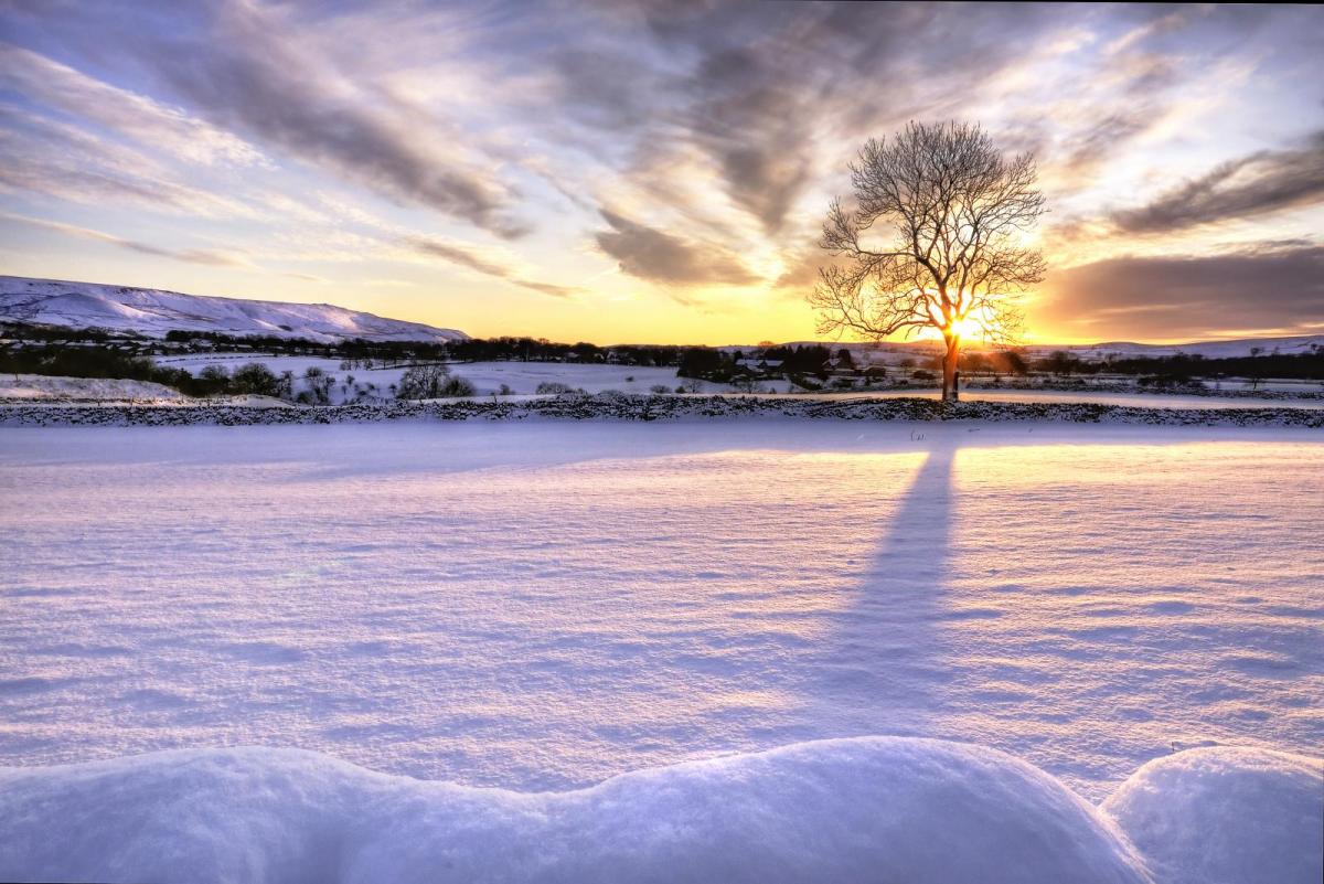
Altnaharra in the Scottish Highlands saw temperatures fall to -17c overnight, and severe frosts will be a theme during the next few nights. There'll be further snow showers today as well.
We've just had the coldest night of the winter so far, with -17C (only 1F) noted at Altnaharra in the Scottish Highlands early this morning. And it's going to remain very cold because over the next few nights we're likely to see frosts the severity of which we haven't seen since 2010. As we import much drier air off the nearby continent, river levels will continue to fall alleviating any further flooding problems.
We still have a Met Office yellow warning today of snow and ice for central and eastern areas, where snow showers between sunny intervals continue through the day. Some will be heavy briefly coming in 'streets' making the showers quite frequent, while others just see a few snow flurries. Northern Ireland will also continue to see a few snow showers, but it'll be fine with spells of winter sunshine for many other more sheltered western areas.
A bitter East or North Easterly wind won't be as blustery as recently but will remain bitterly cold, with temperatures struggling again to get much above freezing, with -1 to +3C about the best you can expect.
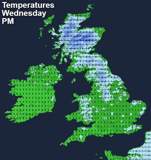
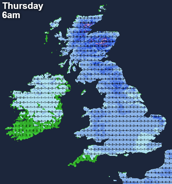
Eastern coastal counties continue to see scattered snow showers after dark, with Kent probably seeing the bulk of them giving further accumulations. The South-West may also see some later in the night in a freshening and bitter East wind. Elsewhere apart from a few rogue snow showers, there'll be clear spells, and with the East or North-East wind lighter, you can expect yet another harsh frost overnight. Temperatures should fall between -5 and -10C quite widely, with -17C perhaps even lower possible in a few of the coldest Scottish glens once more. While not quite as cold in the far South West it'll still feel bitter in a freshening East wind that may bring some snow showers here later in the night.
Tomorrow sees the snow showers mostly over North East England and the East and North East of Scotland, where Met Office warnings of snow and ice remain. The South West and Kent at first may also see some, but for most after a severe frost, there'll be spells of winter sunshine. It'll remain bitterly cold though in a piercing East wind that may tend to freshen a little. Later Cornwall and Devon see an increase in cloud ahead of approaching Atlantic systems, with the Isles of Scilly and the Channel Islands possibly seeing a little rain or snow later. Here while not feeling so it'll be a little less cold but for most expect another perishing day, with top temperatures in the range -2 to +2C.
Another widespread penetrating sharp frost is expected after dark, with clear spells allowing temperatures to probably fall to between about -3 and -7C in a piercing easterly breeze. Further West winds will be fresher, and as fronts edge closer to the South West and perhaps parts of Northern Ireland, you'll see more cloud here and perhaps a little freezing rain, snow or few ice pellets before morning.
Friday and the weekend sees a 'battle' developing as milder air tries to move in from the West. As computer models continue to struggle to grasp the situation, you couldn't go far wrong than to take a look at the month ahead forecast for guidance issued on the 1st February.