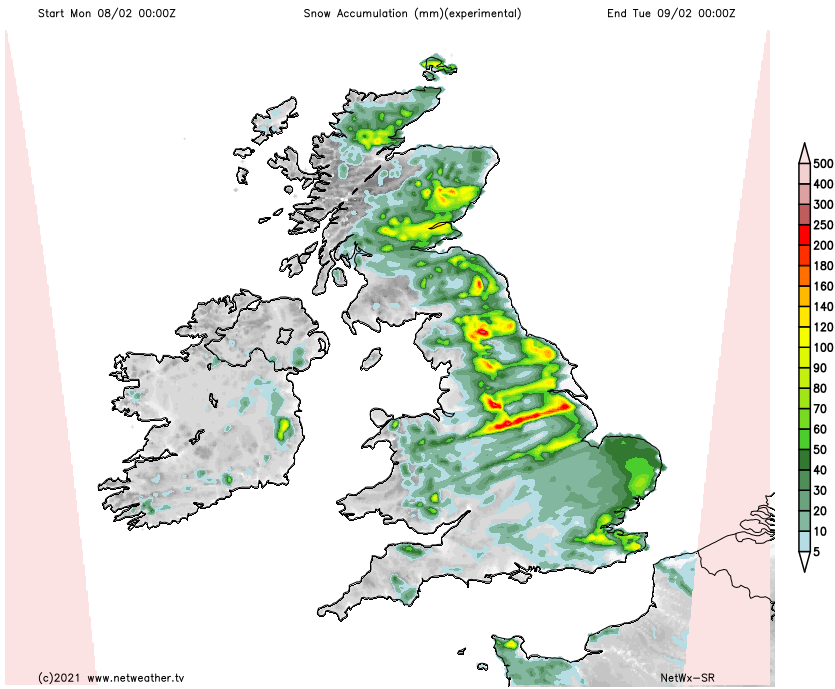
Easterly winds have set in bringing much colder air and snow showers, these mostly in the east today but becoming more widespread into next week.
We're into a real taste of winter now. There are many yellow warnings of snow and ice today particularly for eastern areas, with even an amber warning of more substantial falls across parts of Norfolk, Suffolk, Essex and Kent. The severe weather seems likely to persist well into the coming week and perhaps beyond, depending on how far North and East attacking milder air gets towards next weekend.
In a bitterly cold day, any mostly light rain in the South East and across the far South West will soon turn to snow.
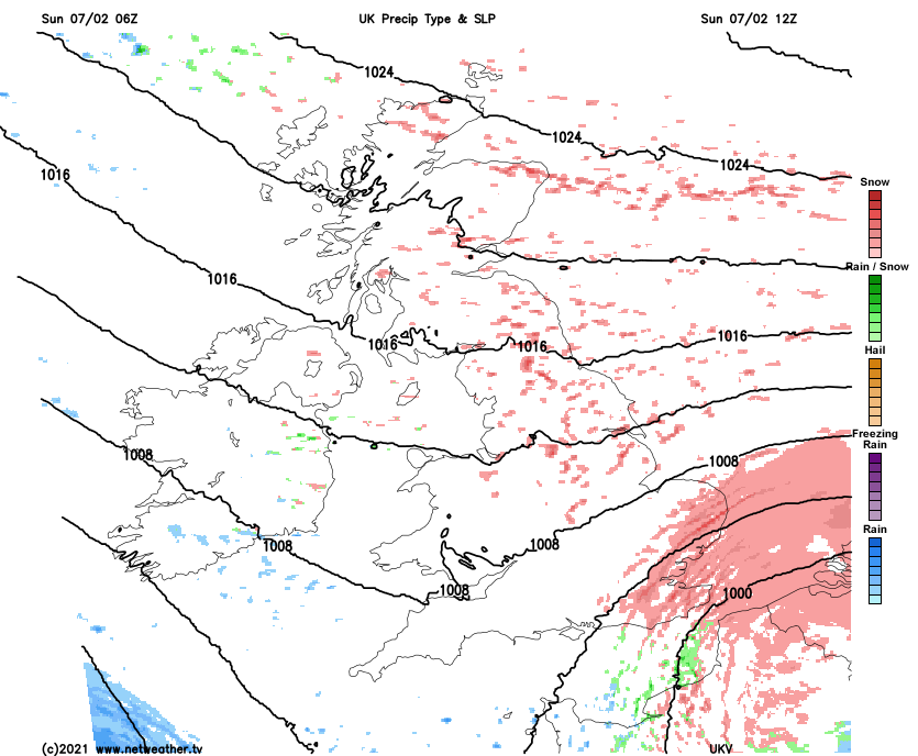
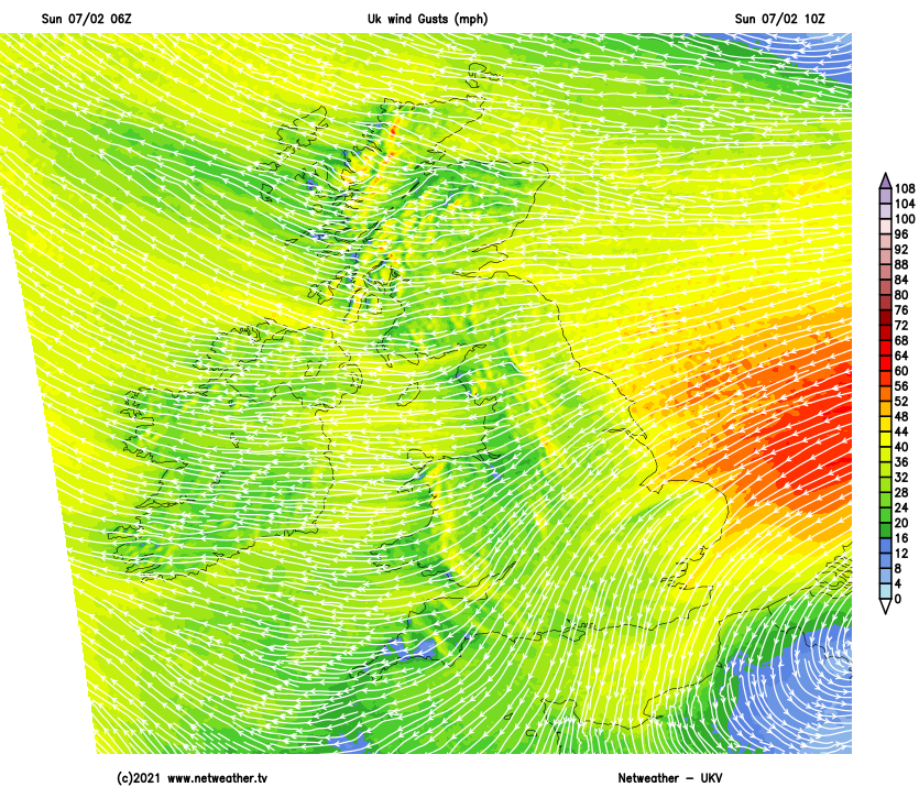
There'll be snow showers in the East particularly North of the Midlands some locally heavy that'll cause problems later, with the tail end of Storm Darcy named by the Dutch weather service bringing heavy snow eventually to parts of East Anglia and the South East. Here blizzards will cause disruption, with some drifting likely in a fresh or strong North East wind that may give gusts of 45 to 50mph along exposed North Sea coasts.
Northern Ireland mostly to the South of Belfast will also see snow showers, but on the whole, the West will see fewer showers. This'll allow more in the way of sunny intervals, but despite the sunshine, top temperatures of just 1 to 4C across the country will feel more like -4 or -5C in the bitter wind.
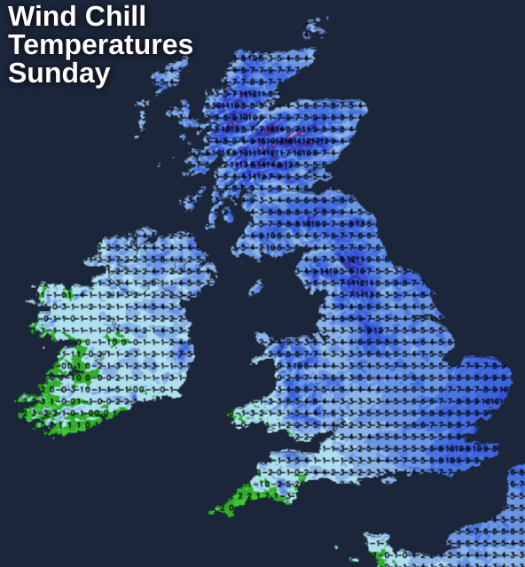
It remains much the same after dark, with further snow or snow showers, especially in the South East and across many eastern parts. This'll lead to further accumulations and some drifting particularly on hills in a fresh or strong and very gusty East or North Easterly wind. The West and Northern Ireland will also see more in the way of snow showers, but there'll also a few clearer spells. It'll feel bitterly cold everywhere with a penetrating frost, as temperatures fall to between zero and -3C.
The bitterly cold weather continues into the new working week, with more snow showers, especially in eastern areas where some will be heavy, giving further falls particularly on hills. The West will also see them, but they'll be fewer here generally, where you should see the best of the sunny intervals on offer.
An East or North Easterly wind remains fresh and blustery giving strong gusts along North Sea coasts and in some of the heavier showers. As a result, it remains bitterly cold as temperatures across most parts struggle to get above freezing, with 3C about the best you can expect in some sheltered parts of the West.
Eastern areas continue to see snow showers into the evening, but they should be fewer as winds begin to decrease a little. More in the way of clear spells, particularly in the West, will lead to a widespread sharp and penetrating frost. Temperatures could fall as low as -5 or -6C across sheltered parts of Northern Ireland and perhaps even lower in some Highland glens, with -1 to -3C probably a more general minimum in a still piercing East or North Easterly wind.