Mild again in the south as rain clears the SE. Heavy rain and hill snow further north in a cold east wind. Significant snow in Scotland later this week before winter takes hold for more of the UK.
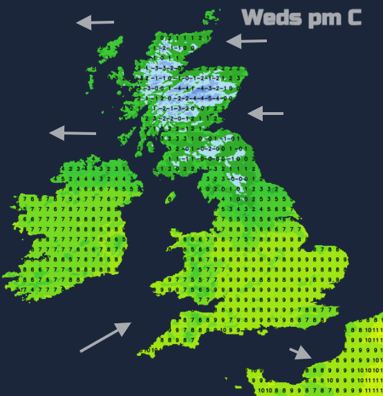
Once more there are huge differences north-south across the UK. Yesterday temperatures peaked around 13C, very mild for the time of year for southern Britain. For northern Scotland temperatures will now hover around zero for the rest of the week, feeling even colder in a brisk east wind.
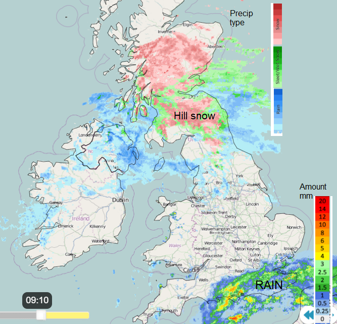
A frontal band has parked itself across Scotland and the far north of England, also affecting Northern Ireland this morning. It is utterly grim this morning in SE Scotland with icy rain and a howling east wind, half term next week will be fun. For Northern Ireland, there has been heavy rain and there is plenty of surface water about. Northern counties will stay in the colder air at 3C with a moderate east wind, fresh along the coasts. Further south and for Belfast up to 7 or 8C in the milder air with much lighter winds and the rain will pull northwards, still with snow on the Antrim Hills. More rain tomorrow.
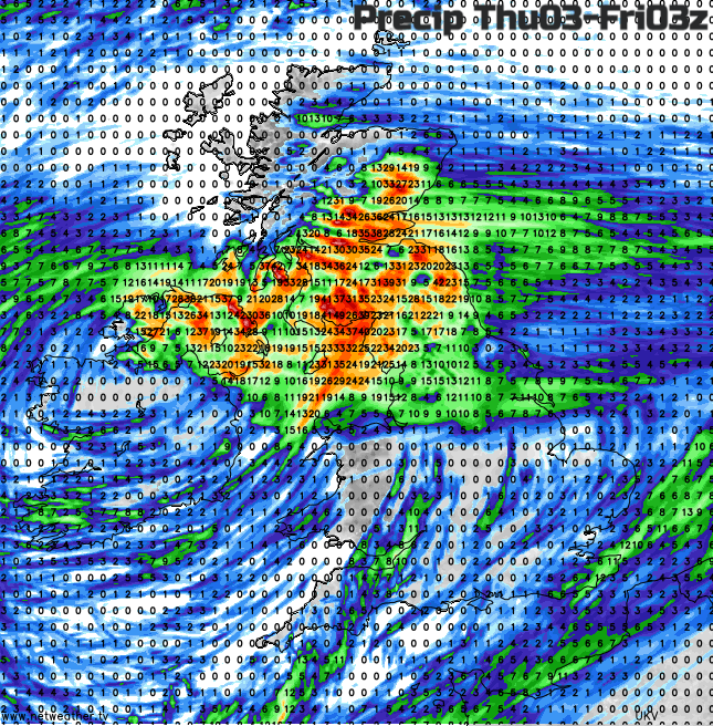
This links to one main low pressure which hangs around over the UK until at least the weekend. Before that two low pressure nip by to the south. One on Thursday and one we can see the rain from at the minute over the English Channel. This is bringing a wet start to parts of southern England but will pull away from the SE over lunchtime as the low continues eastwards.
The mild bit
For the rest of England (away from the far north) and Wales, it is a mild start, often cloudy and damp but with some breaks between the frontal band in the north and this passing low with rain in the far south. There will only be light winds from the west with temperatures of 7 to 11C today. For northern England, say north of the Humber it will be colder in the east wind, around 3 to 6C. There will be further outbreaks of rain with snow over the Pennines and Cumbrian Fells with ongoing concerns about flooding for NE England and Yorkshire with snowmelt adding to this week’s rain. The River Severn and the Thames remain high.
A fine end to the day for southern Britain but clusters of heavy rain showers will move in from the west tonight over Wales and NW England, rotating around the main low centre stretching across northern England with snow on the hills for the start of Thursday. To the south of that, there will be sunshine, it stays mild but with some heavy showers being flung up over southern England by the next little low passing by.
The cold bit
Northern Britain, particularly Scotland is facing a spell of wintry weather with ongoing heavy snowfall in places and with the cold easterly wind, a real chill. Warnings for snow stretch out right through the weekend. Midweek these start on the Pennines, southern Uplands and through the high ground of central Scotland into the Grampians. Then the area becomes more widespread over Scotland, even to low levels for the mainland but not so much for the west coast.
“Periods of snow may lead to disruption to travel in places, especially on routes over high ground.” MO
This morning the frontal band is bringing rain and sleet to low levels with a few heavier snow flurries in the mix. Snow over the hills and mountains with temperatures of 0 to 4C but clearer brighter skies in the far north of Scotland. Not a lot changes through the day but it will be very cold overnight with the driving winds. Through Wednesday night the rain and snow eases for western Scotland but continues for central and eastern areas as the other band moves up into northern England.
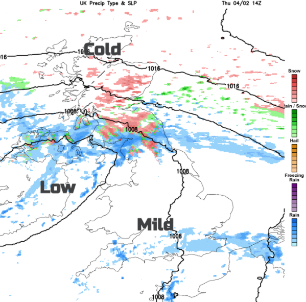
The same areas continue with the rain, sleet and hill snow and cold windy conditions through Thursday until the main snow band begins to nudge northwards over more of mainland Scotland by Friday all still rotating around the same low. The warnings up the impacts at this point.
“Prolonged periods of snow and snow showers could bring significant disruption. Strong winds could lead to significant drifting of snow and temporary blizzard conditions.” MO
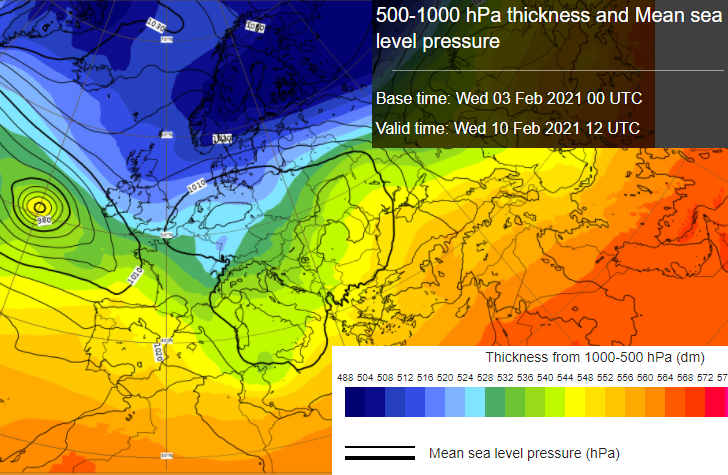
NE Scotland looks to be particularly badly hit as the warnings continue through the weekend and even deeper cold heads in. Of interest for next week and even this weekend, is the potential spread south of that very cold air on the easterly winds and if it will bring snow showers racing across the North Sea to more of Britain.