A wintry picture across the northern half of the UK today, but milder air is moving up from the south to melt some of the snow. The battle between cold and mild will then continue through the rest of this week.
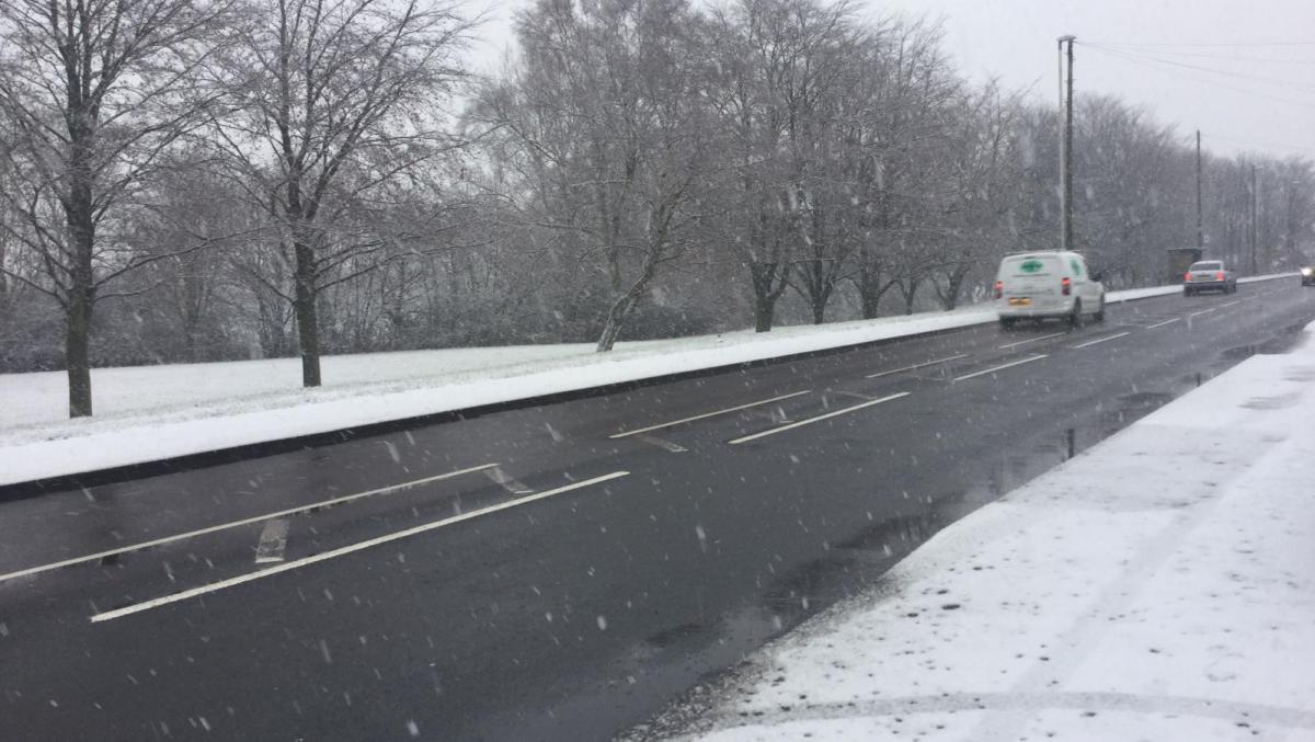
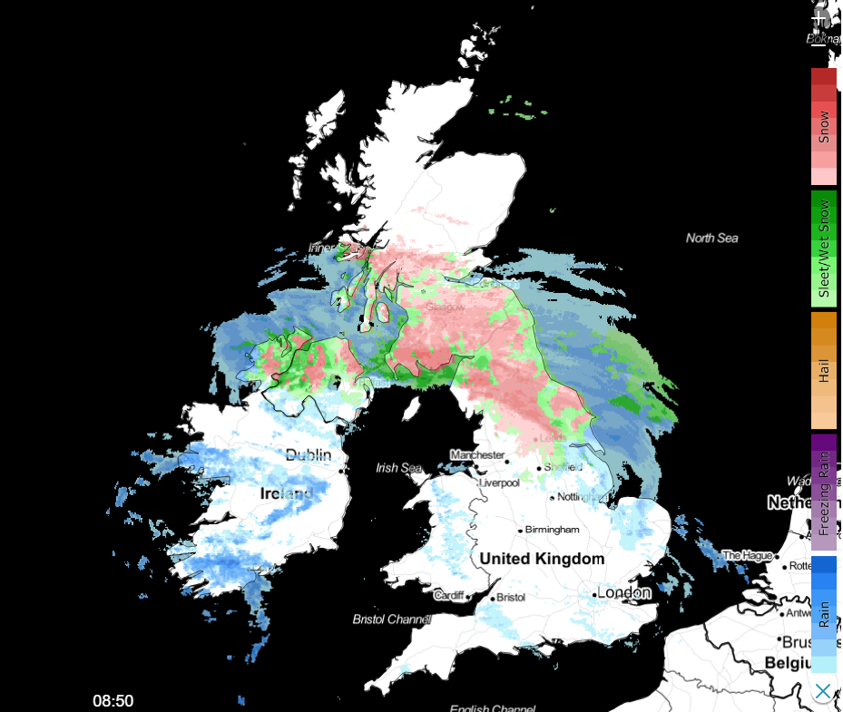
For Northern England, Southern and Central Scotland it's been a wintry start to the day, with several centimetres of snow falling widely overnight, making for some tricky travel conditions. Milder air is arriving from the south though, so, at lower levels, the snow will turn to rain across a good deal of Northern England, with a fairly rapid melt of the lying snow and the threat of some very icy surfaces. For Scotland, the colder air will stay in place, so more snow ongoing through the day, but even here it'll be the hills seeing the larger accumulations with some lower parts, especially near to coasts, likely to see the snow turn wetter with sleet or rain possible.
The fronts bringing the rain, sleet and snow won't make a good deal of progress further north through the day, so the northern quarter of Scotland is likely to stay mostly dry. There'll also be a top-up of heavy showery rain moving in from the across Ireland this morning and into England and Wales this afternoon, with further snow over the high ground of Northern England.
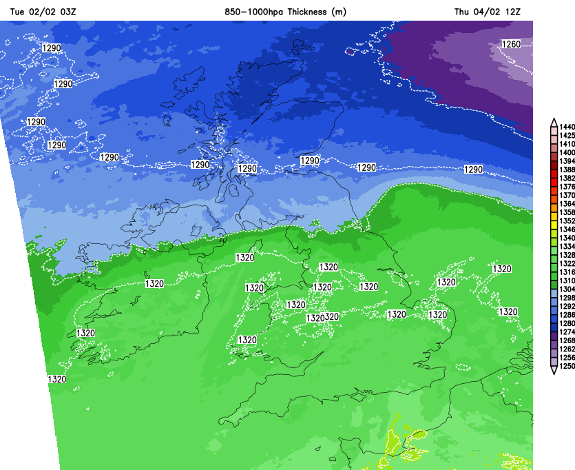
It'll be another of those days with a really noticeable temperature difference North to South, with a sharp contrast where the colder and milder air meets. So, you could be at 10-11c in one spot, not too many miles up the road and it'll be 3-4c.
This evening and overnight, the fronts will stay in situ with more rain, sleet and snow over the north of England and into Scotland. To the south of that region, the snow is likely just to be limited to high ground, but head further north, and lower levels are likely to see some snow as well. Through the night, rain will also move into the south of England.
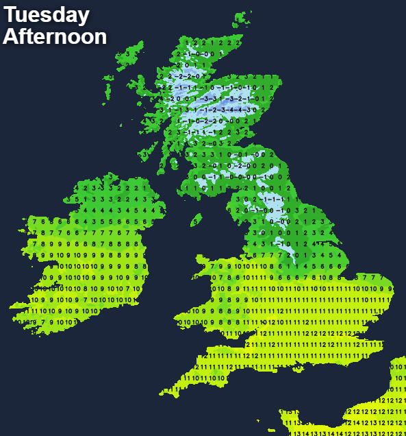
Into Wednesday, the northern half of the UK stays stuck with a similar picture with showery outbreaks of rain, sleet and snow and these will start to extend further north as well. A biting easterly wind will also be a noticeable feature in the far north of England and Scotland tomorrow. Further south, central England and Wales will start dry with a few showers blowing in from the west through the day. South of that, the overnight rain will be slow to clear east through the day, with sunny spells and a scattering of showers following behind it. Temperatures on Wednesday will again be split north to south, with highs of 7-10c for the southern half of the country, 0-4c as you head further north - and feeling way colder than that in the wind.
Thursday and Friday will follow a similar pattern with the cold air really entrenching itself over central and northern Scotland, with snow really beginning to pile up in places. Southern Scotland and Northern England will be on the cold side too, with further periods of rain, sleet, and snow, with the snow generally limited to the higher ground. For the remainder of the country, it's milder with further spells of rain or showers moving through at times as low pressure continues to dominate the UK's weather, keeping everywhere unsettled.
Into the weekend, the cold air in Scotland will start to move south with the risk of snow and ice becoming more widespread. It's a complex picture at that stage though; there are more details on this in Nick Finnis' latest blog.