Cold this weekend, snow showers for central and northwestern areas today, otherwise dry & bright. Snow affecting southern areas on Sunday. Turning milder and wetter from Tuesday.
All of the UK will be in a cold polar airmass over the weekend. It will be particularly cold at night with temperatures widely falling well below freezing with a widespread hard frost. By day it will be dry, bright or sunny for much of the time, but there will be some snow showers affecting central and northwestern areas today, while tomorrow a more organised band of snow looks to spread from the west across central and southern areas. Monday again cold, dry and bright for many, but there will be some wintry showers moving southeast across northern and central areas. Tuesday onwards turning increasingly unsettled and milder, as winds turn southwesterly while Atlantic frontal systems and areas of low pressure move in from the west, bringing spells of rain, which could increase the risk of flooding again. By the end of the week – temperatures recovering into double figures in the south.
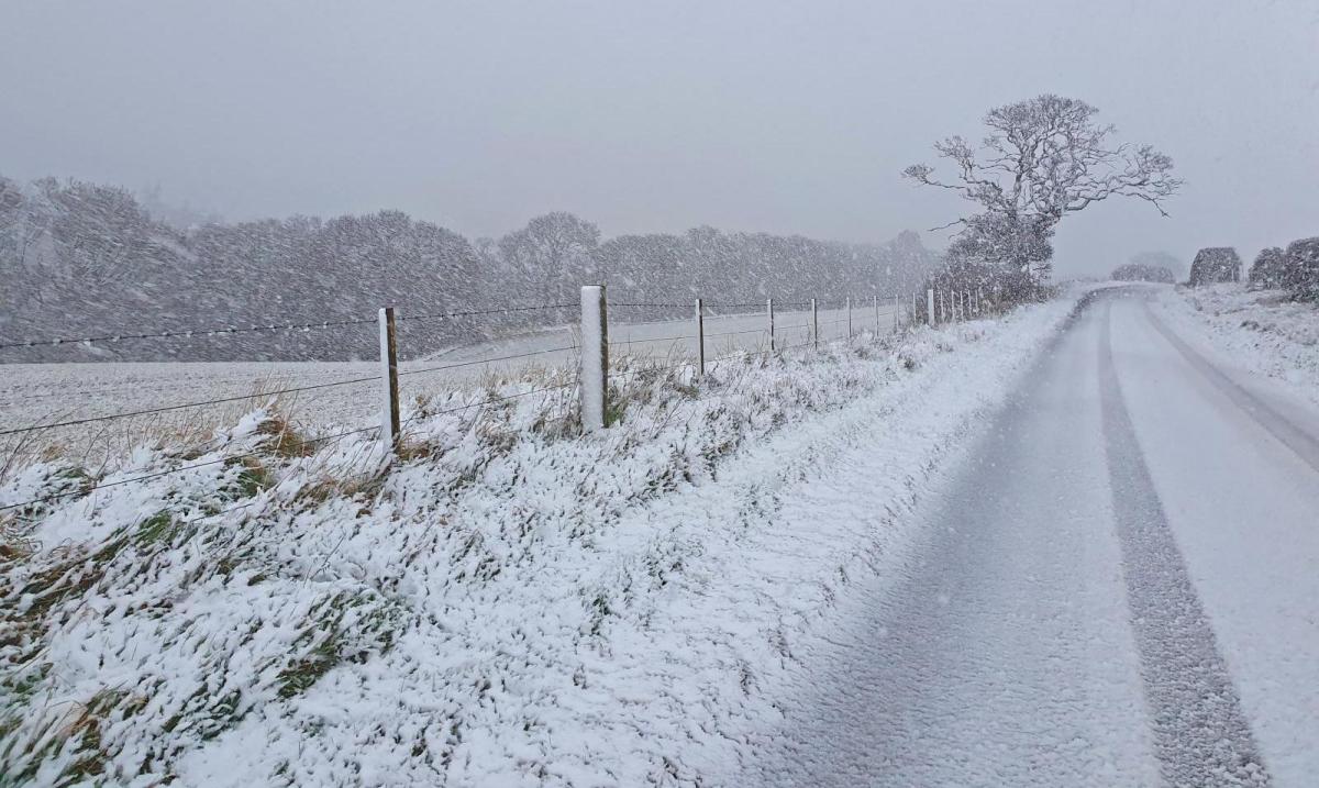
For now, a rather cold and frosty start for many, tempeartures widely below freezing a dawn with a widespread frost, temperature falling as low -8C in the Cairngorms, -6C in NE England. For most it will be a cold day with bright or sunny skies. Many places will stay dry, but the northwesterly flow around low pressure to the northeast will feed in scattered sleet and snow showers across western Scotland, N. Ireland, north Wales and NW England for much of the day, some of these snow showers heavy at the moment across NW England. Met Office yellow warning for snow and ice is in force today for overnight ice and the risk of snow accumulations from showers today.
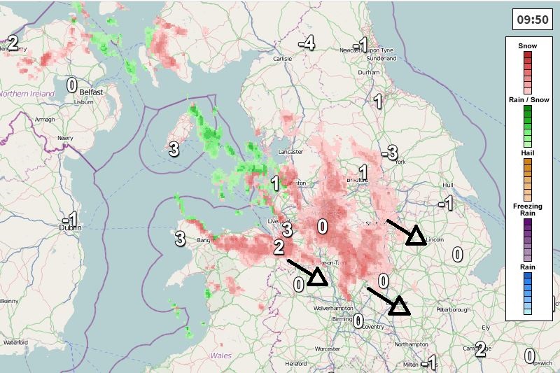
The snow showers also eventually feeding southeast across the Midlands and towards East Anglia and the northern Home Counties too this afternoon/evening. But many southern areas of England and Wales, NE England and eastern Scotland will have a dry and bright or sunny day. Temperatures reaching 2-5C at best generally, perhaps 7C across the far SW England and Channel Islands.
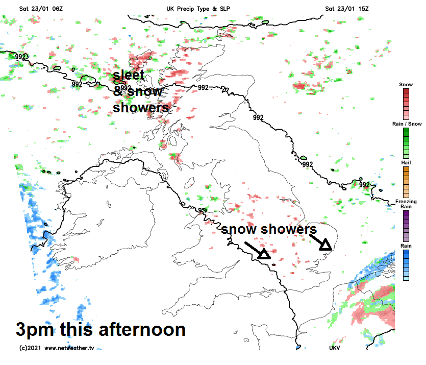
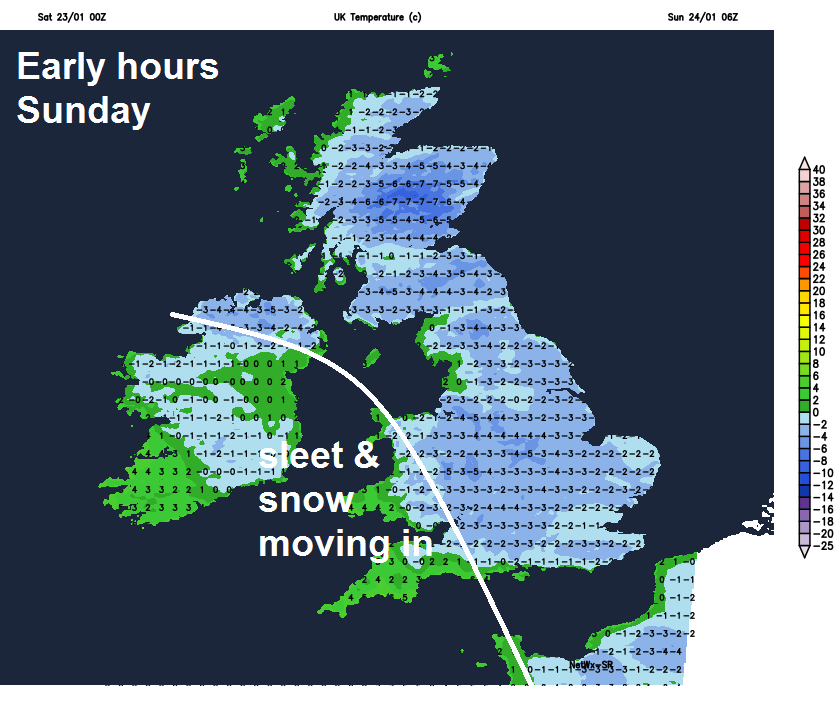
Snow showers continuing for a time across central and eastern England for a time this evening before fading overnight, sleet and snow showers continuing across western Scotland, while a band of sleet and snow will spread in from the west across SW England, Wales and N. Ireland in the early hours. But otherwise most areas will have a dry night with clear spells – which will lead to a widespread hard frost developing, temperatures falling to -2 to -5C widely, perhaps as low as -8 to -10C in the Highlands.
Another cold day, a band of snow, rain or sleet on coasts, across Wales and SW England first thing will extend east across central and southern England along with parts of East Anglia through the morning, falling as snow inland, even to lower levels, giving a couple of centimetres in places, perhaps 5-10cm over higher ground in the west. The snow turning more showery through the afternoon while tending turn lighter before fizzling out through the evening, turning drier across Wales and SW England through the afternoon. Met Office yellow warnings for snow and ice are in force, as there’s likely to be some disruption from the snow in places.
Further north, most of Scotland, N. Ireland and northern England will have a dry, bright or sunny day away from western coasts of Scotland and northern coasts of N. Ireland – where there will be some wintry showers – especially through the afternoon. Temperatures reaching 1-4C at best generally across the UK, perhaps 6C in far southwest and Channel Islands.
Starting off cold early next week, a widespread frost again to start Monday, then a mostly dry day with brightness or sunny spells, but also some wintry showers across the northwest and perhaps feeding southeast across northern and central areas of England. But on Tuesday it will be cloudier for all, with rain spreading in across southern and western areas through the day, preceded by snow over western hills, while turning less cold. After a dry start on Wednesday, wind and rain sweeping northeast across most areas and the southwesterly wind bringing in milder air. Windy with further spells of rain or showers on Thursday and Friday and mild in the southwesterly wind. Given the frequency of rainfall from mid-week, unfortunately we could see the return of flooding issues with the ground saturated and rivers levels not had enough time to drop following the flooding during the past week.