You'll have to take your chances this weekend with spells of heavy rain and blustery winds. It will be mild for November.
You will have to take your chances this weekend. There weather looks mixed with further bands of rain and blustery winds whirling about. There will be brighter bits in between with sunshine and showers some the west. There is a coolness with the damp air, overnight temperatures are dipping away a bit more this weekend, but pulses of warmer air still push up from the south lifting the daytime temperatures well into the teens.
November has been mild so far. This weekend will feel cooler comparatively, but it won’t be until next weekend that winter will be in the air. There are signs that it will turn much colder in the north and then chillier everywhere after that.
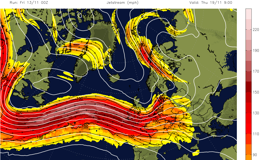
The increasingly powerful Jetstream nudges southwards into next week, its zonal flow keeping the UK in a mostly westerly influence. Already there have been bands of heavy rain sweeping in from the Atlantic and these continue. Always wettest for Ireland, Wales, western Scotland and NW England, sometimes SW England too. Further east particularly for SE Britain it is drier and not as windy. With this pattern, everything stays mobile, no stagnating weather patterns except the ongoing unsettledness.
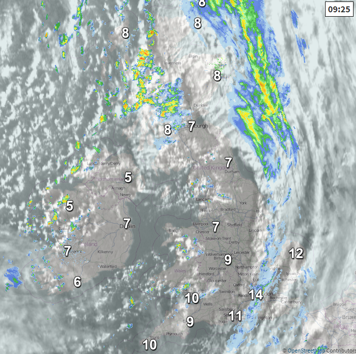
These bands of rain have been moving through quite quickly, there is one this morning making its way over England towards the North Sea. All of this is gradually adding to the river catchments and to conditions on the ground. Local surface water or river flooding is possible and local coastal/tidal flooding is being highlighted by the Environment Agency along the west coast of Britain at the weekend. There is even more rain on the way for the start of next week, more so for north-western areas.
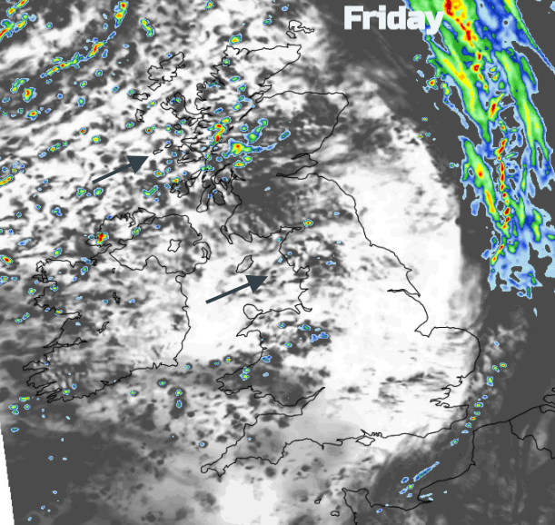
As the fading cold front takes its rain away from eastern England this morning Friday will have a fresher feel to it. Temperatures today range from 13 or 14 for the southeast with light winds but only 9C for Northern Ireland and Scotland. Here, with blustery southwest to west winds, there will be a scattering of showers some heavy even thundery with hail, even some wintriness over the Scottish mountains. A few rain showers will also feed over Wales and NW England from lunchtime onwards but well scattered. For much of the UK, the day becomes fine and bright but will feel cool if you are lingering outside.
During the weekend a swirling mess of weather fronts and lows move over the UK from the south and west. If you are looking for a dry spell for exercise or essential shopping don’t put too much faith in the hourly weather symbols on an app. Take a look at the rain radar and see where the rain is currently and how it is moving.
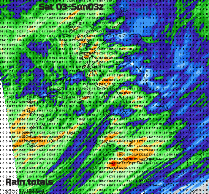
Wales and the West Country start off Saturday with heavy showery outbreaks and in a mild southerly flow these pulse up through the Midlands into northern England. There could be thundery outbreaks too. Another area of heavier rain looks to head in from the SW during Saturday afternoon as the winds pickup. SW Britain will see strong winds adding to that push of water and flood risk. NE Britain will be more sheltered and fair until much later in the day.
Overnight there will be clearing skies for England, Wales and Northern Ireland as the rain bands move northward through Scotland. Mild and breezy everywhere.
Sunday will see more sunshine but again lively bands of heavy rain. One developing low looks to head towards SW Britain later on Sunday bringing coastal gales as it moves across southern England. Something to watch.
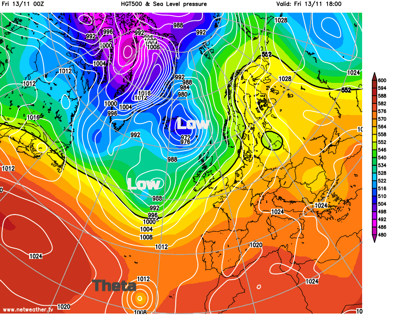
Northwestern Africa, Spain and Portugal, the Canary Islands are encountering cloudy and unsettled weather as Tropical Storm Theta lurks in the eastern Atlantic. As it heads towards Madeira it will lose its tropical characteristics by Sunday and then fade next week.