A murky start, a few showers but most dry today, brightening up in places. Turning wet and windy across all parts by end of Wednesday and staying generally unsettled but mild thereafter.
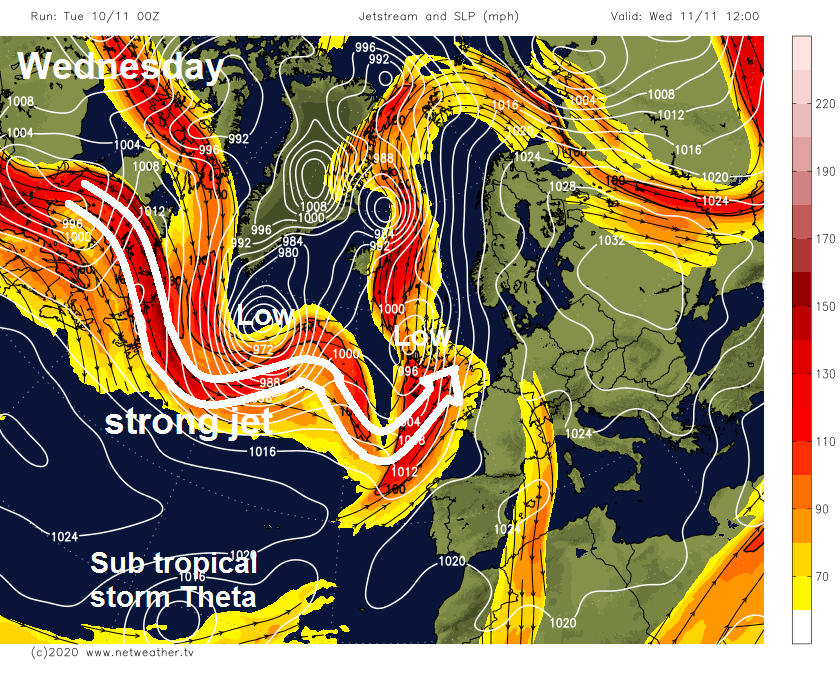
The weather has been rather slow over recent days, showers in places but also a lot of low cloud, mist and fog. It has turned milder though over the last few days following the cool and frosty weather last week, thanks to southerly winds, the temperature reaching 18C in Gogerddan in west Wales on Monday. Today will be mostly dry and mild, but a big change is on the way tomorrow, as a strong jet stream moves in off the Atlantic, bringing a spell of wet and windy conditions across all parts by the end of the day. Thursday will bring a window of mostly dry and bright conditions, before rain and stronger winds returns Friday morning. The weekend continuing the unsettled theme, with low pressure in charge, bringing windy conditions, spells of rain or showers. But, with winds from the southwest for the most part, it will be mild for all.
It’s a grey and murky start across many areas this morning, with some dense fog patches across the Highlands, southern and eastern Scotland, eastern and southeastern England – visibility down to 100m in places. For most it’s a mild start too – with temperatures widely in double figures, however across northern Scotland, clear skies have allowed temperatures to fall close to freezing, bringing a touch of frost.
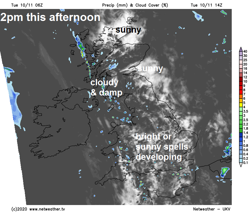
For many it’s dry though, bar a few well scattered showers. The early fog will take a while to lift into low cloud and generally it will be a cloudy and misty morning, with weak weather fronts bringing further scattered showers moving northeast in places, though some breaks will allow some brightness or sunshine in places. However, as we head into the afternoon, sunny spells will increasingly develop from the south, the best of the sunshine across southern and eastern areas. Cloudier skies at times across northern and western areas will bring scattered showers in places. A mild day, afternoon highs reaching 12-15C.
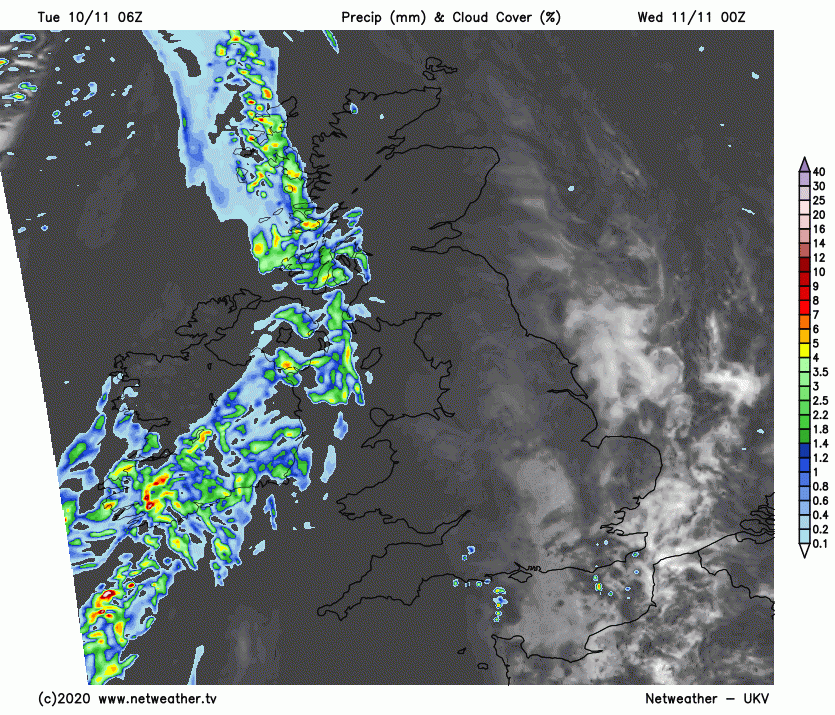
Increasingly windy across the west this evening and overnight, with outbreaks of rain spreading in from the west across N. Ireland and western Scotland. Becoming breezy elsewhere, but mainly dry but generally cloudy away from eastern and southeastern England which will have clearer skies and lighter winds – which may lead to some fog patches forming.
After recent fairly calm weather, a change on Wednesday, as strong southerly or southwesterly winds develop ahead of a deepening low pressure system moving northeast towards western Scotland and associated squally active cold front moving east. The low and its cold front will bring wet and windy conditions eastwards across Scotland, NW England, N. Ireland through the morning and lingering into the afternoon, outbreaks of heavy squally rain then pushing in across Wales, SW England and the Midlands during the afternoon. Eastern and southeastern England mostly dry during daylight hours, but becoming increasingly cloudy after a bright start, some drizzle possible in places. Another mild day, temperatures reaching 11-14C.
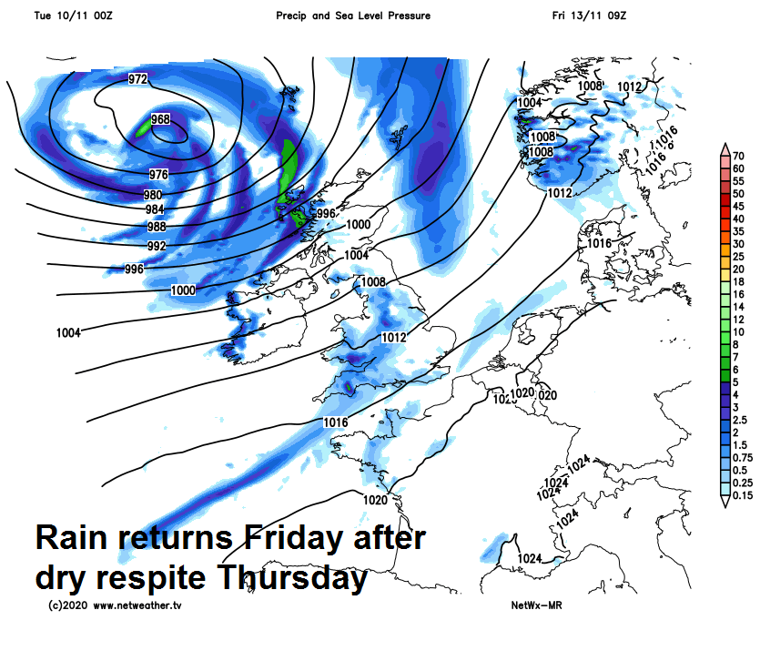
Band of heavy rain and squally winds along a cold front will continue to push eastwards across much of Britain Wednesday night, clearing out over the North Sea in the early hours of Thursday. Then a calmer, mostly dry and sunny start to Thursday leading into a mostly dry day with sunny spells –as a brief ridge of high pressure moves in. Turning cloudier across northern and western areas later, with a few showers, then more general rain arriving across western Scotland after dark. Temperatures reaching 11-13C.
All change again on Friday, windier – with a band of squally and locally heavy rain pushing east across most parts during the morning, followed in the afternoon by cooler, brighter but breezy conditions with a few showers across England and Wales, while Scotland see very windy conditions and squally showers in the west. Temperatures reaching 10-13C.
The general theme as we go through the weekend is staying unsettled and windy thanks to a strong jet stream aimed at the UK and Ireland and deepening lows passing close to NW Britain. So generally windy, perhaps with gales towards the northwest at times, while spells of rain or showers affect most parts throughout. Staying mild though.