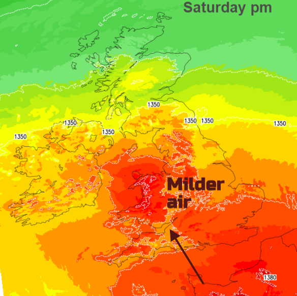
Typical November weather with frost and fog, fine sunshine and little wind. A change this weekend though as much milder air moves up from the south.
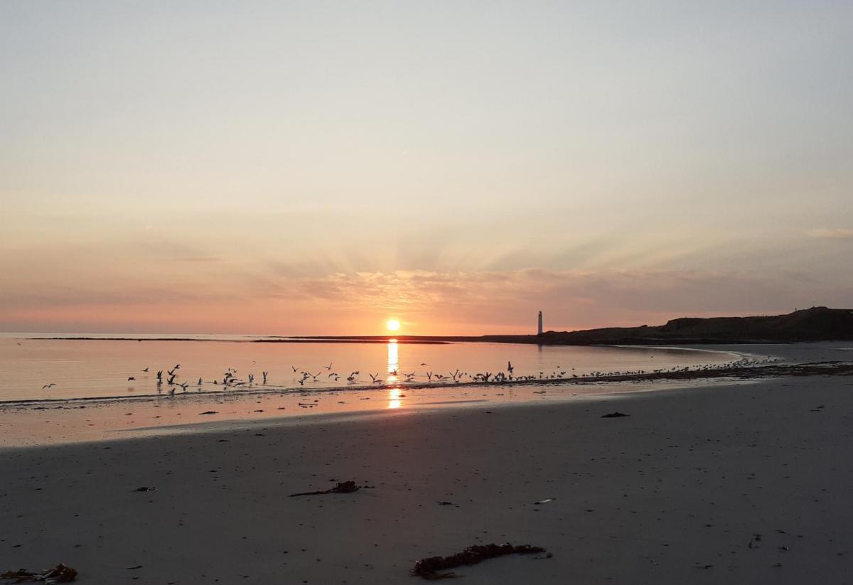
There is fog this morning with warnings for parts of eastern and southern England. High pressure, light winds, the low temperatures and aerosols lingering in the air after last night’s bonfires and fireworks make for ideal conditions for fog forming. And poor air quality, yet stunning views at sunrise.
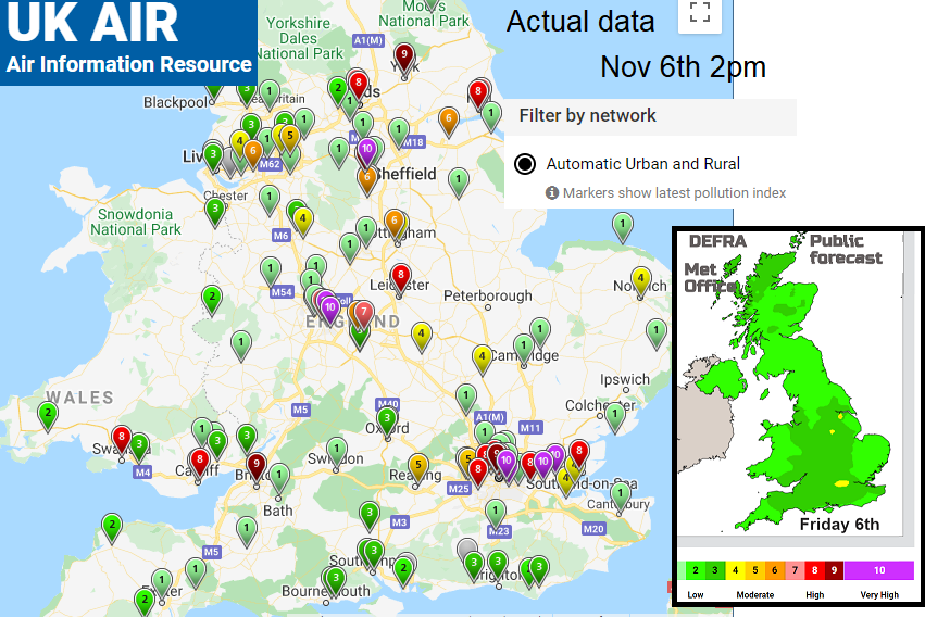
"Pockets of moderate air pollution continue into next week. There will be patches of high or very high pollution near urbanised areas with bonfire and firework-related pollution adding to the issues". DEFRA
The fog is dense and even freezing in places. It is expected to thin and lift for most today but in the northern warning area it could linger for much of the day, the Vale of York is mentioned. There have been beautiful sunrise photos this morning and it will be a fine, dry day across the UK.
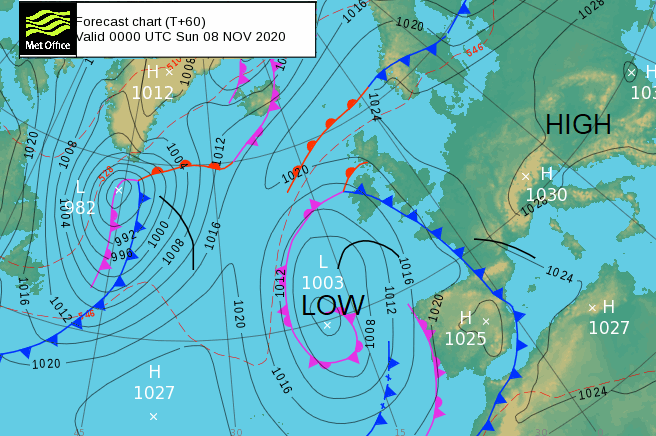
Saturday morning will also be fine and dry but the dominating high pressure which has brought this quiet spell of weather will be slipping away to the east, taking up much of central Europe. An Atlantic low pressure will bring more unsettled weather to western Europe with rain and blustery winds.
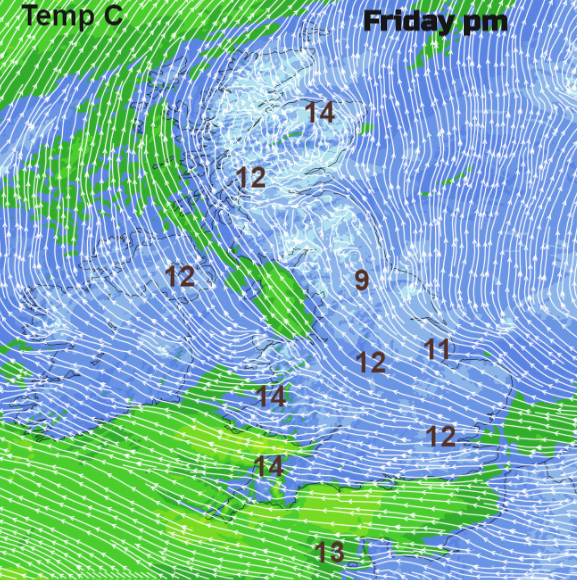
On Thursday Edinburgh reached 14.7C, the Highlands 16.1C and Aberdeen airport 16.6C. It has been a cool start across the UK with some spots down to freezing. The top temperatures today look to be 14 or 15C in areas to the lee of high ground. An easterly breeze picking up over southern Britain and a very light southerly flow for northern Britain, south-easterly for Northern Ireland. Where the fog lingers it will remain cold, not even into single figures.
Many places stay around 11 or 12C and it will turn chilly again tonight inland, down to around freezing with a touch of frost. Fog will form again, NE England looking particularly prone and the Central Belt. SW Britain looks murky as milder air edges in, so low cloud and mistiness through the night.
A quiet still nippy start for Saturday for much of the UK. It will be milder, more cloudy with an easterly breeze over Cornwall and Devon. The fog will again be reluctant to clear for parts of Yorkshire and inland NE England. There will also be more cloud for the SW half of England/Wales including low cloud and early murk, more sunshine to the NE. North and western Wales soon brighten and warm up. With a light east to SE breeze northwest Wales could see around 19C, much warmer. Southern Britain feeling milder with temperatures of 13 to 15C. Further north in Britain it remains colder with no breeze but sunny and fine.
Northern Ireland will have a light easterly breeze and see the odd showery burst by late afternoon as the cloud cover increases. There will also be outbreaks of rain arriving over Cornwall by teatime, from the Atlantic low. This frontal system looks to bring some wet and wild weather over Iberia and a Mediterranean Episode of torrential rain is being warned about for southern France.
Further outbreaks of rain spread over Ireland, SW Britain and over western Scotland during Saturday night with milder air after the recent chilly nights.
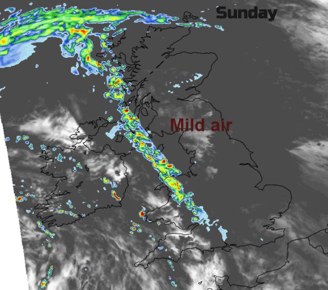
Sunday will be mild again but with more cloud. A SE breeze and outbreaks of rain for Wales, western Scotland and a bit for NW England. Well scattered showery outbreaks, the milder air and more cloud last into Monday. So not the crisp, dry sunny weather that we have to end this week.