A day of sunshine and showers before the weather settles down for the rest of the week, as high pressure builds, but with it some cold, frosty and locally foggy nights
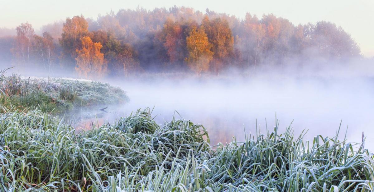
There is a change on the way to drier and calmer weather starting tomorrow, as a ridge of high pressure builds in from the west and lingers well into the weekend. However, with winds falling light and clear skies at night, it will turn cold, with risk of frost and also fog patches.
For now, it’s a cold start out there across many areas, temperatures widely in single figures at breakfast time away from far SE of England – where a strong southwesterly wind is blowing in milder air. There’s even been snow overnight over the mountain tops of Scotland and some sleet as far south as the tops of the Moors of SW England.
It’s not dry this morning for some. A wave of low pressure running east across southern England overnight is still bringing outbreaks of heavy rain and even the odd rumble of thunder this morning across SE England and East Anglia for the morning commute and school run, while showers are packing in across western areas of England, Wales, parts of Scotland and N. Ireland.
The heavy rain across SE England, East Anglia and Lincolnshire will continue to clear northeast into the North Sea through the morning followed by drier and sunnier conditions here for the rest of the day. Many central, southern and eastern areas of England will remain dry and sunny with just an isolated shower risk, but showers from the word go this morning across SW England, Wales, NW England and N. Ireland will continue for the rest of the day. Showery rain and hill sleet or snow over Scotland this morning will also clear away east over the North Sea, followed by drier and brighter conditions in the east, but further showers continuing across the west.
It will be a breezy day, but not as windy as recent days. On the cool side, with temperatures reaching 8-9C at best in the north, 9-11C in the south.
There will continue to be a few showers running southeast across northern Scotland tonight, while isolated showers will affect western coasts, but for many it will be dry with clearing skies leading to a cold night, with a widespread frost developing across inland Wales, central, southern and eastern England in particular.
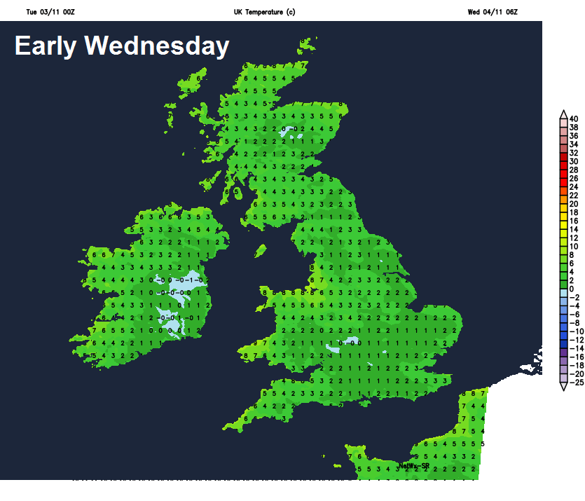
After a cold start, frosty in the south, Wednesday will be a generally fine, dry and sunny day across England and Wales as high pressure begins to build in from the west, just an isolated shower risk towards western coasts. Scotland and N. Ireland will also remain mostly dry, but after a bright or sunny start, it will turn cloudier from the northwest, with rain arriving in the far northwest by evening. Temperatures reaching highs of 10-12C generally.
High pressure builds in from the west for the rest of the week, settling the weather down, but with it, some cold nights.
Another cold start on Thursday, with a frost likely and also some fog patches across parts of England and Wales at dawn. Fog maybe slow to clear across parts of the south, due to little wind, where it lingers temperatures staying in single figures. Otherwise a dry day for most, with a good deal of sunshine across England and Wales, more in the way of cloud across Scotland, N. Ireland and far north of England – which may be thick enough to bring the odd bit of drizzle. Temperatures will actually be lowest in the south, where they’ll reach 10-11C, in the north, where there will be a brisk westerly breeze, 12-15C.
Fog perhaps more widespread to start Friday, staying chilly where fog lingers, otherwise another fine and dry day for most, with light winds and sunny spells in places. Temperatures reaching 9-12C.
Another mainly dry day on Saturday, after a bright start, perhaps turning cloudier across the south with an easterly wind picking up, northern areas staying generally sunny.
High pressure retreats east by Sunday, allowing low pressure to the southwest to have increasing influence across the south, perhaps bringing showery rain north across England and Wales through the day, but also milder air with temperatures returning to the mid-teens. Scotland and N. Ireland probably staying dry and bright.