After a very wet weekend, there are still flood alerts and warnings in place. There will be a bit more rain, plenty of showers from the west as the UK weather stays unsettled but not quite as soggy.
What a wet weekend. Parts of Wales, southern England and eastern Scotland saw over 100mm of rain from this event. It started with Storm Alex which led to a collection of low pressures with one still lingering over the UK this morning. With showers and a bit more rain, this low slowly edges away north-eastwards over the next few days. It will be western areas seeing most of the heavier showers with blustery winds on Wednesday. Later in the week, a new Atlantic low could bring more rain to southern Britain but there is a lot of uncertainty in that part of the forecast.
The weekend rain brought flooding, high river levels, a washout of a day on Saturday and just a general feeling of “will it ever stop?” However, September had been dry for many of the areas soaked at the weekend which lessened the flooding blow. The next few days won’t be as wet, but it still looks unsettled and mixed with showers, some longer spells of rain in the west and an ongoing cool feeling to the air. There will be sunny spells too as it turns nippy by Wednesday night.
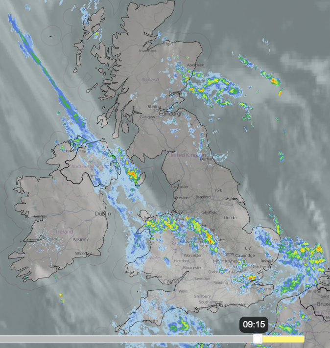
Today the low centre is over eastern England with light winds, a good deal of cloud about and some early mist and fog from all the dampness in the ground over northern Britain. Showers continue to move in from the North Sea this morning and bright spells will appear. Fronts wrapped around the low are bringing rain to Northern Ireland, north Wales and Merseyside, also SW England. And the curl of the occlusion means a wet start for Norfolk and Suffolk, but this will clear away this morning and then the frontal bands from the SW shift NE. So, NE Britain has a rash of showers today. SW Britain and Northern Ireland start with a distinct frontal band but this edges towards SW Scotland, across Wales into the Midlands turning more showery and later reaches London and East Anglia. Temperatures could reach 16C in the Home Counties, feeling better than at the weekend. A westerly breeze develops for southern Britain, fresh for Cornwall and Pembrokeshire, strong for the Channel Islands with some sharp showers.
There are a few flood alerts for western Wales this morning. One flooding warning for Kintore and flood alerts across NE half of Scotland. Numerous flooding warnings for southern and SW England and one on the River Ouse.
Env.Agency- "Ongoing local flooding impacts from rivers are probable today across parts of central and southern England. Local flooding is also possible for parts of the River Avon in central England during Tuesday. Tidal flooding impacts are probable near Ynyslas in Ceredigion Monday during times of high tide."
Bright spells appear then fade; another band of rain moves into SW England later in the day as the main band heads northwards.
This rotated and mixed weather continues overnight into Tuesday with areas of showery rain, a good deal of cloud and early murk with some brightness as the day progresses. There will be very light winds over northern Scotland but for most of the UK there will be a westerly flow bringing in the showers and they will reach right across Britain by the afternoon.
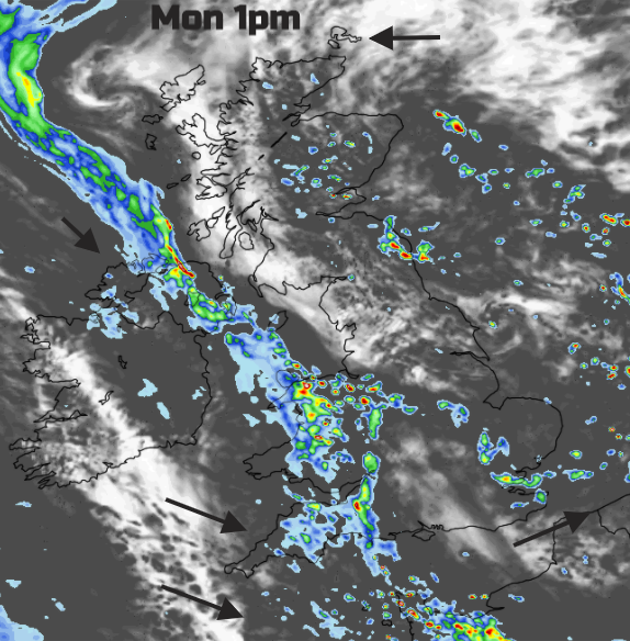
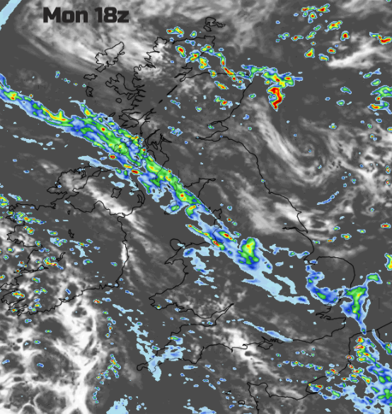
As the low centre heads away over Shetland, a fresh westerly wind picks up for southern Britain and Northern Ireland on Tuesday and affecting northern and eastern Britain by Wednesday, strong winds for northern Scotland. It will feel colder on Wednesday with temperatures of 10 to 15C but quite a breeze. NW Scotland keeps a feed of showers but elsewhere more fair bright weather for midweek as long as the frontal band away to the south doesn’t wave northwards. It is this boundary which had shown signs of developing a significant low pressure later in the week but that seems less likely now. It’s like holding a long skipping rope out and flicking your wrist to send ripples along it. Mostly there are gentle undulations, some larger bumps then an occasional knot. We’ll have to watch developments and how the computer models handle it in the coming days, to see what this week brings for the UK.