Some rain about during the next couple of days, with Atlantic systems keeping the weather on the mixed side.
Despite the shortening days, September can be warm and quite pleasant. The month has certainly begun that way in central and eastern areas, but in what I suspect will be a changeable month, we've already seen Atlantic systems move in. We currently have a cold front giving bursts of rain across central parts, but this'll weaken as it comes South East, giving mostly light patchy rain by the time it reaches the South.
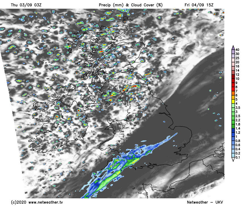
To the South of the front much of East Anglia, the Midlands, the South and South Wales are waking to murky conditions, with some mist, fog and very low cloud especially across the South West but it's very mild. This'll persist for much of the day towards Kent and the South coast, while most other parts see some sunshine later. Across the remainder of the country there'll be sunny spells through the day, but with scattered showers mostly in the West and over Scotland and Northern Ireland, where some in the North and West will become heavy perhaps with hail and thunder.
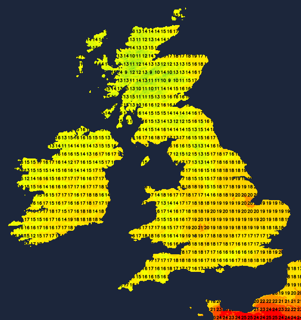
A South West or West wind will be blustery in the North giving gales later, with gusts of 45 to 50mph expected across the Northern Isles, Highland and over exposed western coasts and hills. But over much of England and Wales winds will be somewhat lighter, with top temperatures 14 to 16C in the North and 18 to 21C further South.
Into the evening and after dark, Scotland and Northern Ireland continue to see showers, heaviest and most frequent in the North and West. These will be driven along by a blustery West or South West wind that'll give further gusts in excess of gale force in the North. Meanwhile, over England and Wales where winds will be lighter, apart from a few showers in the West it'll be dry with clear spells. The exception will be the Channel Isles and maybe the South coast, where the cloud may persist, giving a little drizzle in places. Lowest temperatures nationwide will be in the range 9 to 14C.
On Friday, cloud in the South could spread as far North as Monmouth, the South Midlands and parts of East Anglia on Friday giving patchy rain. A few heavier bursts are possible before the weather begins to clear from the West through the afternoon. Scotland and Northern Ireland see further showers some heavy in the North and West, while remaining parts of the country apart from the odd shower in the West, see sunny spells. A chilly West wind remains blustery in the North so it won't be particularly warm, with top temperatures only 13 to 15C in the North and 17 to 19C in the South.
Blustery showers continue into the evening over Scotland, before becoming largely confined to the North and West after dark, when winds may decrease a little. Northern Ireland and the far North of England may also see a few evening showers, but these should fade to leave a dry night over much of England and Wales. There'll be clear spells, and with lighter Westerly breezes here it could turn slightly chilly in some sheltered rural areas by dawn, when temperatures should be in the range 7 to 12C.