Last night was chilly enough for some to get the heating on, did you? With lighter winds, the rest of the long weekend will feel warmer by day in the sunshine, but there's another chilly night on the way tonight.
Did you do it? Did the heating go on last night? It may be the end of August, but it was chilly last night, with temperatures falling well down into single figures for many. The highlands of Scotland nearly made it to 0c, with Cairngorm falling to 0.2c, but even in towns and cities it was cold - Glasgow fell to 3c, Sennybridge to 1.5c and Belfast to 2c. Not what you'd typically expect at the end of August, with average lows at this time of year closer to 10c.
The sun is still strong enough at this time of year though, so it will warm up today to take maxes into the mid-high teens generally. The wind will continue to be strong in eastern areas, especially to start with, but in the main, it'll be lighter. For most, it'll be a dry day but we will still see some showers near to coasts, especially in the east and southeast. Another chilly, central heating tempting night then follows with most regions again dipping away into single figures.
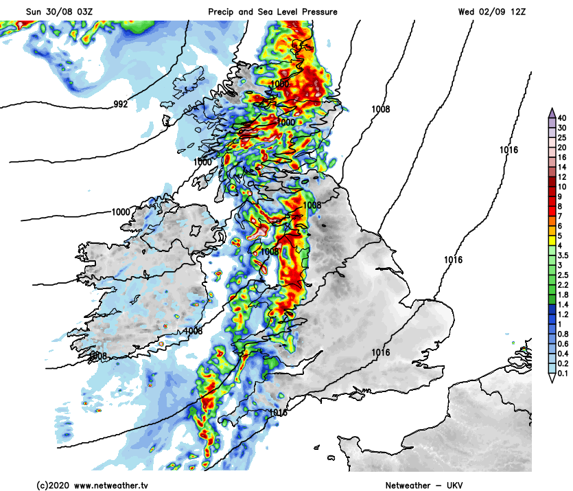
Into (Bank Holiday) Monday and the final day of meteorological summer, thanks to high pressure overhead it'll be another mostly dry day with plenty of sunny spells. We'll have a few things going on during the day though. First, there may be one or two showers still leftover in the southeast. Second, winds will be increasing in the west - this time blowing up from the south rather than from the north as we've seen during the last couple of days. And third, a weather front will approach from the west, bringing some patchy rain into the western half of Ireland by the end of the day.
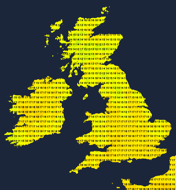
Temperatures won't be too dissimilar to today, but perhaps with more places making up into the high, rather than mid-teens. So, feeling pleasant enough in what will be some long sunny spells.
Once the long weekend is over, the weather will be back into a downhill slide again, as the high pressure gets squeezed away to the east and low pressure starts to takeover again. The first attempt at that will be the front making its way in from the west during Monday, but that one looks likely to struggle to make too many inroads. Even as it crosses Ireland overnight Monday and into Tuesday, it'll bring patchy and generally light rain. Then, during Tuesday, much of England and Wales will stay dry with some sunny spells, with any wet weather likely to be limited to the north and west of Scotland, along perhaps with northwest England.
The next set of fronts will have a bit more about them though, arriving from the northwest later on Tuesday before pushing southeast and bringing some rain across all parts during Wednesday. It'll be blustery as well, especially in the north and west. with low pressure centred between Iceland and the northwest of Scotland.
The last of the rain should clear away from the southeast during on Thursday, to leave sunny spells and a scattering of showers behind it. Another low is then likely to swing past the north of Scotland during the latter part of the week, but by this point, high pressure may be starting to ridge up from the south as well.
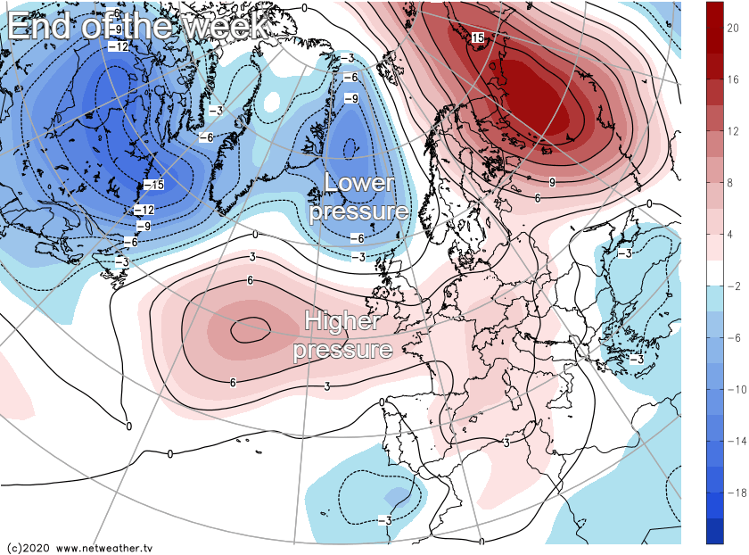
So a northwest-southeast split is the most likely picture, with the unsettled weather more confined to those northern and western regions.