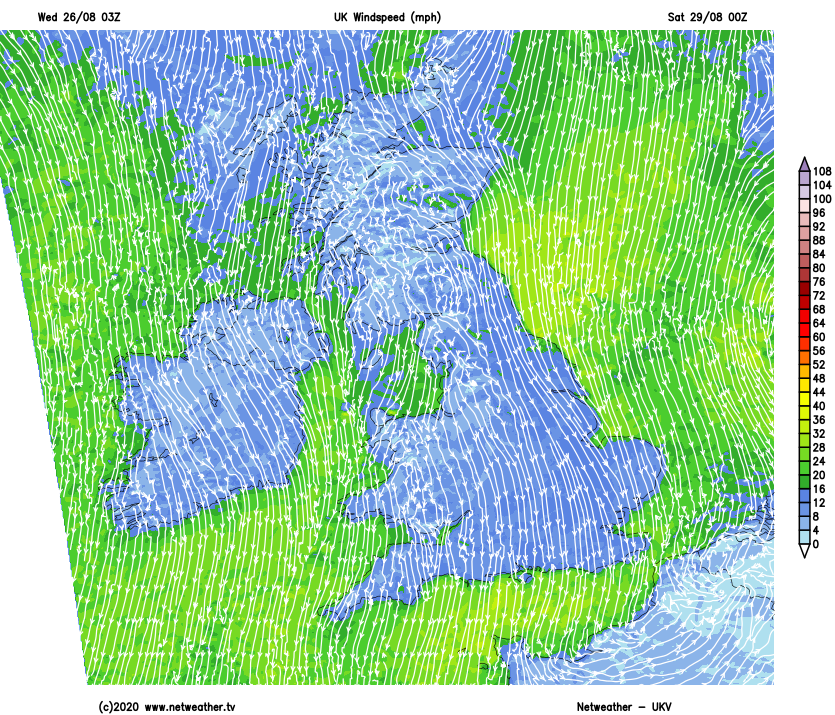
Storm Francis has now moved away to leave a much calmer day today. Another less fierce low arrives tomorrow, bringing heavy rain and showers which will last into Friday. High pressure will settle the weather down in time for the (long) weekend though.
Storm Francis is now moving away through the North Sea and towards Denmark, having brought, high winds, flooding and disruption yesterday. And although it's still been blustery in eastern regions first thing, today will be a much calmer day.
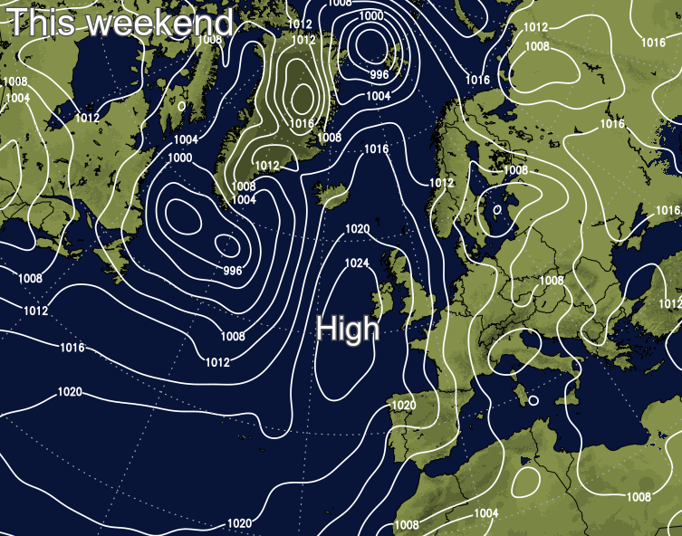
The unsettled weather isn't done with us yet though, with more rain and showers arriving tomorrow and into Friday as another Atlantic low moves in - this one won't be so tightly wound up as Francis though, the rain won't be as persistent and the winds nowhere near as strong. With a long weekend ahead (south of the border), there is some good news though, as a ridge of high pressure will arrive on Saturday to (temporarily) settle things down.
After the soaking yesterday, it's also a much drier picture today, with much of England and Wales staying dry with just the odd shower - there's even a reasonable shot of seeing some sunshine! The far north of England, southern and central Scotland aren't going to fare quite so well though, with outbreaks of rain slowly moving away east through the day. The bulk of those will affect Scotland, with just a few patchy bits and pieces into Northern England. It's likely to be after dark before it all finally clears off from the east coast.
Temperatures today will be warm enough in the sunny spells across England, Wales and much of Ireland with maxes into the high teens generally, the low twenties in the southeast of England. Head north under the cloudier skies and outbreaks of rain, and it's cooler with the far north of England and Scotland doing well to make it into the mid-teens.
Much of today's rain will die out overnight, but following in from the west will be Thursday's batch of showers. They're going to become pretty widespread during the day on Thursday as well, with some merging into longer spells of rain. There'll be some heavy, thundery downpours in the mix, especially across England, Wales, a good part of the island of Ireland, along with southern Scotland. Not all will catch the rain though, with a good portion of Northern Scotland well placed to miss the worst.
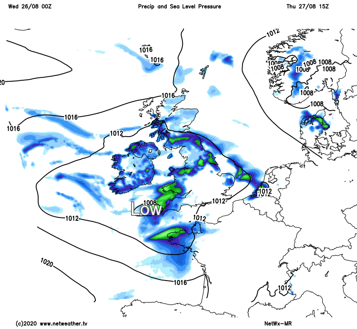
The low pressure bringing the rain and showers will slowly move across the south of the UK during Thursday and Friday, before edging off into the continent later in the day on Friday. That's going to mean the showers continue for England and Wales in particular as we end the week, with some still leftover in the southeast during the first part of Saturday. But with a nose of high pressure moving in from the west by that point, the over-riding picture will be a dry one, but also cooler as winds swing into the north.
That more settled, but still fairly cool weather lasts into Sunday as well - there may even be a touch of frost for parts of Scotland first thing. It'll feel warm enough once the sun comes out though, with maxes typically reaching 15-19c - perhaps scraping into the low-twenties in some sheltered parts of southern England.
For (bank holiday) Monday, many eastern and central regions should stay dry and bright, but a weather front will be approaching from the west, bringing outbreaks of rain with it.