It's going to be a quieter end to the weekend but the unsettled weather is nowhere near done with us yet. Another deep low will arrive into Tuesday bringing further strong winds and heavy rain, finally clearing later on Wednesday.
Having seen the back of one unseasonably deep and vigorous low pressure system, we're only going to get a brief lull before the next one arrives from later on Monday. This one will bring the usual mix of rain and wind, with warnings for high winds on Tuesday and Wednesday already issued by the Met Office.
Despite the winds generally becoming lighter as we end the weekend, there are still going to be some showers around during Sunday, with just about all parts at risk of catching one or two. Between them, there'll be some sunshine though, with temperatures rising into the high teens or low twenties for a good part of England. For Wales, Scotland and Northern Ireland it'll be a touch cooler though with the mid-teens just about the peak.
This evening and overnight, a weather front will move in from the west into southern and central England along with south Wales, bringing some outbreaks of heavy rain with it. They'll stick around into Monday as well, especially in the east and south, before fading later in the day.
Elsewhere, Monday will be a mostly dry day with sunny spells and just a few showers here and there - these most likely in eastern parts during the first half of the day. Winds will generally be light throughout, but southern coastal counties of England will buck the trend by staying blustery until later.
By evening the first sign of trouble from the Atlantic will arrive as rain moves into southern Ireland and the southwest of England. As it does so, the wind will start to increase with the low pressure nearing. The wet weather will quickly spread northeast overnight and into Tuesday, with a spell of heavy, persistent rain affecting much of the UK and Ireland, with perhaps the far north of Scotland missing the bulk of it.
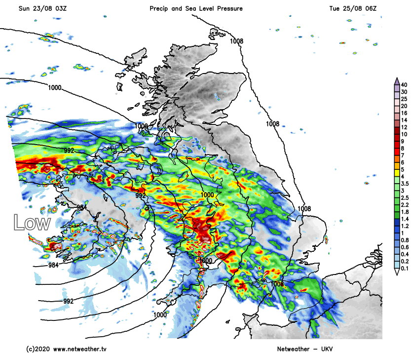
As the rain moves through, the winds will be gusty, but it's not until after that initial band of rain that the low pressure itself will push through into Ireland and then across Britain, which is when the winds will be at their strongest.
The timing and track of the low aren't nailed down at this point, so the details are subject to change, but it'll be as that low moves through during Tuesday and into Wednesday that those around the flanks of it, particularly the southern side will see gusts of 50-60mph or so. In the scheme of things that's not especially strong. But for the time of year, with more of us and about, and with trees in full leaf, some of which may also have been weakened by the strong winds in recent days, it's liable to create some disruption.
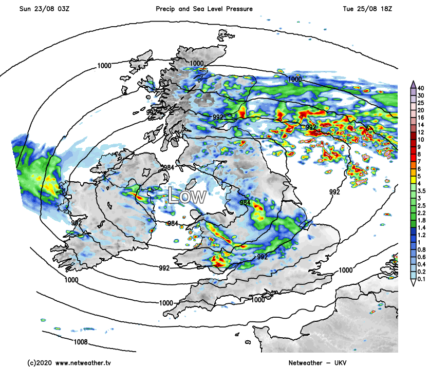
Eventually, the winds will ease back on Wednesday as the low heads out into the North Sea. What that will do though, is pull colder air south, meaning a chilly night is likely, especially across the north of the UK, with a ground frost possible for parts of Scotland. Beyond that, the unsettled spell is set to continue with another low pressure system likely to follow quite swiftly behind, bringing more wet but probably not quite such windy weather with it on Thursday.
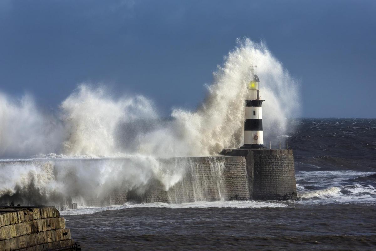
Main photo today: Seaham Lighthouse, County Durham