


Strong to gale force southwesterly winds today, blowing in showers for many. Blustery Saturday but winds easing into Sunday, however further showers likely.

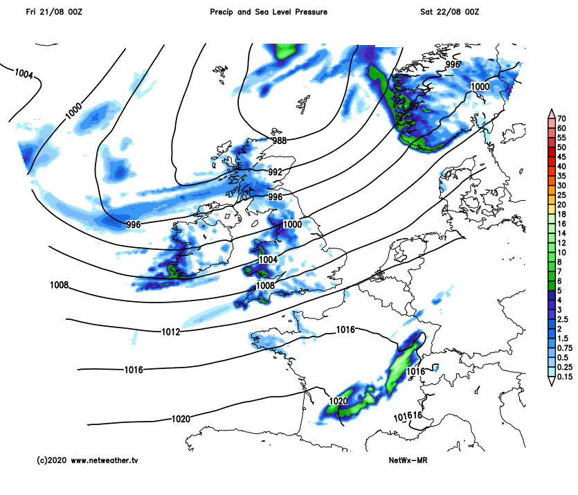
A deep area of low pressure moving in over the northwest of Britain will make it feel more like autumn than summer today, with very unseasonably strong winds for late August and some squally showers too. Saturday will be another blustery day, with a scattering showers, though not quite as windy as today and it will be drier towards the southeast. Winds will ease on Sunday, but there will still be some showers. Next week looks to continue unsettled, with showery rain for most on Monday and another spell of potentially wet and windy conditions spread northeast on Tuesday. Further rain or showers looking likely for the rest of the week.
For now, a very windy morning for many across England, Wales and southern Scotland, strong to gale force southwesterly winds around western and southern coasts. The strongest gusts for the morning commute across Wales and SW England, gusting to 71mph at the exposed Needles on the Isle of Wight, 68mph at Mumbles Head near Swansea, Wales. So there is a risk to high sided vehicles on exposed roads, the old Severn Bridge between England and Wales is currently closed due to the high winds. Also, with spring tides, there is a risk of coastal flooding, particularly in the west.
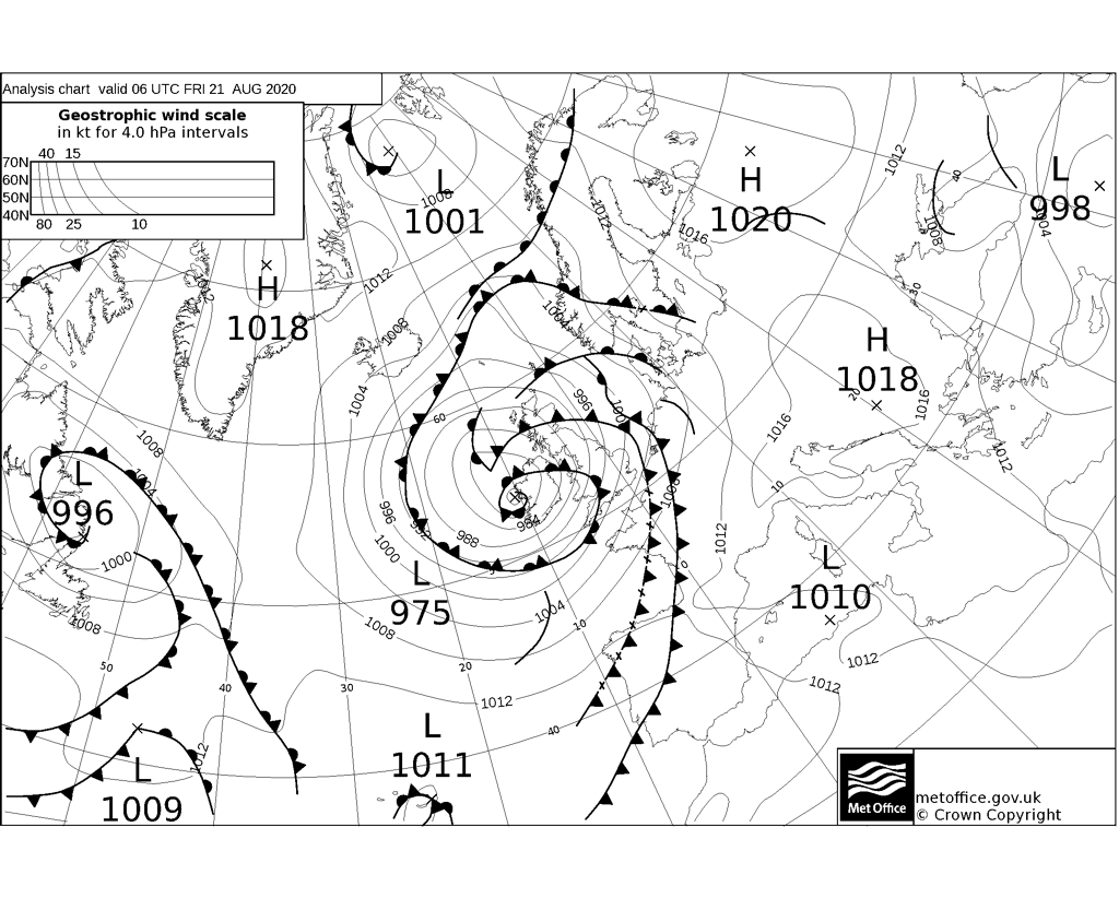
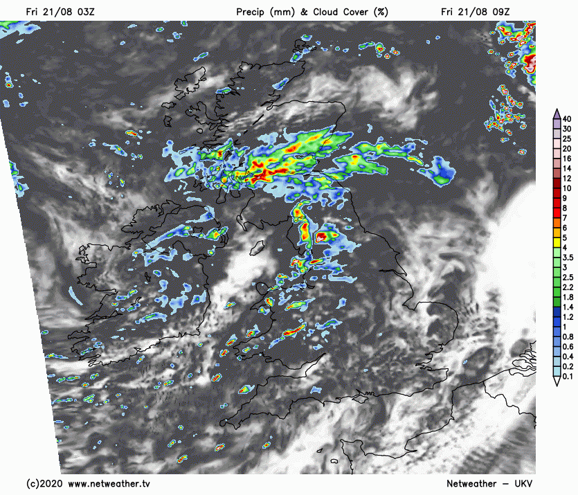
There will also be a rash of showers rattling northeast across England and Wales through the morning and afternoon on the strong wind, heaviest and most frequent across Wales and western areas of England, lighter towards eastern England. Fronts moving north across northern England, N. Ireland and Scotland this morning bringing more persistent areas of rain north here through the morning, followed by scattered showers later this morning and through the afternoon, heavy with thunder in places. Winds will increase through the morning across Scotland too, with gusts of 40-50mph quite widely inland across the UK this afternoon, 50-60mph around southern and western coasts. With trees in full leaf, there is a risk of large branches or small trees falling.
Despite the strong winds, it will feel warm towards eastern England – where we will see the best of any sunshine, temperatures reaching 23-25C. Elsewhere across England and Wales reaching 20-21C, across Scotland and N. Ireland reaching 18-19C.
Low pressure will begin to pull away from Scotland tonight, but it will remain windy, with showers continuing across northern and western areas, merging into longer spell of rain across western Scotland. Fewer showers and drier with clear spells across the southeast.
Although low pressure will be moving away along the west coast of Norway tomorrow, we will still be under its influence, so another blustery day with sunny spells and showers, heavy and frequent across the west. Although not as windy as today, winds locally gusting to 30-40 mph. SE England and East Anglia escaping most the showers and with the lengthiest spells of sunshine and where it’ll be warmest too. Temperatures reaching 22C in London and Norwich, 19C in Manchester and Belfast, 18C in Cardiff and Glasgow.
Low pressure over Scandinavia on Sunday, pulling in a northwesterly breeze bringing sunshine and showers on Sunday, less windy for all though showers this time heaviest and most frequent across central, southern and eastern England, drier and sunnier across Scotland. A fairly cool day for late August, temperatures reaching 20-21C towards the southeast, 16-19C elsewhere.
After a bright start in the east, showery rain moving east across most parts through the day on Monday. Then on Tuesday, a potentially deep area of low pressure tracking northeast close to Ireland then on towards western Scotland could bring a spell of wet and windy weather followed by blustery showers for all. A showery and cool northwesterly flow on Wednesday, before perhaps further rain sweeps in from the west across southern Britain on Thursday. Perhaps a drier end to the week on Friday, as high pressure builds in from the west.


