Today's low pressure brings rain and hefty showers with gales developing by Tuesday for far north of Scotland. After a cooler than average spell of weather, the UK could see 30C on Friday.
This week starts off unsettled with more rain and blustery winds making it feel cool across the UK. However, warmer air will feed up from the south by Thursday and Friday lifting temperatures well into the 20s Celsius and maybe up to 30C. We haven’t seen 30C so far this July, even though the sun has been strong and felt very warm at times, the air overall has been cooler than average. The last day of July could change that, briefly.
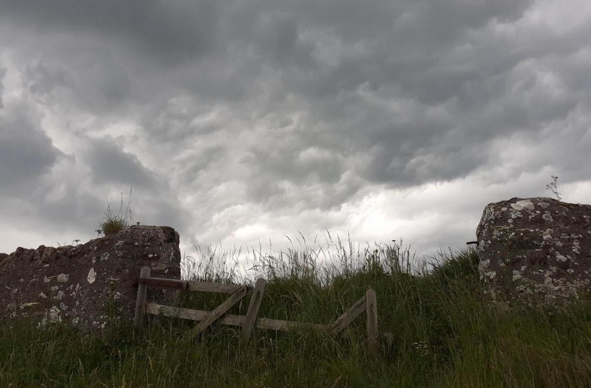
This past weekend brought heavy downpours, thundery showers and a tornado to Northampton. Quite an event with damage to garden fences and allotments with roof tiles down as well.
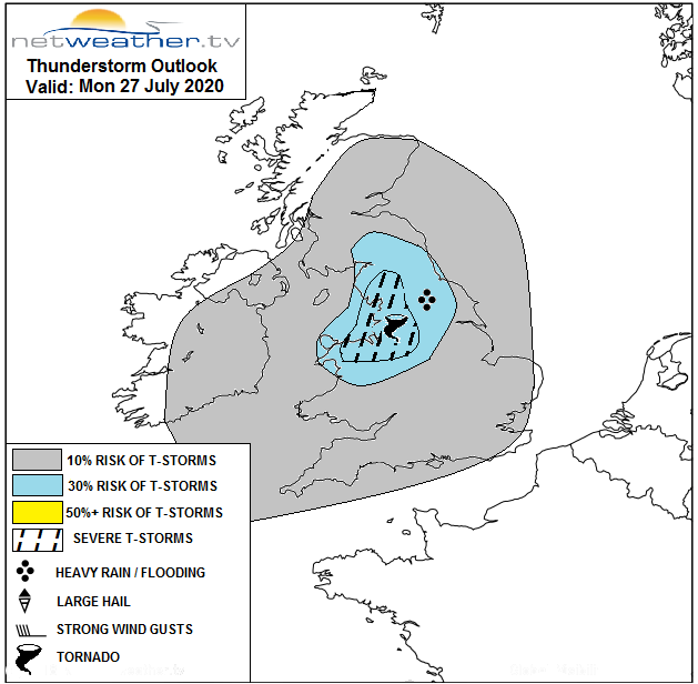
There is the risk of lively showers again today particularly across N Wales and N England. Nick Finnis’s convective forecast mentions
'Storm organisation into bowing line segments or perhaps an isolated supercell…locally strong surface instability …could support a weak tornado too with stronger convective updrafts across NW England in particular. Localised flash-flooding is possible with any storms too.'
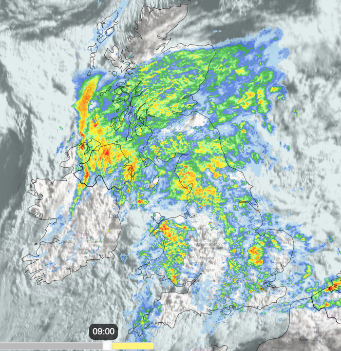
Low pressure has moved over the UK during the night and brought rain in from the Atlantic. There will be heavy downpours particularly for NW England, wales, Dumfries and Galloway and Northern Ireland in the morning. With plenty of cloud the low centre will move over northern Britain by lunchtime. Around this, there will be fresh south then southwest winds for England and Wales veering to a NW wind for Northern Ireland as the rain clears over the Irish Sea by lunchtime.
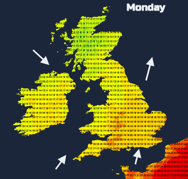
Temperatures will only reach the high teens and low 20sC, feeling cooler in the wind and rain. The far southeast and south coasts of England will miss most of today’s rain.
The main area of heavy rain moves up over more of mainland Scotland through lunchtime and the afternoon, towards the NE and Northern Isles. Frontal bands drag over Wales and then England with the risk of heavy even thundery showers appearing through the afternoon and edging eastwards. The low pressure continues to deepen as it reaches Grampian this evening with strong winds around the low as the rain continues over the far north of Scotland.
Windy for Scotland and through the Irish Sea on Monday night from the NW or west. There will also be heavy rain and high rainfall totals for the Moray coast and the Northern Isles by Tuesday. There is the risk of flooding here.
The low centre will be between Aberdeen and Norway by Tuesday as the winds strengthen with gales around the Moray Firth and for Orkney. Also, strong, gusty winds for Cairngorms so walkers should take note.
Southern Britain will have lighter winds and see temperatures in the high teens or low 20sC on Tuesday. Much of England and Wales start the day dry and bright although showers appear for the NW quite quickly. There will also be showers for Northern Ireland and western Scotland and all of these will be pushed south and east on the brisk breeze, particularly for northern Britain. The wild and wet weather in the far northeast continues but does drift away from the Aberdeenshire coast during the afternoon.
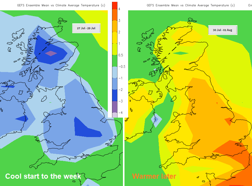
The weather becomes more settled as pressure builds in by Thursday as the warmer air moves in, and Friday does look much warmer throughout the UK. Hot in the south when 30C is possible.
Hurricanes
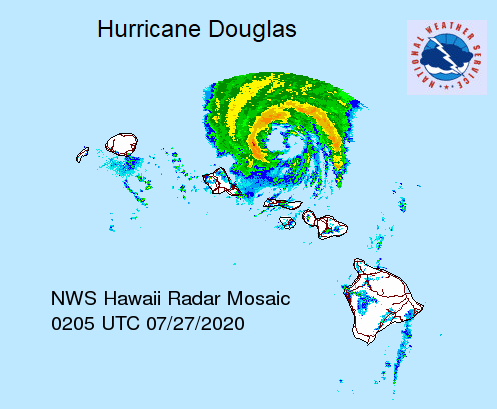
Hurricane Douglas is moving just north of the Hawaiian Islands with hurricane warnings and watches continuing for the western islands including Oahu. Concerns about damaging winds, heavy rainfall, coastal flooding, and life-threatening surf remain.
What was hurricane Hanna is still bringing torrential rain, storms and the risk of flash flooding to inland deep south Texas and NE Mexico with still dangerous surf and rip currents along the coast.