A fine Friday before rain arrives over Ireland this afternoon and the weather turns unsettled. There is the risk of heavy, even thundery downpours on Saturday, just to keep us on our toes.
A fair, quiet day for much of Britain on Friday before a spell of frontal rain then heavy showers head in for the weekend. It will feel warm in any sunshine today, but the rain will be reaching Northern Ireland mid-afternoon and into western Scotland and Wales later.
Saturday will be a mixed day with bright or sunny spells but the risk of hefty downpours even thunderstorms. Sunday also sees scattered showers but not as heavy.
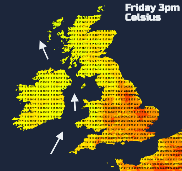
The UK still hasn’t reached 30C this July. Temperatures today will be mostly in the high teens to low 20sC with mid 20sC for southern England inland. In the sunshine with light winds, it can still feel very warm but we’re not seeing a summer heatwave which could be welcome news for those who remember sweltering in the city last year when temperatures rose into the high 30sC. Next week we see similar values, high teens, low twenties but still with strong UV rays.
Today
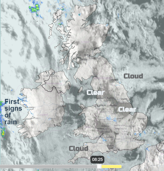
The visible satellite has been overlain on the Netweather Radar image. You can see a lot of cloud over the UK but there are breaks, clear spells with sunshine. There are showers over the Western Isles and some outbreaks of light rain lingering from the cold front over southern England, these clear south-eastwards. On the far left of the image, you can see the first signs of the rain from an Atlantic low pressure.
The UK brightens up this morning and it will be fine at lunchtime with sunny spells, warmth and light winds. During the afternoon the southerly breeze picks up around Ireland and the Irish Sea as the frontal rain moves in. The low pressure centre heads towards NW Scotland, still deepening and there will be heavy rain as the fronts move in, particularly for western then southern Scotland, Cumbria and north Wales.
Saturday
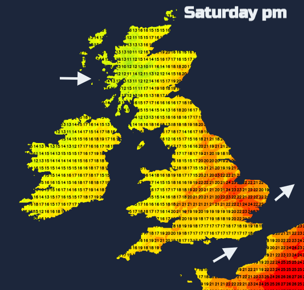
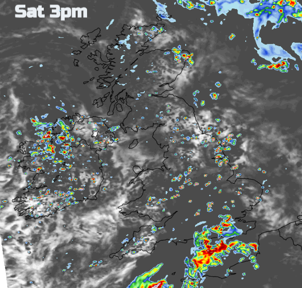
The SW winds eventually veer to a westerly on Saturday, light to moderate in the day. It will be a mixed day with warm sunny spells lifting the temperatures into the 20sC then cloudier times with the risk of hefty showers making it feel cooler. Clusters of showers work their way east or northeast. One area looks to move through the English Channel bringing a wet spell to southern England in the afternoon. This will lower the temperatures with an onshore wind. East Anglia, the East Midlands and Lincolnshire could all see temperatures into the low 20sC maybe up to 24 or 25C.
Later in the afternoon heavier showers move over SE England as another pulse heads over Northern Ireland and Grampian shows signs of shower development. The risk of heavy, thundery showers continues as bands work their way eastwards. Not everyone will see a downpour but there is the risk of slow-moving heavy rain, 30 to 60mm in places. There could also be hail and lightning and poor visibility on the roads with surface water.
Sunday will be cooler and more blustery. A scattering of showers blows in from the west with the risk of further heavy showers for northern Scotland and other showers for the west coast, Northern Ireland, Wales and western England. East Anglia could see 23 or 24C. Sunday night looks colder for inland Scotland, down into single figures.
For Monday, a low pressure is showing on the forecast charts moving right over the UK with rain and blustery winds. There is some uncertainty about how far north it will move, and so areas affected could vary.
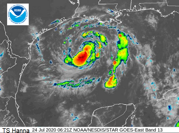
Hurricane Season – Hurricane Douglas will be near the Hawaiian Islands this weekend in the central Pacific. Tropical Storm Gonzalo could intensify to hurricane status as it heads for the Windward Islands including Barbados which is on Hurricane watch currently. And heading towards Texas, there is Tropical Storm Hanna (you may see the bizarre emoji auto-linked to #Hanna as it's been hijacked on Twitter by an Amazon Prime show called Hanna) A strange look as the NHC National Hurricane Centre try to warn of Storm winds, large swell and heavy rains extending to Louisiana and Mexico.