A mixed picture today and tomorrow, with rain moving down across England & Wales today, but drier and sunnier for many Friday. Unsettled, cool & windy weather over the weekend, with heavy showers or spells of rain.
It’s looking a rather mixed picture weather-wise to end the week. Today will be mostly cloudy for England and Wales, with patchy rain affecting many parts, while Scotland and N. Ireland will see sunny spells developing and a few showers. Friday though is looking mostly dry with increasing sunshine, as a brief ridge of high pressure builds in, warm in the south too. But it’s all downhill as we head into the weekend, turning unsettled, cooler and windier. Saturday will see early rain giving way to heavy and locally thundery showers, Sunday seeing sunny spells and blustery showers.
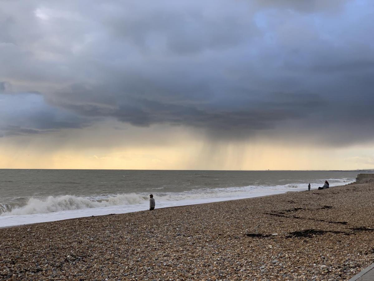
For now, a cloudy but mild start to the day for many, a waving weather front bringing a swathe of moderate and persistent rain across southern Scotland, N. Ireland along with the far north and northwest of England, a few showers further south around western coasts of Wales and SW England, otherwise mostly dry.
The rain will clear southern Scotland and N. Ireland through the morning followed by increasingly sunny conditions late morning and the afternoon, though some showers are likely in places. Outbreaks of rain continuing across northern England and Wales, but turning lighter and more patchy, some showers affecting Devon and Cornwall too. But for the Midlands, southern England and East Anglia – it will stay mostly dry and bright, with some sunny spells, but not the blue skies like yesterday. Temperatures reaching 17-19C across the north and west, but across central, southern and eastern England reaching 20-24C.
A weakening cold front will continue to clear southeast across England and Wales this evening and overnight, taking cloudier skies and increasingly light and patchy rain or drizzle across the Midlands, SE England and East Anglia. Clearer skies across much of Scotland, N. Ireland and northern England.
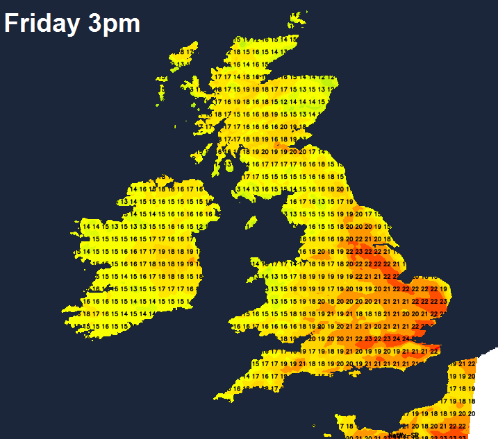
Fair bit of cloud hanging on across southern England and south Wales on Friday, as a weak cold front is slow to clear, producing a few showers in places. Otherwise, further north, most will have a dry and bright or sunny day on Friday. However, thickening cloud and outbreaks of rain pushing in across the far west by early evening. A warm day, temperatures reaching 20C in the central belt of Scotland, up to 22-24C across central and eastern England, high teens in the far west.
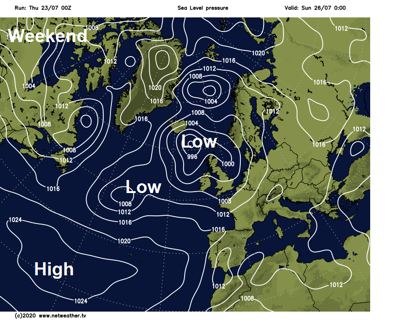
Weekend
Outbreaks of rain, locally heavy, sweeping northeast across western and northern areas Friday night accompanied by a strengthening southwesterly wind. Rain clearing the northeast early Saturday morning to sunny spells and scattered heavy showers, locally with thunder, across much of England, Wales and southern Scotland. Temperatures down as a result of the showers and stronger winds, reaching 21C in London, 20C in Cardiff, 19C in Edinburgh, 18C in Belfast.
Windy and cool with sunshine and showers on Sunday, most of the showers across the north and west though, merging into longer spells of rain in the far northwest, best of the sunshine towards eastern England – where some places here will stay dry all day. Temperatures ranging from 17C across central Scotland to 22C in the southeast of England.
Continuing unsettled and cool early next week, with outbreaks of rain spreading northeast across England and Wales during Monday, reaching southern Scotland by the evening. Heavy showers or longer spells of rain across England and Wales on Tuesday, Scotland and N. Ireland drier and sunnier. Some uncertainty from mid-week, but high pressure looks to build in bringing drier, sunnier and warmer conditions on Wednesday, but how long high pressure hangs on thereafter a little uncertain for now.