Summer is really struggling to get into gear at the moment, with more unsettled and cooler than average weather on the way this week. But, it at least does look like high pressure will build across the country for a time this weekend.
Summer is really struggling to get into gear at the moment, with more unsettled and cooler than average weather on the way this week. But, it at least does look like high pressure will build across the country for a time this weekend.
For now, low pressure is in charge, although it's a pretty benign start to the week after a wild weekend, with lighter winds and a scattering of showers. Those showers will become increasingly limited to eastern regions by this afternoon, with many parts of the country seeing plenty of sunny spells. Although those winds are a touch lighter, it'll still be a breezy, if not blustery day with maxes perhaps just about touching 20c in the southeast but elsewhere 16-19c will be about your lot.
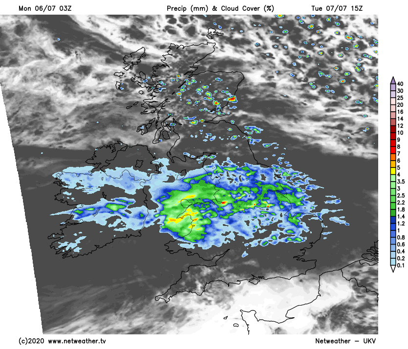
A few showers continue this evening and overnight, particularly in the northeast of Scotland, but most parts stay dry. Low pressure will be pushing fronts in from the west during the early hours though, with wet weather crossing Ireland overnight. That reaches into Wales and western England during the morning, with the bulk of it crossing through into northern and central England, along with Wales. To the north of rain, there'll be showers affecting Scotland at times, but to the south, it should stay mostly dry with some sunny spells likely close to the south coast in particular.
It'll be warmest near to the south coast as well, as temperatures reach into the high-teens, maybe low-twenties in the southeast but under the rain and further north, the mid-teens will be about your lot. Not what you'd expect in July.
Into midweek, a bit of a tropical influence arrives in the form of the remnants of tropical storm Edouard. The forecasting models diverge a little in how they handle this one, with the GFS bringing a more defined low through, meaning stronger winds as well as a spell of rain. Most of the other models don't develop the low as much though, so less wind but still a further period of wet weather.
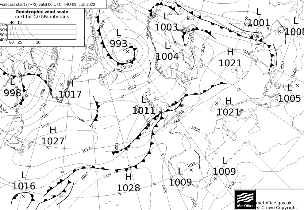
That rain is likely to affect similar areas to Tuesday as well, moving in during Wednesday and clearing east into Thursday. To the north of the wet weather in England and Wales, Scotland and Northern England look set to stay mostly dry, with a scattering of showers. Despite the tropical link though, temperatures will still be below par in most parts - peaking into the high-teens or low-twenties.
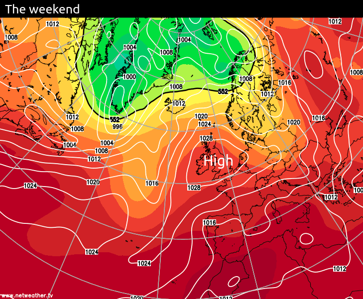
As we head towards the end of the week, high pressure will be starting to ridge towards the British Isles from the southwest, so the showers on Friday will become increasingly limited to the north and east. The high continues to build as we move into the weekend though, setting itself up over the UK by Sunday to bring a settled and warm end for all - with highs by this stage heading up towards the mid-twenties in places.