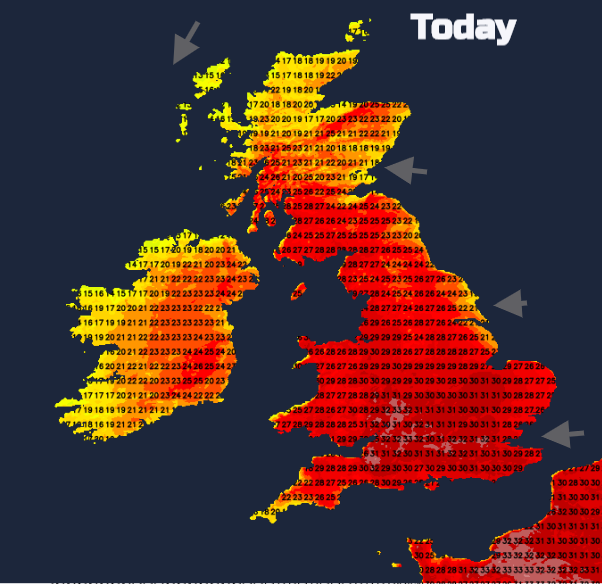
Another day of hot weather, with temperatures into the 30s Celsius. There is also the risk of thunderstorms, increasing tonight and into Friday.
Another day of heat and sunshine but this time with the risk for thunderstorms. Yesterday London Heathrow reached 32.6C. Many parts of England and Wales were in the high 20sC or around 30C and could go a shade higher today. The likelihood of 33C, possibly 34C today could be for the West Midlands or eastern Wales. The heat will spread to more of Scotland and Northern Ireland today, but we have already seen thunderstorms breakout this morning, moving from Co. Antrim to the Inner Hebrides.
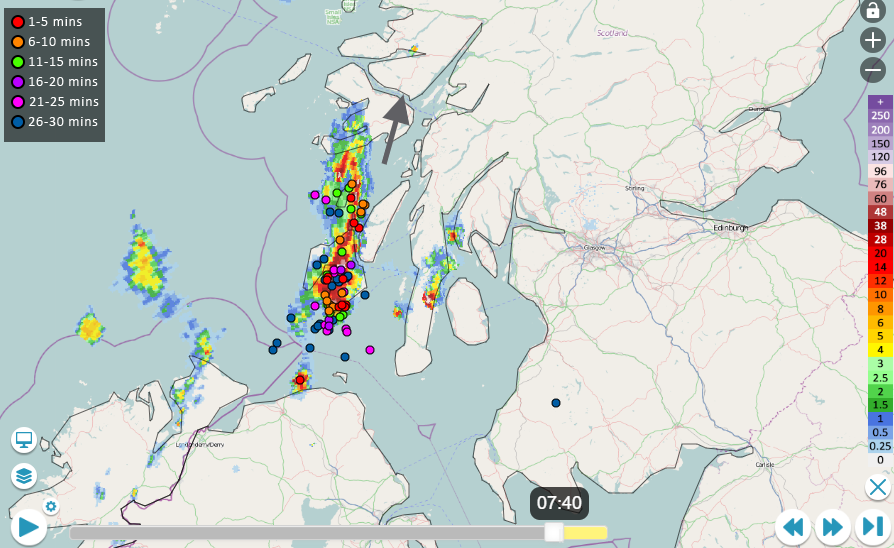
For many, it will be a hot, humid day with sunshine and blue skies again. Very high UV today, especially in SW England and the pollen is very high again. There is a little cloud in the far NW from Wednesday’s frontal band and with a southerly steering wind, a cluster of heavy showers and thunderstorms will head away from Northern Ireland over western Scotland this morning. Running up the west coast, over the Inner Hebrides and bringing downpours to the NW Highlands with lightning. The risk of showers remains into the afternoon for the far NW of Scotland before we look to SW England and Northern Ireland this evening.
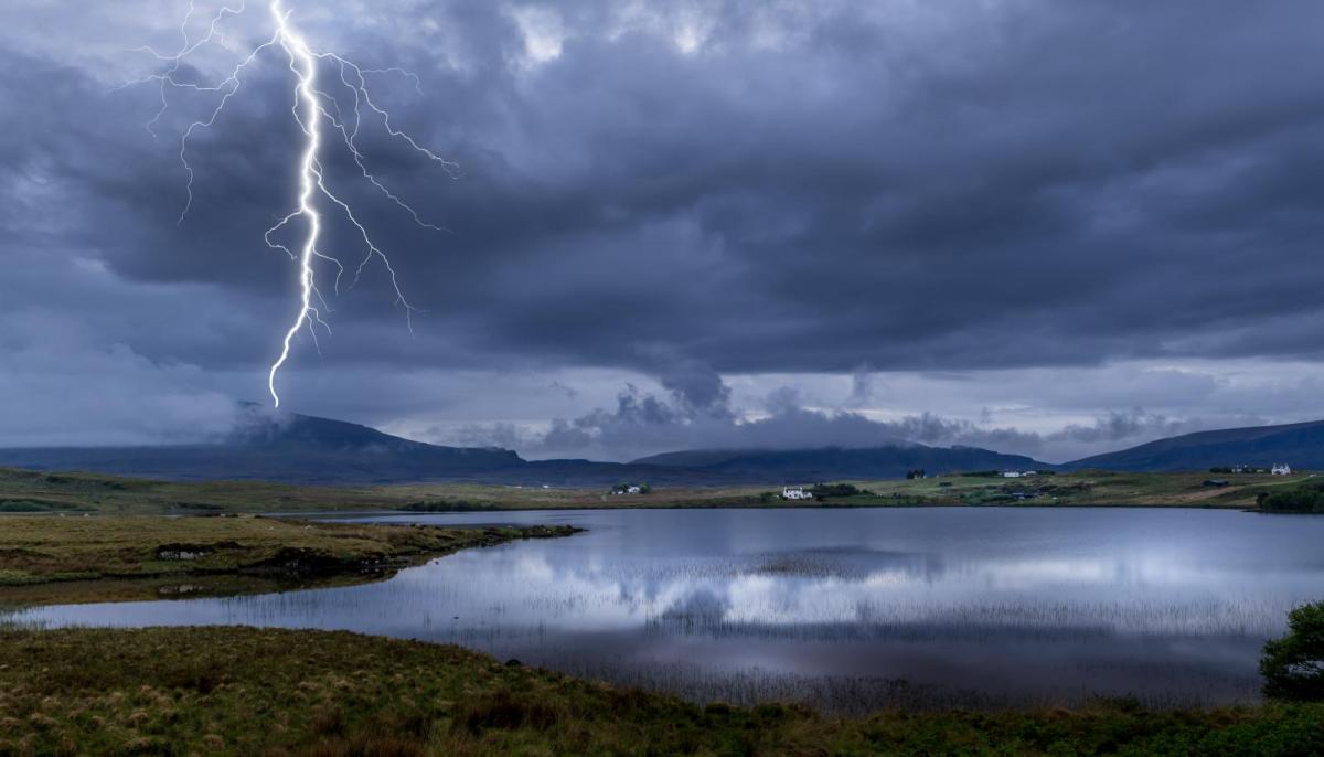
The highest risk of severe convection today is over Northern Ireland, Ireland and western Scotland later. This could result in supercell like structure, torrential rain and the risk of flash flooding, large hail, gusty winds and even funnel clouds or tornadoes.
There is more detail in Nick’s convective forecast about the two destabilising areas within the plume of very warm air from Spain and France, the first one in NW this morning and second in the SW later today.
“…elevated thunderstorms look to breakout during the afternoon, spreading north across Ireland, N. Ireland, Wales, Irish Sea and western Scotland through the evening. Frequent lightning, isolated large hail (2-3cm), strong wind gusts and intense rainfall, leading to localised flash-flooding, are possible.”
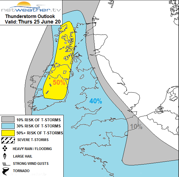
There are weather warnings from the Met Office for thunderstorms. One today over western Britain and Northern Ireland for late afternoon, Thursday night and Friday morning, then another for Scotland and much of England, away from the SW. This runs for Friday afternoon, overnight into early Saturday.
Later afternoon the storm risk will be for Cornwall and Devon, clipping Pembrokeshire. By this evening through the western Channel, over more of SW Britain and over Ireland into Northern Ireland, swerving NE then north. A slight shift in the steering wind during the night sees the rain showers and thunderstorms drift NE into western Scotland, more of Wales over the Midlands and across southern England closer to London by Friday morning.
The band of thunderstorms moves over SE England with another section for the Central Belt of Scotland during Friday morning, both could bring torrential rain and surface water flooding.
Ahead of this, the heat and humidity remain with temperatures well into the 20sC, possibly 30C again but further west some relief from the highest temperatures. The heat sets off more heavy showers and thunderstorms for inland central Britain during Friday afternoon, surface-based convection, as the rain band creeps NE over Scotland with more downpours,
A scattering of heavy showers remains into Friday evening as with downpours over northern England and eastern Scotland during the night. Further bands of heavy rain appear from the far SW and these spin up over the UK during Saturday, So an unsettled day, not as hot. The weekend looks mixed but will feel much fresher by Sunday,