After the thunderstorms this week, today brings more persistent rain to England and Wales with a smaller storm risk in the south. Sunshine and showers follows tomorrow ahead of a mixed weekend.
After the thunderstorms this week, the focus today is more on the heavy, persistent rain which has moved in from the east overnight. By the time it clears overnight, it'll have brought over 25mm of rain in places. Good news for those who have missed out on the bulk of the shower and storm action this week, but not so great for those who have already seen flash-flooding this week.
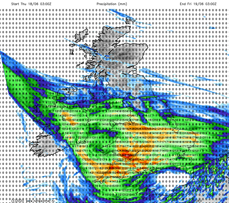
To the south of the main area of wet weather, there will also be showers wrapping around, with some further thunderstorms possible through parts of southern England during today and continuing at times overnight. Wales and southwest England will see the rain for longest, with the highest rain totals here, central and eastern England will start to dry out from late morning. Elsewhere today, the best of the sunshine will be in western Scotland and perhaps also Eastern England at the tail end of the day. There'll also be some showers around, but these should be few and far between, and not as intense as we've seen this week.
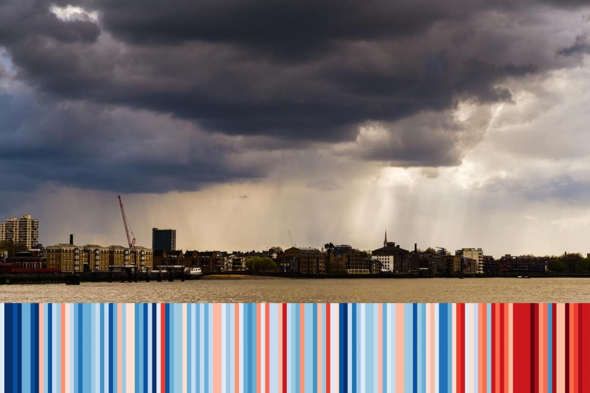
You may have spotted the stripes on today's photo - they show a depiction of the average yearly temperature for the UK from 1884 to 2019. As you can see, the warming trend is pretty clear, and 2020 is currently set to be one of, if not the warmest year on record globally too. If you'd like to discuss this, or other climate related subjects, please head over to the Netweather climate forums.
#ShowYourStripes
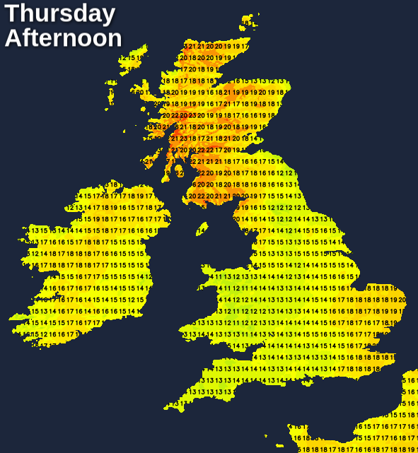
Temperatures today won't exactly be thrilling underneath the rain, with the low-mid teens about your lot. Scotland will be warmest with highs into the low-twenties maybe even mid-twenties in the sunnier west. Other parts of the UK will reach up into the mid or high-teens by this afternoon.
The rain in the southwest and south Wales will continue this evening and overnight, as the wet weather also spreads further into Ireland. Later in the night, as the front pivots, the far southwest will tend to dry out, but showery bursts, some of them thundery will start to feed back up into other parts of southern and eventually central England.
That takes us into a day of sunny spells and showers on Friday. Initially, those showers will be in southern and central parts, but they will spread and develop further north as the day moves on. Some will be heavy and thundery once again, but they're likely to be less widespread and generally not as intense as earlier this week. The north and particularly northeast of Scotland will be the spot with the best chance of avoiding them altogether. Temperatures will generally reach into the high-teens, maybe low-twenties locally - with the northeast of Scotland perhaps the warmest place thanks to southerly winds and the foehn effect.
Into this weekend, for most Saturday will see plenty of sunshine but with a scattering of showers. That is only part of the story though, as rain will cross into Ireland during the day with increasing southerly winds getting into western Britain ahead of it. The wet weather will also reach western parts by the end of the day, before quite quickly spreading east during the evening and overnight.

It may take a little while to clear the southeast corner on Sunday morning, with sunshine and blustery showers left it its wake. The showers will be heaviest and most frequent in the west and north of the country, with eastern parts seeing more in the way of sunshine, and it'll be warmest in the east too with highs closing in on the mid-twenties potentially.