The mixed June weather continues this week, warm and humid with sunshine. There's the threat of further heavy even thundery downpours, but low cloud is also lingering off the North Sea.
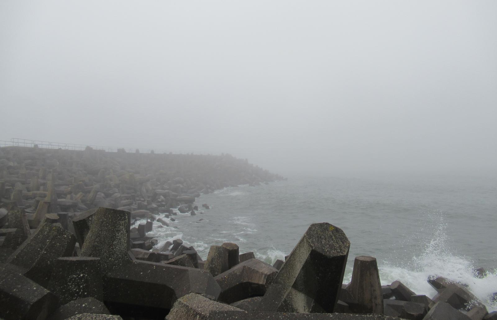
After a weekend of humid air which bought warm sunshine with hefty showers even thunderstorms to some, we continue with the showery threat this week. That same warm and humid air brought a lot of low cloud and sea fog off the North Sea and its around this morning for NE Britain and eastern England. Inland and to the south and west, there will be more sunshine and further downpours.
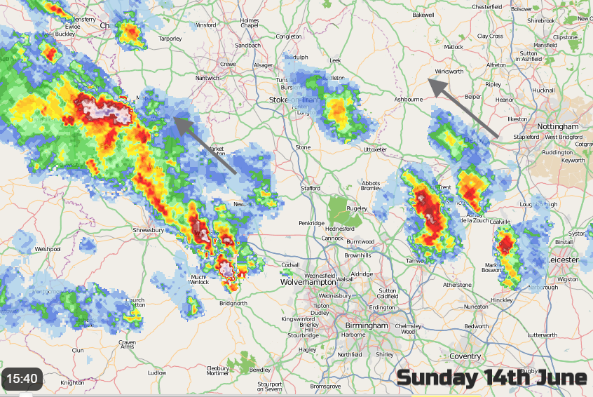
As always with showers, their cell nature means one location could see a heavy downpour but just down the road it remains dry, although you might see the dark ominous cloud in the distance. There was flooding yesterday in Ironbridge from one line of thundery showers, the lines heading NW but also drifting northwards during the evening to NW England and Sheffield later. A storm forecast has been issued for today.
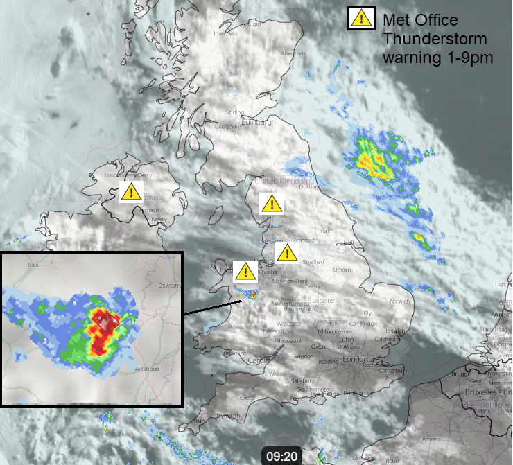
Today the UK Met Office has Thunderstorm warnings for Northern Ireland, western counties and NW England, up to the Pennines, north Wales and NW Midlands.
"Heavy showers and thunderstorms will break out this afternoon before slowly fading this evening... torrential downpours are possible...Frequent lightning is possible and a few places may see some hail."
This morning there is one large shower over Shropshire moving into Powys and the low cloud off the North Sea is bringing damp drizzly rain that soaks you by stealth and poor visibility. Other areas are starting the day fine, dry and sunny with temperatures in London already in the high teens. The sea fog will disappear from inland places through the morning, taking its time to lift the grey blanket. Coastal counties will stay misty and cooler. More showers break out with heavy, sometimes thundery downpours forecast for Northern Ireland, NW England again and north Wales. There will be scattered showers over other parts of England and Wales with an area of rain moving over Scotland east to west. There will be lingering low cloud around this.
Northern Scotland will reach into the low 20sC with more sunshine, Northern Ireland up to 21C with sunshine and the heaviest showers in the west this afternoon and very light winds. Wales will see clusters of heavier showers in the north around lunchtime with a few scattered about into the afternoon. Temperatures will reach 21C with hardly any breeze.
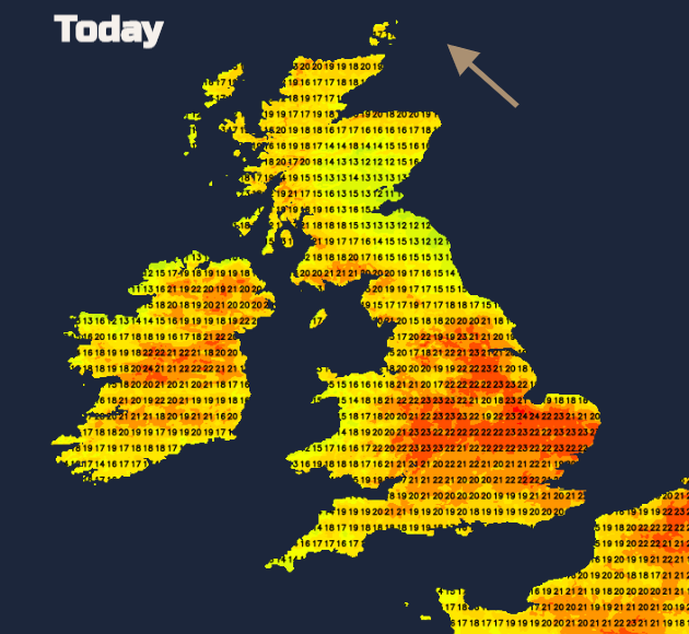
For Britain, the east coast under the low cloud will struggle to reach 11 to 14C. In the sunshine, England England will feel warm and close with temperatures in the low 20sC, 25C for London and western Scotland. SE Britain will have a lovely day with sunshine and warmth. By this evening, there will be a scattering of showers over SW England and the Channel Islands. The low pressure, responsible for the more unsettled conditions will be centred away to the SW of Cornwall. Further showers break out for SW Britain overnight and by Tuesday morning there will be a clustery of heavy showers around the Irish Sea.
Overnight rain will still be lurking for western Scotland with low cloud in the east. AS the warmth of the day builds showers begin to break out over England and Wales. With very light winds, these will be slow-moving and again there could be thunderstorms. Nights will be mild but the low cloud off the North Sea will envelope more areas.
A cold front fades to the west of Ireland on Wednesday but manages to bring more cloud and showery rain to start the day to Northern Ireland. The heavy showers break out again, mainly for western and southern Britain. By Thursday the low centre will have moved along the English Channel and the heavy showers will be mostly over southern England although rain could reach into East Anglia, the Midlands and Wales during the day. There will be more of a breeze, particularly for eastern England with a moderate NE Wind off the sea.
June has seen a strange mix, just not reliable weather. You could have a whole day of fine warm sunshine and not see a shower. North Sea coasts are being plagued by the haar or sea fret and then inland western areas have the threat of heavy, thundery downpours with the risk of surface water flooding just to keep us all on our toes. Keep an eye on the Netweather Radar to see what’s coming your way.