


More heavy downpours and thunderstorms on the way today, thanks in part to the warm sunshine providing energy to an unstable atmosphere. The weather stays very similar into next week as well.
The weather is stuck in a rut at the moment with low pressure hanging around near to the south of the UK. There are some warm, sunny spells, but that sunshine is providing extra energy into an already quite unstable atmosphere, which means heavy showers and thunderstorms develop each day. And little is going to change into next week.
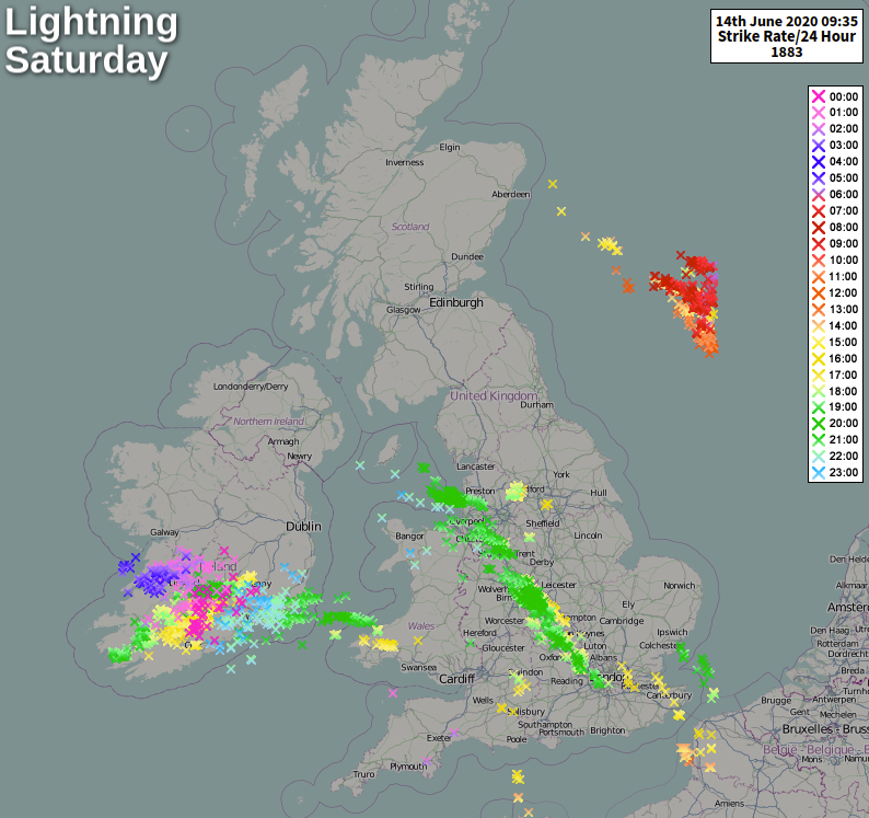
Yesterday it was central and western parts seeing the majority of the thunderstorms, as they ran up southeast to northwest through the afternoon and evening. Parts of the Midlands and Northwest England, in particular, enjoyed an evening light show as the storms rolled through. It'll be similar areas at risk of isolated but beefy showers and some thunderstorms storms again today, with Wales. Northern Ireland and Southwest England perhaps also getting into the action a bit more later on.
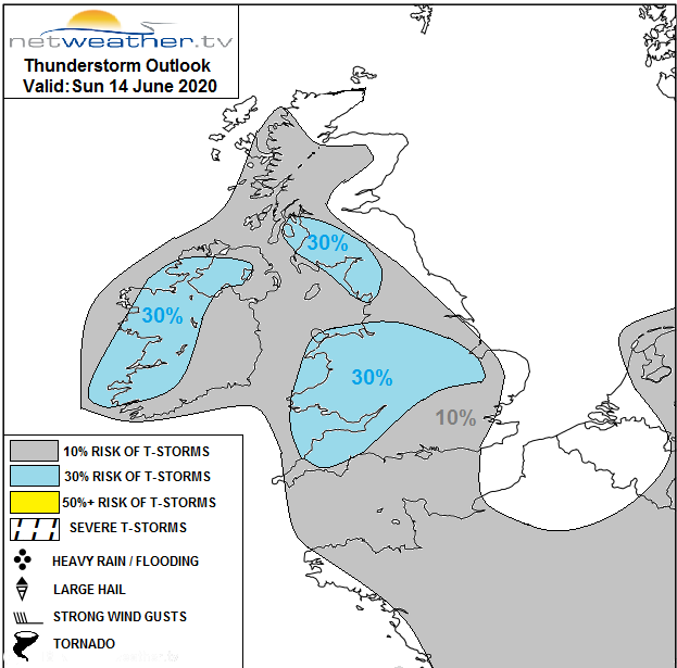
Not everywhere, even in the higher risk areas will catch a shower or storm today though, with many getting away with a mostly dry, often sunny day, apart from the cloudier coastal counties of northeast England and southeast Scotland. Should you see a shower today, you'll very likely know about it with hail, gusting winds and torrential downpours all possible. There's even the threat of some funnel clouds or tornadoes today - more details over on the storm forecast.
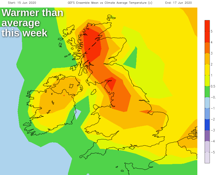
Another noticeable feature yesterday, especially after a cooler couple of weeks was the warmth. It was almost a surprise being out in it - I wonder how many times the phrase 'oohh that sun's strong' was used, I know I said it after 10 minutes in the garden hanging out the washing. The warmth will continue through the upcoming week, away from those more prone eastern coastal counties and also the southwest where it'll often be cloudier.
Locally, temperatures will vary day to day depending on cloud amounts and the distribution of any showers. Still, generally, highs will peak into the low-mid twenties, keeping it warmer than average for the time of the year. Today, the northeast coast will struggle just about into the teens, but everywhere else will reach the high teens or low-mid twenties with the warmest temperatures up through southeast England and East Anglia, into central and NW England, along with Western Scotland.
This evening and overnight, most of the showers will die away, with perhaps just a few left to drift into eastern Scotland through the early hours. Monday then dawns with a fair amount of low cloud, but across southern and central England, Wales and much of Ireland it'll burn back to allow the sun to breakthrough. That sunshine will help to trigger more heavy showers and storms though, especially into the afternoon.
For Northern England and Scotland, it'll be a generally cloudier day with a few showers running in off of the North Sea. Western and Northern Scotland will see the best of any sunnier breaks, but that, in turn, may mean the odd sharp downpour brewing here too. Temperatures will be warmest in the brighter regions, peaking at 23-25c here. Elsewhere 18-22c will be more typical, but coastal counties of northeast England southeast Scotland will struggle into the low-mid teens under a blanket of cloud.
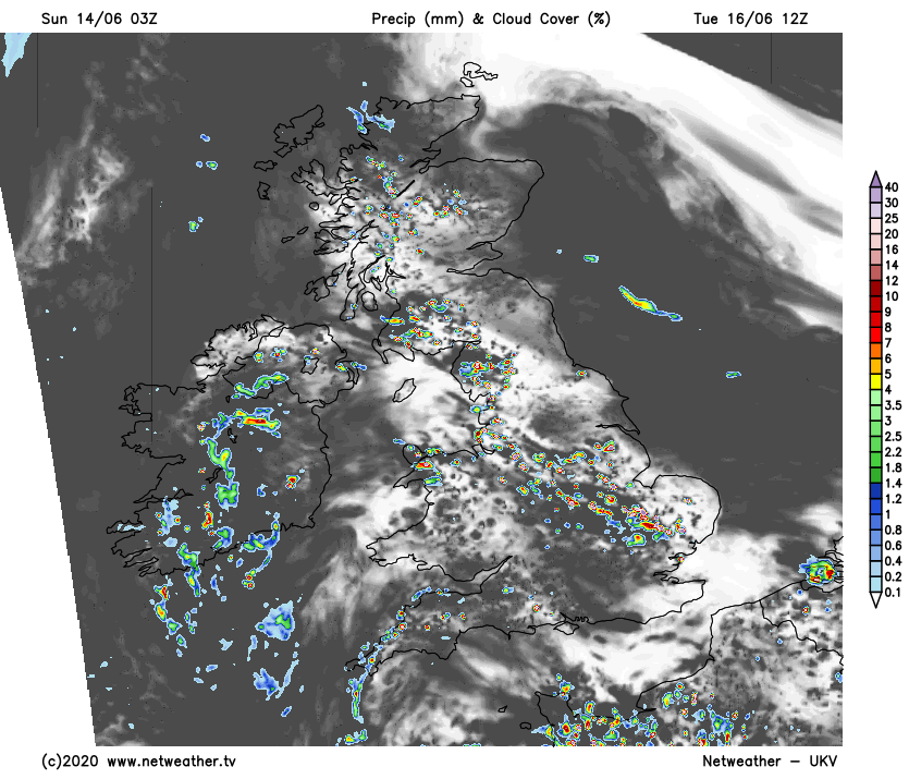
Tuesday is then likely to see more widespread sunshine, but also thanks to that, more widespread downpours into the afternoon. Wednesday brings more of the same.
Thursday throws up some potential variation, with the showers fewer and further between as the wind takes a turn into the northeast. There's also the threat of some potentially thundery rain running in from the east through southern and central regions, but there's a lot of uncertainty over this at the moment.


